Yorii — Original name in latin Yorii Name in other language Yorii State code JP Continent/City Asia/Tokyo longitude 36.11667 latitude 139.2 altitude 96 Population 38717 Date 2012 01 19 … Cities with a population over 1000 database
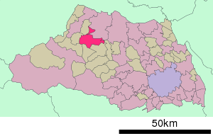
Yorii (Saitama) — Yorii machi 寄居町 Geographische Lage in Japan … Deutsch Wikipedia
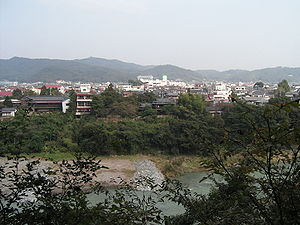
Yorii, Saitama — nihongo|Yorii|寄居町|Yorii machi is a town located in Ōsato District, Saitama, Japan.As of 2003, the town has an estimated population of 37,548 and a density of 585.13 persons per km². The total area is 64.17 km².Hachigata Castle is located in Yorii … Wikipedia
Yorii Station — ] * October 6, 1934 New line between Yorii and Ogawamachi opens and merges the Hachikō North and South Lines to form the Hachikō Line Adjacent stations ReferencesExternal links* [http://www.jreast.co.jp/estation/station/info.aspx?StationCd=1655… … Wikipedia
3823 Yorii — Infobox Planet minorplanet = yes width = 25em bgcolour = #FFFFC0 apsis = name = Yorii symbol = caption = discovery = yes discovery ref = discoverer = M. and Mori Arai discovery site = Yorii discovered = March 10, 1988 designations = yes mp name … Wikipedia
Tōbu Tōjō Line — Infobox rail line box width = name = Tōbu Tōjō Line color = logo = logo width = image width = caption = Tōbu 50090 series TJ Liner type = Commuter rail system = status = locale = Kantō region start = Ikebukuro end = Yorii stations = routes =… … Wikipedia
Tojo-Hauptlinie — In diesem Artikel oder Abschnitt fehlen folgende wichtige Informationen: Es fehlen Streckenverlauf, Geschichte, Streckensicherung, Hoch und Kunstbauten Du kannst Wikipedia helfen, indem du sie recherchierst und einfügst … Deutsch Wikipedia
Tōbu-Tōjō-Hauptlinie — In diesem Artikel oder Abschnitt fehlen folgende wichtige Informationen: Es fehlen Streckenverlauf, Geschichte, Streckensicherung, Hoch und Kunstbauten Du kannst Wikipedia helfen, indem du sie recherchierst und einfügst … Deutsch Wikipedia
Tōbu Tōjō Line — In diesem Artikel oder Abschnitt fehlen folgende wichtige Informationen: Es fehlen Streckenverlauf, Geschichte, Streckensicherung, Hoch und Kunstbauten Du kannst Wikipedia helfen, indem du sie recherchierst und einfügst … Deutsch Wikipedia
Ogawamachi Station (Saitama) — Ogawamachi Station 小川町駅 Station entrance, May 2006 Location Prefecture … Wikipedia


