Beresford (South Dakota)

Beresford (South Dakota)
Beresford
Lincoln County South Dakota Incorporated and Unincorporated areas Beresford Highlighted.svg
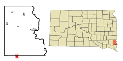
Lage in South Dakota
Basisdaten
Staat: Vereinigte Staaten
Bundesstaat: South Dakota
Countys:

Lincoln County
Union County

Koordinaten: 43° 5′ N, 96° 47′ W43.080833333333-96.776111111111457Koordinaten: 43° 5′ N, 96° 47′ W
Zeitzone: Central Standard Time (UTC−6)
Einwohner: 2006 (Stand: 2000)
Bevölkerungsdichte: 436,1 Einwohner je km²
Fläche: 4,6 km² (ca. 2 mi²)
davon 4,6 km² (ca. 2 mi²) Land
Höhe: 457 m
Postleitzahl: 57004
Vorwahl: +1 605
FIPS: 46-04980
GNIS-ID: 1267667
Webpräsenz: www.beresfordsd.com
Bürgermeister: Jim Fedderson

Beresford ist ein Ort im Union County im US-Bundesstaat South Dakota. Er hat 2006 Einwohner (Stand 2000) auf einer Fläche von 4,6 km².

Beresford liegt an der Grenze zwischen dem Lincoln County und dem Union County. Die Grenze verläuft entlang der Cedar Street von Beresford. Ungefähr zwei Drittel der Ortsfläche (einschließlich des Rathauses) liegen im Union County.

Die Stadt trug zunächst den Namen Paris, Dakota Territory. Sie wurde nach Lord Charles Beresford, einem britischen Admiral und Abgeordneten, umbenannt und am 12. Juli 1884 offiziell gegründet.

Söhne und Töchter

  • Ernest Lundeen, (1878–1940), Politiker (Kongressabgeordneter und US-Senator in Minnesota)

Wikimedia Foundation.

Игры ⚽ Нужно решить контрольную?

Schlagen Sie auch in anderen Wörterbüchern nach:

  • Beresford, South Dakota — Infobox Settlement official name = Beresford, South Dakota other name = native name = nickname = settlement type = City motto = imagesize = image caption = flag size = image seal size = image shield = shield size = image blank emblem = blank… …   Wikipedia

  • South Dakota locations by per capita income — South Dakota is the forty fourth richest state in the United States of America, with a per capita income of $17,562 (2000).# Cottonwood town, South Dakota $79,000 # Naples town, South Dakota $78,450 # Camp Crook town, South Dakota $30,178 #… …   Wikipedia

  • Dakota Dunes, South Dakota — Dakota Dunes   Unincorporated   …   Wikipedia

  • South Dakota — • The thirty ninth state, admitted to the Union on 2 November, 1889 Catholic Encyclopedia. Kevin Knight. 2006. South Dakota     South Dakota      …   Catholic encyclopedia

  • South Dakota — This article is about the U.S. state of South Dakota. For other uses, see South Dakota (disambiguation). State of South Dakota …   Wikipedia

  • South Dakota Highway 46 — Infobox road state=SD marker highway name=Highway 46 length mi=107 established=1936 decommissioned= direction a=West terminus a=Jct|state=SD|US|18|US|281 in Pickstown direction b=East terminus b=Jct|state=IA|IA|10 at Iowa state line… …   Wikipedia

  • Outline of South Dakota — …   Wikipedia

  • Saint John Cemetery (Union County, South Dakota) — See also Saint John Cemetery. St. John Cemetery is a Catholic cemetery located in Prairie Township, Union County, South Dakota. The cemetery is one of four adjacent cemeteries, which are a mile south and a mile east of Beresford, South Dakota. Of …   Wikipedia

  • Mitchell, South Dakota —   City   Corn Palace in Mitchell …   Wikipedia

  • Deadwood, South Dakota — For other uses, see Deadwood (disambiguation). Deadwood, South Dakota   City   Modern Deadwood viewed from Mount Moriah …   Wikipedia

Share the article and excerpts

Direct link
Do a right-click on the link above
and select “Copy Link”