- Buluan
-
Municipality of Buluan Lage von Buluan in der Provinz Maguindanao 
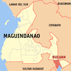
Basisdaten Bezirk: Autonomous Region in Muslim Mindanao Provinz: Maguindanao Barangays: 7 Distrikt: 2. Distrikt von Maguindanao PSGC: 153803000 Einkommensklasse: unbekannt (1-6) Haushalte: 9501 Zensus 1. Mai 2000Einwohnerzahl: 32.310 Zensus 1. August 2007Koordinaten: 6° 52′ N, 124° 45′ O6.8666666666667124.75Koordinaten: 6° 52′ N, 124° 45′ O Postleitzahl: 9616 Offizielle Webpräsenz: www.buluan.gov.ph Geographische Lage auf den Philippinen Buluan ist eine philippinische Stadtgemeinde in der Provinz Maguindanao.
Die Bevölkerung ist fast ausschließlich muslimisch.
Am 30. Dezember 2006 wurden die Stadtgemeinden Mangudadatu und Pandag aus jeweils acht Baranggays gegründet, die zuvor zu Buluan gehört haben.
Baranggays
Buluan ist politisch in sieben Baranggays unterteilt.
- Digal
- Lower Siling
- Maslabeng
- Poblacion
- Popol
- Talitay
- Upper Siling
Städte und Stadtgemeinden in der Provinz MaguindanaoStädte: Cotabato City
Stadtgemeinden: Ampatuan | Buluan | Datu Abdullah Sangki | Datu Anggal Midtimbang | Datu Paglas | Datu Piang | Datu Saudi-Ampatuan | Datu Unsay | Gen. S. K. Pendatun | Guindulungan | Mamasapano | Mangudadatu | Pagagawan | Pagalungan | Paglat | Pandag | Rajah Buayan | Shariff Aguak | South Upi | Sultan sa Barongis | Talayan | Talitay
Wikimedia Foundation.
Schlagen Sie auch in anderen Wörterbüchern nach:
Buluan — Original name in latin Buluan Name in other language Buluan State code PH Continent/City Asia/Manila longitude 6.72028 latitude 124.80194 altitude 16 Population 28025 Date 2012 02 01 … Cities with a population over 1000 database
Buluan, Maguindanao — Infobox Settlement official name = Buluan, Maguindanao other name = native name = nickname = settlement type = motto = imagesize = image caption = flag size = image seal size = 100px image shield = shield size = city citylogo size = mapsize = map … Wikipedia
Lake Buluan — Infobox lake lake name = Lake Buluan image lake = caption lake = image bathymetry = caption bathymetry = coords = coord|6|38|26|N|124|49|30|E|region:PH type:waterbody|display=inline,title type = Freshwater lake inflow = Buluan River outflow =… … Wikipedia
Heshui Campaign — Infobox Military Conflict conflict=Heshui Campaign partof=Chinese Civil War place=Eastern Gansu, Northwestern China date=May 28, 1947 May 31, 1947 result=nationalist victory combatant1= combatant2= commander1= Ma Jiyuan 马继援 commander2= strength1 … Wikipedia
Maguindanao massacre — Map of the Philippines with Maguindanao highlighted Location Ampatuan, Maguindanao, Mindanao, Philippines … Wikipedia
Maguindanao — redirects here. For other uses, see Maguindanao (disambiguation). Maguindanao Province … Wikipedia
Lutayan, Sultan Kudarat — Lutayan is a 3rd class municipality in the province of Sultan Kudarat, Philippines. According to the 2000 census, it has a population of 40,881 people in 7,110 households.This lakeside town shares the lake with its neighboring municipality,… … Wikipedia
Mangudadatu, Maguindanao — For other uses, see Esmael Mangudadatu. Mangudadatu Municipality Map of Maguindanao showing the loca … Wikipedia
Meridian Ridge Campaign — Part of the Chinese Civil War Date August 13, 1947 August 18, 1947 Location Southern Shaanxi and eastern Gansu, China … Wikipedia
Second Sino-Japanese War — Part of the Pacific War of World War II (from 1941) … Wikipedia

