Pagalungan

Pagalungan
Municipality of Pagalungan
Lage von Pagalungan in der Provinz Maguindanao
Karte
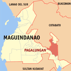
Basisdaten
Bezirk: Autonomous Region in Muslim Mindanao
Provinz: Maguindanao
Barangays: 12
Distrikt: 2. Distrikt von Maguindanao
PSGC: 153810000
Einkommensklasse: unbekannt (1-6)
Haushalte: 4715
Zensus 1. Mai 2000
Einwohnerzahl: 31.052
Zensus 1. August 2007
Koordinaten: 7° 3′ N, 124° 42′ O7.057124.701Koordinaten: 7° 3′ N, 124° 42′ O
Postleitzahl: 9610
Offizielle Webpräsenz: www.pagalungan.gov.ph
Geographische Lage auf den Philippinen
Pagalungan (Philippinen)
Pagalungan
Pagalungan

Pagalungan ist eine philippinische Stadtgemeinde in der Provinz Maguindanao. Nach dem Zensus vom 1. Mai 2000 hat sie 25.908 Einwohner in 4715 Haushalten.

Baranggays

Pagalungan ist politisch in zwölf Baranggays unterteilt.

  • Bagoenged
  • Buliok
  • Damalasak
  • Galakit
  • Inug-ug
  • Kalbugan
  • Kilangan
  • Kudal
  • Layog
  • Linandangan
  • Poblacion
  • Dalgan

Wikimedia Foundation.

Игры ⚽ Нужно решить контрольную?

Schlagen Sie auch in anderen Wörterbüchern nach:

  • Pagalungan — 1 Original name in latin Pagalugan Name in other language Pagaluan, Pagalungan, Pagalugan State code PH Continent/City Asia/Manila longitude 7.14167 latitude 124.38056 altitude 4 Population 31052 Date 2012 01 17 2 Original name in latin… …   Cities with a population over 1000 database

  • Pagalungan, Maguindanao — Pagalungan is a 1st class municipality in the province of Maguindanao, Philippines. According to the 2000 census, it has a population of 25,908 people in 4,715 households.BarangaysPagalungan is politically subdivided into 12 barangays.* Bagoenged …   Wikipedia

  • Maguindanao — redirects here. For other uses, see Maguindanao (disambiguation). Maguindanao   Province   …   Wikipedia

  • Polomolok, South Cotabato — Infobox Settlement official name = Municipality of Polomolok other name = native name = nickname = settlement type = motto = imagesize = image caption = flag size = image seal size = image shield = shield size = city citylogo size = mapsize = map …   Wikipedia

  • Cotabato (Stadt) — Cotabato City Lage von Cotabato innerhalb der Provinz Maguindanao Basisdaten Bezirk: SOCCSKSARGEN …   Deutsch Wikipedia

  • Maganoy — Municipality of Shariff Aguak (Maganoy) Lage von Shariff Aguak in der Provinz Maguindanao Basisdaten Bezirk: Autonomous Region in Muslim …   Deutsch Wikipedia

  • PH-MAG — Lage der Provinz Maguindanao (vor 2006) Maguindanao ist eine Provinz der Philippinen, die sich in der Zentralregion der Insel Mindanao befindet. Die Provinz gehört politisch zum Bezirk ARMM (Autonomous Region in Muslim Mindanao). Die Hauptstadt… …   Deutsch Wikipedia

  • Cotabato City — Cotabato   City   Mindanao River at Cotabato City …   Wikipedia

  • 1998 in aviation — yearbox in?=in aviation cp=19th Century c=20th century cf=21st century yp1=1995 yp2=1996 yp3=1997 year=1998 ya1=1999 ya2=2000 ya3=2001 dp3=1960s dp2=1970s dp1=1980s d=1990s dn1=2000s dn2=2010s dn3=2020sThis is a list of aviation related events… …   Wikipedia

  • Datu Abdullah Sangki, Maguindanao — Map of Maguindanao showing the location of Datu Abdullah Sangki Country Philippines …   Wikipedia

Share the article and excerpts

Direct link
Do a right-click on the link above
and select “Copy Link”