- Datu Anggal Midtimbang
-
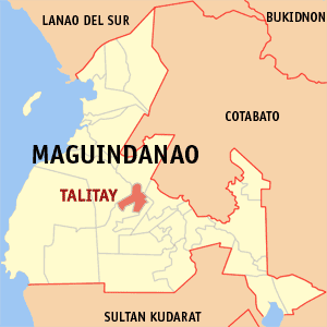
Municipality of Datu Anggal Midtimbang Lage von Datu Anggal Midtimbang in der Provinz Maguindanao 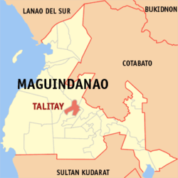
Basisdaten Bezirk: Autonomous Region in Muslim Mindanao Provinz: Maguindanao Barangays: 7 PSGC: 153831000 Einkommensklasse: unbekannt (1-6) Haushalte: Zensus 1. Mai 2000Einwohnerzahl: 23.713 Zensus 1. August 2007Koordinaten: 6° 56′ N, 124° 20′ O6.9333124.3333Koordinaten: 6° 56′ N, 124° 20′ O Geographische Lage auf den Philippinen 

Datu Anggal Midtimbang Datu Anggal Midtimbang ist eine philippinische Stadtgemeinde in der Provinz Maguindanao. Nach dem Zensus vom 1. Mai 2000 hat sie 10.628 Einwohner.
Datu Anggal Midtimbang wurde durch den Muslim Mindanao Autonomy Act Nr. 206, der am 30. Dezember 2006 in einer Volksabstimmung ratifiziert wurde, gegründet. Drei Baranggays gehörten zuvor zu Talayan, vier zu Talitay[1].
Baranggays
Datu Anggal Midtimbang ist politisch in sieben Baranggays unterteilt.
Baranggay Einwohnerzahl
(2000)Adaon 1554 Brar 1502 Mapayag 1389 Midtimbang (Pob.) 941 Nunangan (Nunangen) 2567 Tugal 1655 Tulunan 1020 Einzelnachweise
- ↑ National Statistical Coordination Board: Newly created provinces, municipalities, barangays, converted city. Abgerufen am 9. März 2006.
Städte und Stadtgemeinden in der Provinz MaguindanaoStädte: Cotabato City
Stadtgemeinden: Ampatuan | Buluan | Datu Abdullah Sangki | Datu Anggal Midtimbang | Datu Paglas | Datu Piang | Datu Saudi-Ampatuan | Datu Unsay | Gen. S. K. Pendatun | Guindulungan | Mamasapano | Mangudadatu | Pagagawan | Pagalungan | Paglat | Pandag | Rajah Buayan | Shariff Aguak | South Upi | Sultan sa Barongis | Talayan | Talitay
Wikimedia Foundation.
Schlagen Sie auch in anderen Wörterbüchern nach:
Datu Anggal Midtimbang, Maguindanao — Country Philippines Region Autonomous Region in Muslim Mindanao Province Maguindanao Districts Lone district of Maguindanao … Wikipedia
Datu Piang, Maguindanao — Datu Piang Seal … Wikipedia
Datu Saudi-Ampatuan, Maguindanao — Datu Saudi biruar Ampatuan, Maguindanao Map of Maguindanao showing the location of Datu Saudi Ampatuan Country Philippines … Wikipedia
Datu Unsay, Maguindanao — Map of Maguindanao showing the location of Datu Unsay Country Philippines Region … Wikipedia
Datu Abdullah Sangki, Maguindanao — Map of Maguindanao showing the location of Datu Abdullah Sangki Country Philippines … Wikipedia
Datu Paglas, Maguindanao — Map of Maguindanao showing the location of Datu Paglas Coordinates … Wikipedia
Datu Salibo, Maguindanao — Datu Salibo is a municipality in the province of Maguindanao, Philippines. According to the 2007 census, it has a population of at least 13,876 people (not counting the population of barangays only partially included). It was created out of 4… … Wikipedia
Datu Hoffer Ampatuan, Maguindanao — Datu Hoffer Ampatuan is a municipality in the province of Maguindanao, Philippines. According to the 2007 census, it has a population of at least 22,471 people (not counting the population of barangays only partially included). It was created out … Wikipedia
Datu Abdullah Sangki — Municipality of Datu Abdullah Sangki Lage von Datu Abdullah Sangki in der Provinz Maguindanao Basisdaten … Deutsch Wikipedia
Datu Paglas — Municipality of Datu Paglas Lage von Datu Paglas in der Provinz Maguindanao Basisdaten Bezirk … Deutsch Wikipedia
Datu Anggal Midtimbang

18+
© Academic, 2000-2026
- Kontaktieren Sie uns: Unterstützung, Werbung
Wörterbücher Export, schritte mit PHP, Joomla, Drupal, WordPress, MODx.