Flughafen Cerro Largo

Flughafen Cerro Largo
Aeropuerto Internacional de Cerro Largo
BW
Flughafen Cerro Largo (Uruguay)
Red pog.svg
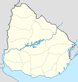
Kenndaten
IATA-Code MLZ
ICAO-Code SUMO
Koordinaten
Verkehrsanbindung
Entfernung vom Stadtzentrum 6 km nordwestlich von Melo
Basisdaten
Eröffnung
Start- und Landebahn
07/25 1500 m × 30 m Asphalt

i1 i3 i5 i6 i7 i10 i12

i14

Der Aeropuerto Internacional de Cerro Largo (IATA-Flughafencode: MLZ - ICAO-Flughafencode: SUMO) ist ein Flughafen in Uruguay.

Er liegt im Osten Uruguays 6 Kilometer nordwestlich der Stadt Melo im Departamento Cerro Largo.

Siehe auch

Weblinks


Wikimedia Foundation.

Игры ⚽ Нужно сделать НИР?

Schlagen Sie auch in anderen Wörterbüchern nach:

  • Liste der Flughäfen in Uruguay — Die Liste der Flughäfen in Uruguay enthält die wichtigsten Flughäfen in Uruguay. Zu den wichtigsten Flughäfen werden jeweils die Kenndaten IATA Code, ICAO Code, Klassifizierung, Nutzung[1], Art der Landebahn[1] und die Stadt, in der sich der… …   Deutsch Wikipedia

  • Melo — 32.368055555556 54.167777777778111 Koordinaten: 32° 22′ S, 54° 10′ W Mel …   Deutsch Wikipedia

  • Republik Östlich des Uruguay — República Oriental del Uruguay Republik Östlich des Uruguay …   Deutsch Wikipedia

  • URU — República Oriental del Uruguay Republik Östlich des Uruguay …   Deutsch Wikipedia

  • URY — República Oriental del Uruguay Republik Östlich des Uruguay …   Deutsch Wikipedia

  • Uruguay — República Oriental del Uruguay Republik Östlich des Uruguay …   Deutsch Wikipedia

  • Rivera (Departamento) — Rivera Symbole …   Deutsch Wikipedia

  • Canelones (Departamento) — Canelones Symbole …   Deutsch Wikipedia

  • Aeropuerto de Berlín-Tempelhof — IATA: THF   OACI: EDDI Sumario …   Wikipedia Español

  • Indiana Jones y la última cruzada — Para los videojuegos basados en la película, véase Indiana Jones and the Last Crusade (videojuegos). Indiana Jones and the Last Crusade …   Wikipedia Español

Share the article and excerpts

Direct link
Do a right-click on the link above
and select “Copy Link”