

- Akpatok Island
-
Akpatok Island Satellitenbild der Ungava Bay mit Akpatok Island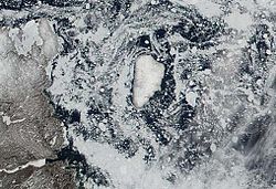
Gewässer Ungava Bay Geographische Lage 60° 25′ N, 68° 8′ W60.416666666667-68.133333333333281Koordinaten: 60° 25′ N, 68° 8′ W 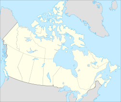

Länge 48 km Breite 26 km Fläche 903 km² Höchste Erhebung Cox Ridges
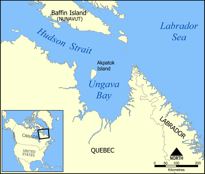
281 mEinwohner (unbewohnt) Karte der Ungava Bay mit Akpatok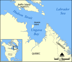
Akpatok Island ist eine unbewohnte Insel in der Ungava Bay vor der Nordküste der Labrador-Halbinsel in Kanada. Administrativ gehört sie zur Region Qikiqtaaluk des Territoriums Nunavut.
Inhaltsverzeichnis
Geographie
Akpatok Island liegt rund 70 km vor der Ostküste der Ungava-Halbinsel im Norden Labradors sowie rund 180 km südlich der Baffininsel. Sie ist 48 km lang, 26 km breit und hat eine Fläche von 903 km²[1], was sie zur bei weitem größten Insel in der Ungava Bay macht. Die Küste ist geprägt von 40 bis 250 m hohen Kliffs aus Kalkstein, die zu einem 45 × 23 km großen Plateau führen.
In den Cox Ridges im Zentrum ragt die Insel bis 281 Meter auf.[2]
Tierwelt (Fauna)
Akpatok Island ist eine kanadische Important Bird Area (#NU007) sowie eine Key Migratory Bird Terrestrial Habitat Site (NU Site 50)[3] des Canadian Wildlife Service. Schützenswerte Vogelarten sind der Wanderfalke (Falco peregrinus), die Gryllteiste (Cepphus grylle) sowie die Dickschnabellumme (Uria lomvia), deren Inuit-Name Akpat Namensgeber für die Insel war. An Säugetieren kommen Eisbären und Walrosse vor.
Weblinks
- Ein Bild der Kliffküste auf panoramio
- Akpatok bei Oceandots (englisch)
- Akpatok Island bei IBA Canada (englisch)
Einzelnachweise
- ↑ The Atlas of Canada - Other Arctic Islands (englisch)
- ↑ Map of Akpatok Island in the Atlas of Canada (englisch)
- ↑ Key migratory bird terrestrial habitat sites in the Northwest Territories and Nunavut S. 6. ngps.nt.ca. Abgerufen am 5. Mai 2009.
Kategorien:- Unbewohnte Insel
- Insel (Nunavut)
- Insel (Nordamerika)
- Insel (Atlantischer Ozean)
- Naturschutzgebiet in Nordamerika


Wikimedia Foundation.

