Amphoe Mueang Saraburi

Amphoe Mueang Saraburi
Mueang Saraburi
เมืองสระบุรี
Provinz: Saraburi
Fläche: 301,6 km²
Einwohner: 106.107 (2000)
Bev.dichte: 351,8 E./km²
PLZ: 18000
Geocode: 1901
Karte
Karte von Saraburi, Thailand mit Mueang Saraburi

Amphoe Mueang Saraburi (Thai อำเภอเมือง สระบุรี) ist ein Landkreis (Amphoe - Verwaltungs-Distrikt) in der Provinz Saraburi. Die Provinz Saraburi liegt im Nordosten der Zentralregion von Thailand.
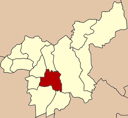
Geographie

Benachbarte Bezirke (von Norden im Uhrzeigersinn): Amphoe Chaloem Phra Kiat, Amphoe Kaeng Khoi, Amphoe Wihan Daeng, Amphoe Nong Khae, Amphoe Nong Saeng und Amphoe Sao Hai - alle Amphoe liegen in der Provinz Saraburi.

Verwaltung

Der Landkreis (Amphoe) von Mueang Saraburi ist in elf Unterbezirke (Tambon) gegliedert, welche ihrerseits in 77 Dorfgemeinschaften (Muban) unterteilt sind.

Saraburi selbst hat einen Stadtstatus (Thesaban Mueang), sie besteht aus dem gesamten Tambon Pak Phriao.

Phok Phaek hat einen Kleinstadt-Status (Thesaban Tambon) und besteht aus Teilen des Tambon Nong No.

Nr. Name Thai   Nr. Name Thai
1. Pak Phriao ปากเพรียว   10. Pak Khaosan ปากข้าวสาร
5. Daorueang ดาวเรือง   11. Nong Pla Lai หนองปลาไหล
6. Na Chong นาโฉง   12. Kut Nok Plao กุดนกเปล้า
7. Khok Sawang โคกสว่าง   13. Taling Chan ตลิ่งชัน
8. Nong No หนองโน   14. Ta Kut ตะกุด
9. Nong Yao หนองยาว        

Die fehlenden Geocodes beziehen sich auf die Tambon, aus denen jetzt der Landkreis Chaloem Phra Kiat besteht.

Weblinks


Wikimedia Foundation.

Игры ⚽ Нужен реферат?

Schlagen Sie auch in anderen Wörterbüchern nach:

  • Amphoe Mueang Saraburi — Infobox Amphoe name=Mueang Saraburi thai=เมืองสระบุรี province=Saraburi coordinates=coord|14|31|38|N|100|54|35|E|type:adm2nd region:TH area=301.6 population=106,107 population as of=2000 density=351.8 postal code=18000 geocode=1901 Mueang… …   Wikipedia

  • Mueang Saraburi District — Mueang Saraburi เมืองสระบุรี   Amphoe   Amphoe location in Saraburi Province …   Wikipedia

  • Amphoe Mueang Lopburi — Mueang Lopburi เมืองลพบุรี Provinz: Lopburi Fläche: 565,4 km² Einwohner: 247.246 (2000) Bev.dichte: 437,1 E./km² PLZ: 1500 …   Deutsch Wikipedia

  • Amphoe Mueang Nakhon Nayok — Infobox Amphoe name=Mueang Nakhon Nayok thai=เมืองนครนายก province=Nakhon Nayok coordinates=coord|14|12|13|N|101|13|2|E|type:adm2nd region:TH area=728.1 population=98,725 population as of=2005 density=135.6 postal code=26000 geocode=2601Mueang… …   Wikipedia

  • Amphoe Mueang Nakhon Ratchasima — Infobox Amphoe name=Mueang Nakhon Ratchasima thai=อำเภอเมืองนครราชสีมา province=Nakhon Ratchasima coordinates=coord|14|58|16|N|102|5|59|E|type:adm2nd region:TH area=755.6 population=429,853 population as of=2007 density=570 postal code=30000,… …   Wikipedia

  • Amphoe Mueang Lop Buri — Infobox Amphoe name=Mueang Lop Buri thai=เมืองลพบุรี province=Lop Buri coordinates=coord|14|47|53|N|100|39|13|E|type:adm2nd region:TH capital=Thale Chup Son area=565.6 population=247,842 population as of=2007 density=438.2 postal code=15000… …   Wikipedia

  • Saraburi (Provinz) — Saraburi จังหวัดสระบุร Statistik Hauptstadt: Saraburi Tel.vorwahl …   Deutsch Wikipedia

  • Saraburi —   Town   …   Wikipedia

  • Saraburi — …   Deutsch Wikipedia

  • Amphoe Sao Hai — Sao Hai เสาไห้ Provinz: Saraburi Fläche: 111,8 km² Einwohner: 30.292 (2005) Bev.dichte: 270,9 E./km² PLZ: 18160 …   Deutsch Wikipedia

Share the article and excerpts

Direct link
Do a right-click on the link above
and select “Copy Link”