Apoteri

Apoteri
Apoteri
Apoteri (Guyana)
Apoteri
Apoteri
Basisdaten
Staat Guyana
Region Upper Takutu-Upper Essequibo
Fläche 53 km²
Einwohner 310
Dichte 5,8 Ew./km²
ISO 3166-2 GY-UT
4.0333333333333-58.583333333333

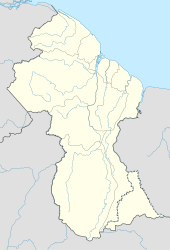
Apoteri ist eine Gemeinde in Upper Takutu-Upper Essequibo in Guyana. Der Ort mit etwa 310 Einwohnern[1] liegt am Zusammenfluss des Rupununi und des Essequibo. Er liegt auf einer Höhe von 53 Metern. In der Nähe des Ortes gibt es einen Luftlandeplatz. Der Ort liegt sehr abseitig und wurde erst 2006 erstmals von einem guyanischen Präsidenten besucht[2].

Einzelnachweise

  1. Vgl. http://www.nrwetlands.org.gy/?q=book/export/s5/171
  2. http://www.gina.gov.gy/archive/daily/b060317.html

Weblinks


Wikimedia Foundation.

Игры ⚽ Поможем написать курсовую

Schlagen Sie auch in anderen Wörterbüchern nach:

  • Apoteri — is a community in the Upper Takutu Upper Essequibo Region of Guyana, near the confluence of the Rupununi River with the Essequibo, at an altitude of 53 metres (177 feet). There is an airstrip near Apoteri.Wildlife is plentiful in the area. Some… …   Wikipedia

  • Cheddi Jagan International Airport — IATA: GEO – ICAO: SYCJ …   Wikipedia

  • Ogle Airport — (IATA: OGL, ICAO: SYGO) is located on the Atlantic Ocean coast of Guyana, 6 miles east of the capital, Georgetown. In 2003 the airport was a local hub shuttling some 50,000 passengers and 1,800 tons of cargo annually. Construction began that …   Wikipedia

  • List of cities and towns in Guyana — This is a list of settlements in Guyana:*Adventure *Aishalton *Anna Regina *Annai *Apoteri *Arakaka *Arimu Mine *Baramita *Bartica *Biloku *Blairmont *Burma *Buxton * Better Hope,Guyana *Catherinas Lust *Charity *Corriverton *Dadanawa *Enmore… …   Wikipedia

  • New Amsterdam, Guyana — New Amsterdam New Amsterdam Town Hall (1950) …   Wikipedia

  • Matthew's Ridge — Matthew s Ridge …   Wikipedia

  • Nonpareil, Guyana — Nonpareil (from the French and meaning matchless, inimitable) was the name of a sugarcane plantation, and later a village, on the east coast Demerara Region of Guyana that operated until the mid 20th century. Although the factory and village were …   Wikipedia

  • Charity, Guyana — Coordinates: 7°24′N 58°36′W / 7.4°N 58.6°W / 7.4; 58.6 …   Wikipedia

  • Corriverton — Corriverton …   Wikipedia

  • Asakata — is a community in Barima Waini region, in the north of Guyana. Its population is approximately 260. [1] The community began receiving electricity in 2004 when a diesel generator was donated by Mr. Monty Niathally, proprietor of Variety Woods and… …   Wikipedia

Share the article and excerpts

Direct link
Do a right-click on the link above
and select “Copy Link”