Bakonynána

Bakonynána
Bakonynána
Wappen von Bakonynána
Bakonynána (Ungarn)
Paris plan pointer b jms.svg
Basisdaten
Staat: Ungarn
Region: Közép-Dunántúl
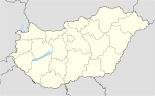
(Mittel-Transdanubien)
Komitat: Veszprém
Koordinaten: 47° 17′ N, 17° 58′ O47.27988611111117.971136111111Koordinaten: 47° 16′ 48″ N, 17° 58′ 16″ O
Fläche: 14,93 km²
Einwohner: 1.011 (1. Jän. 2010)
Bevölkerungsdichte: 68 Einwohner je km²

Bakonynána (deutsch: Nannau) ist eine Ortschaft im Kleingebiet Zirc (ungarisch Zirci kistérség), einer ungarischen Verwaltungseinheit (LAU 1) innerhalb des Komitats Veszprém in Ungarn.

Bakonynána liegt im östlichen Teil des nördlichen Bakonywaldes, 30 km nördlich von der östlichen Nordspitze des Balaton und 22 km nördlich von Veszprém. Im Jahr 2001 lebten 1.062 Menschen auf einer Fläche von 14,93 km² in Bakonynána.

Es gehört zu den Besitzungen des alten, bedeutenden ungarischen Hochadelsgeschlechts Cseszneky (ungarisch auch Cseszneki oder Csesznegi, kroatisch: Česnegić), dessen Ursprung sich bis in das 13. Jahrhundert zurückverfolgen lässt.

Seit 2001 ist Bakonynána Partnergemeinde zur niedersächsischen Gemeinde Jade.

Weblinks

 Commons: Bakonynána – Sammlung von Bildern, Videos und Audiodateien

Wikimedia Foundation.

Игры ⚽ Поможем решить контрольную работу

Schlagen Sie auch in anderen Wörterbüchern nach:

  • Bakonynána — Héraldique …   Wikipédia en Français

  • Bakonynána — Infobox Settlement subdivision type = Country subdivision name = HUN timezone=CET utc offset=+1 timezone DST=CEST utc offset DST=+2 pushpin pushpin label position = pushpin map caption =Location of Bakonynána pushpin mapsize = official… …   Wikipedia

  • Mihály Cseszneky — de Cseszneg was a Hungarian nobleman and border castle hero in 16th century. Member of the Cseszneky family.Mihály Cseszneky was appointed chief lieutenant to the Castle of Várpalota in 1559, after he and Balázs Baranyai had liberated several… …   Wikipedia

  • Veszprém (county) — Infobox Hungarian county name =Veszprém region =Central Transdanubia seat = Veszprém area = 4613 population = 375,000 density = 81 cities = 217: For the historical county see Veszprém (former county). Veszprém (in Slovak Vesprím ) is the name of… …   Wikipedia

  • Aba, Hungary — Infobox Settlement subdivision type = Country subdivision name = HUN timezone=CET utc offset=+1 timezone DST=CEST utc offset DST=+2 pushpin pushpin label position = pushpin map caption =Location of Aba, Hungary pushpin mapsize = official name=Aba …   Wikipedia

  • Devecser — Aerial photography: Devecser Palace …   Wikipedia

  • List of German exonyms for places in Hungary — This is a list of German language exonyms for towns located in Hungary.BudapestOriginal towns: * Buda Ofen * Pest Pesth * Óbuda Alt OfenTowns and villages merged into Budapest in 1950: * Albertfalva Sachsenfeld * Békásmegyer Krottendorf * Budafok …   Wikipedia

  • Kisláng — Infobox Settlement subdivision type = Country subdivision name = HUN timezone=CET utc offset=+1 timezone DST=CEST utc offset DST=+2 pushpin pushpin label position = pushpin map caption =Location of Kisláng pushpin mapsize = official name=Kisláng… …   Wikipedia

  • Káloz — Infobox Settlement subdivision type = Country subdivision name = HUN timezone=CET utc offset=+1 timezone DST=CEST utc offset DST=+2 pushpin pushpin label position = pushpin map caption =Location of Káloz pushpin mapsize = official name=Káloz… …   Wikipedia

  • Countrywide Blue Tour in Hungary — The route of the Countrywide Blue Tour in Hungary The Countrywide Blue Tour (in Hungarian: Országos Kéktúra, Kéktúra or simply OKT) is a part of the Hungarian section of the European Long Distance Walking Route E4. The route starts atop the… …   Wikipedia

Share the article and excerpts

Direct link
Do a right-click on the link above
and select “Copy Link”