Blashenwell Farm Pit

Blashenwell Farm Pit
50.623902777778-2.0692194444445
Blashenwell Farm Pit (Vereinigtes Königreich)
Blashenwell Farm Pit

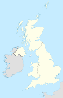
Das 11,4 Hektar große Gebiet Blashenwell Farm Pit liegt nördlich des Gutshauses Blashenwell Farm in der Grafschaft Dorset in England. Es wurde im Jahr 1985 zu einem Gebiet von besonderem wissenschaftlichen Interesse erklärt (engl. Site of Special Scientific Interest).[1] Wissenschaftlich wertvoll ist eine Tuff-Ablagerung, die während des Flandriums gebildet wurde. Sie enthält Fossilien von Mollusken sowie archäologische Überreste und bildet einen langen, ununterbrochenen Aufschluss.

Blashenwell Farm liegt südlich von Corfe Castle, zwischen Kingston und Church Knowle. Der westliche Teil des Geländes wird derzeit als Anbaufläche für Mais genutzt.

Weblinks

Einzelnachweise

  1. http://www.english-nature.org.uk/citation/citation_photo/1002484.pdf Notifikationsdocument SSSI (englisch)

Wikimedia Foundation.

Игры ⚽ Поможем решить контрольную работу

Schlagen Sie auch in anderen Wörterbüchern nach:

  • Blashenwell Farm Pit — (gbmapping|SY952805) is a 11.4 hectare geological Site of Special Scientific Interest in Dorset, notified in 1954.ource* [http://www.english nature.org.uk/citation/citation photo/1002484.pdf English Nature citation sheet for the site] (accessed… …   Wikipedia

  • Crookhill Brick Pit — (grid reference SY644798) is a 4.77 hectare biological and geological Site of Special Scientific Interest in Dorset, notified in 2003. It supports a large population of Great Crested Newts. Source English Nature citation sheet for the site… …   Wikipedia

  • Cerne Abbas — Cerne redirects here. For other uses, see Cerne (disambiguation). Coordinates: 50°48′34″N 2°28′52″W / 50.8095°N 2.4810°W / 5 …   Wikipedia

  • Chesil Beach — Coordinates: 50°36′14″N 2°30′58″W / 50.604°N 2.516°W / 50.604; 2.516 …   Wikipedia

  • Christchurch Harbour — Coordinates: 50°43′22″N 1°45′15″W / 50.72285°N 1.75404°W / 50.72285; 1.75404 …   Wikipedia

  • Cull-Peppers Dish — Cull peppers Dish. Cull Peppers Dish (grid reference SY814926) is a 0.9 hectare (2.2 acre) geological Site of Special Scientific Interest in Do …   Wikipedia

  • Creech Grange — is an elegant country house, south of Wareham at the foot of the Purbeck Hills. Contents 1 History 2 View 3 SSSI 4 References Histor …   Wikipedia

  • Corfe & Barrow Hills — (grid reference SZ005973) is a 102.8 hectare biological Site of Special Scientific Interest in Dorset, notified in 1986. Source English Nature citation sheet for the site (accessed 31 August 2006) External links …   Wikipedia

  • Conegar Road Cutting — (grid reference ST439028) is a 0.15 hectare geological Site of Special Scientific Interest in Dorset, notified in 1996. Sources English Nature citation sheet for the site (accessed 31 August 2006) External links …   Wikipedia

  • Chalbury Hill And Quarry — (grid reference SY694838) is an 11.9 hectare biological and geological Site of Special Scientific Interest in Dorset, England, notified in 1977. The site consists of grassland (10.3 hectare) and a disused limestone quarry (1.6 hectare). The SSSI… …   Wikipedia

Share the article and excerpts

Direct link
Do a right-click on the link above
and select “Copy Link”