- Cairnpapple Hill
-
Der Cairnpapple Hill ist ein prähistorisches Monument in Schottland. Das Plateau auf dem 312 m hohen Hügel südlich von Linlithgow in West Lothian wurde zwischen etwa 3000 und 1400 v. Chr. als Gräberfeld und Kultstätte benutzt. Die Ausgrabungen gegen Ende der 1940er Jahre erbrachte die komplette Chronologie der Elemente auf dem Hügel.
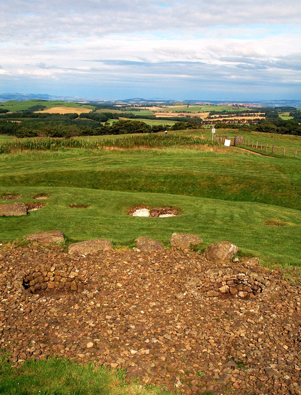
Die erste Aktivität auf dem Hügel bestand in der Aufstellung von drei Menhiren im Zentrum eines Kreisbogens aus kleinen Gruben, in denen verbrannte menschliche Knochen lagen, die in zwei Fällen mit Knochennadeln vergesellschaftet waren. Dieser Friedhof lag innerhalb eines etwa um 3000 v. Chr. errichteten ovalen Henge-Monuments mit Graben und Wall, in dem ein Kreis aus 24 Menhiren errichtet wurde. Ihre ehemalige Lage wird heute durch mit Kies gefüllte Vertiefungen markiert. Ein Grab mit einer Keramikbeigabe wurde in der Nähe eines der Menhire gefunden.
-

Der Hügel des Kammergrabes
-

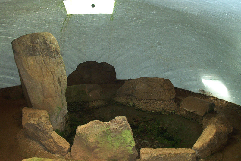
Die Kammer
-
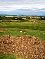
Blick vom Hügel
Jahrhunderte später änderte sich die Art der Nutzung und es fanden Bestattungen in einem Kammergrab statt, das im westlichen Abschnitt des Henges errichtet und von einem Rundhügel bedeckt wurde. Unter dem kleinen von Randsteinen gefassten Steinhügel lag eine Bestattung mit einem Menhir an einem Ende. Das Grab war die Ruhestätte einer wichtigen Person, deren Gesicht mit einer Art Maske bedeckt war. Neben ihr lag eine Holzkeule. Am Kopf- und Fußende lag je ein Trinkbecher. Der Deckstein der Kammer wurde durch eine Betonkuppel ersetzt, um die Gräber zu schützen und die Kammer, in die man von oben einsteigt, der Öffentlichkeit zugänglich zu machen. Der Steinhügel wurde später noch einmal vergrößert um zwei Urnen aufzunehmen.
Siehe auch
Literatur
- Anna Ritchie, Graham Ritchie: Scotland. Archaeology and Early History. Thames and Hudson Ltd., London 1981, ISBN 0-50002-100-7, (Ancient places and people 99).
Weblinks
55.92785-3.622651Koordinaten: 55° 55′ 40″ N, 3° 37′ 22″ WKategorien:- Archäologischer Fundplatz in Schottland
- Menhir
- West Lothian
- Kultbau
- Henge
-

Wikimedia Foundation.