Dankunku

Dankunku
Dankunku
13.569306856944-15.324733779167{{{elevation_save}}}Koordinaten: 13° 34′ N, 15° 19′ W
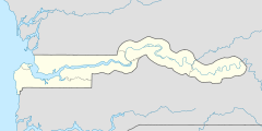
Karte: Gambia
marker
Region: Central River
Distrikt: Niamina Dankunku
Einwohner: 1.652 (2011)

EW3

Dankunku (Namensvarianten: Dankunku Fula) ist eine Ortschaft im westafrikanischen Staat Gambia.

Nach einer Berechnung für das Jahr 2011 leben dort etwa 1652 Einwohner, das Ergebnis der letzten veröffentlichten Volkszählung von 1993 betrug 1679.[1]

Geographie

Dankunku, in der Central River Region im Distrikt Niamina Dankunku, liegt am südlichen Ufer des Gambia-Flusses. Der Ort liegt rund 8,5 Kilometer westlich von Choya an der South Bank Road.

Siehe auch

Einzelnachweise

  1. Dankunku in World Gazetteer, Zugriff August 2011

Wikimedia Foundation.

Игры ⚽ Нужна курсовая?

Schlagen Sie auch in anderen Wörterbüchern nach:

  • Dankunku — Original name in latin Dankunku Name in other language Dankunko, Dankunku State code GM Continent/City Africa/Banjul longitude 13.56667 latitude 15.31667 altitude 26 Population 1641 Date 2012 01 18 …   Cities with a population over 1000 database

  • Dankunku Island — Vorlage:Infobox Insel/Wartung/Fläche fehltVorlage:Infobox Insel/Wartung/Höhe fehlt Dankunku Island …   Deutsch Wikipedia

  • Niamina Dankunku — Lage des Distrikts in der Central River Region …   Deutsch Wikipedia

  • Isla Dankunku — Dankunku Island Localización País  Gambia Río Río Gambia …   Wikipedia Español

  • Niamina Dankunku — Districts of Central River Division Niamina Dankunku is one of the ten districts of the Central River Division of The Gambia …   Wikipedia

  • Niamina Dankunku District — Admin ASC 2 Code Orig. name Niamina Dankunku District Country and Admin Code GM.03.2412424 GM …   World countries Adminstrative division ASC I-II

  • Sea Horse Island — Vorlage:Infobox Insel/Wartung/Fläche fehltVorlage:Infobox Insel/Wartung/Höhe fehlt Dankunku Island NASA World Wind Satellitenbild Der Gambia fließt hier im Bildausschnitt in …   Deutsch Wikipedia

  • Central River Division — Karte Lage der Division in Gambia Central River Basisdaten …   Deutsch Wikipedia

  • Baro Kunda (Central River Region) — Baro Kunda 13.641751427778 15.3123868{{{elevation save}}}Koordinaten …   Deutsch Wikipedia

  • Jessadi — 13.639227715278 15.298222208889{{{elevation save}}}Koordinaten: 13°&# …   Deutsch Wikipedia

Share the article and excerpts

Direct link
Do a right-click on the link above
and select “Copy Link”