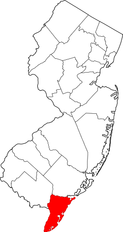
Cape May County (New Jersey)
- Cape May County (New Jersey)
-
Cape May County ist ein County (Landkreis) im US-Bundesstaat New Jersey. Im Jahr 2000 hatte das County 102.326 Einwohner und eine Bevölkerungsdichte von 155 Einwohner / km². Der Sitz der Countyverwaltung (County Seat) ist in Cape May Court House.
Geografie
Das County hat eine Fläche von 1.607 km², wovon 946 km² Wasseroberfläche sind.
Städte und Ortschaften
|
|
|
- Avalon
- Cape May Point
- Cape May
- Dennis Township
- Lower Township
- Diamond Beach
- Erma
- North Cape May
- Villas
|
- Middle Township
- Cape May Court House
- Rio Grande
- Whitesboro-Burleigh
- North Wildwood
- Ocean City
- Sea Isle City
- Stone Harbor
|
- Upper Township
- West Cape May
- West Wildwood
- Wildwood Crest
- Wildwood
- Woodbine
|
39.08-74.867Koordinaten: 39° 5′ N, 74° 52′ W
Wikimedia Foundation.
Schlagen Sie auch in anderen Wörterbüchern nach:
Cape May County, New Jersey — Location in the state of New Jersey … Wikipedia
List of county routes in Cape May County, New Jersey — The following is a list of county routes in Cape May County in the U.S. state of New Jersey. For more information on the county route system in New Jersey as a whole, including its history, see County routes in New Jersey. 500 series county… … Wikipedia
National Register of Historic Places listings in Cape May County, New Jersey — List of the National Register of Historic Places listings in Cape May County, New Jersey Contents: Counties in New Jersey Atlantic Bergen Burlington Camden Cape May Cumberland Essex Gloucester Hudson Hunterdon Mercer Middlesex Monmouth… … Wikipedia
List of Registered Historic Places in Cape May County, New Jersey — NOTOC This is intended to be a complete list of properties and districts listed on the National Register of Historic Places in Cape May County, New Jersey. The locations of National Register properties and districts (at least for all showing… … Wikipedia
County Route 626 (Cape May County, New Jersey) — infobox road state=NJ Cape May type= route=626 maint=Cape May County length mi=6.77 length ref= [ [http://www.state.nj.us/transportation/refdata/sldiag/05000626 .pdf County Route 626] straight line diagram from New Jersey Department of… … Wikipedia
County Route 603 (Cape May County, New Jersey) — infobox road state=NJ Cape May type= route=603 maint=Cape May County length mi=8.18 length ref= [ [http://www.state.nj.us/transportation/refdata/sldiag/05000603 .pdf County Route 603] straight line diagram from New Jersey Department of… … Wikipedia
County Route 657 (Cape May County, New Jersey) — infobox road state=NJ Cape May type= route=657 maint=Cape May County length mi=9.71 length ref= [ [http://www.state.nj.us/transportation/refdata/sldiag/05000657 .pdf County Route 657] straight line diagram from New Jersey Department of… … Wikipedia
County Route 618 (Cape May County, New Jersey) — infobox road state=NJ Cape May type= route=618 maint=Cape May County length mi=3.17 length ref= [ [http://www.state.nj.us/transportation/refdata/sldiag/05000618 .pdf County Route 618] straight line diagram from New Jersey Department of… … Wikipedia
County Route 623 (Cape May County, New Jersey) — infobox road state=NJ Cape May type= route=623 maint=Cape May County length mi=2.33 length ref= [http://www.state.nj.us/transportation/refdata/sldiag/05000623 .pdf County Route 623] straight line diagram from New Jersey Department of… … Wikipedia
Cape May Point, New Jersey — Infobox Settlement official name = Cape May Point, New Jersey settlement type = Borough nickname = motto = imagesize = image caption = The entrance to Cape May Point image image mapsize = 250x200px map caption = Cape May Point Borough highlighted … Wikipedia

