Desolation Sound Provincial Marine Park
- Desolation Sound Provincial Marine Park
-
Der Desolation Sound Provincial Marine Park ist ein Provinzpark im kanadischen British Columbia. Das Meeresschutzgebiet wurde 1973 gegründet, ist 84 km² groß und nur per Boot zugänglich. Wegen der malerischen Buchten ist das Schutzgebiet bei Yacht- und Sportbootfreunden sehr beliebt. An Land ragen die bewaldeten Hänge steil zu den Gletschern und Bergen auf, wobei sie ab und zu durch Wasserfälle unterbrochen werden.
Lage
Das Schutzgebiet befindet sich 32 km nördlich von Powell River und 150 km nördlich von Vancouver im Desolation Sound.
Weblinks
Wikimedia Foundation.
Schlagen Sie auch in anderen Wörterbüchern nach:
Desolation Sound Marine Provincial Park — Desolation Sound Provincial Marine Park … Wikipedia
Desolation Sound — Waterfalls in Toba Inl … Wikipedia
Desolation Sound — Baie Desolation Pour les articles homonymes, voir Desolation Sound (homonymie). 50°12′N 124°47′W / … Wikipédia en Français
Desolation Sound — Der Desolation Sound ist ein Sund an der Sunshine Coast in British Columbia in Kanada. Er ist wegen seiner landschaftlichen Schönheiten bei Bootstouren beliebt. Der Desolation Sound In der Nähe befindet sich der steilste Wasserfall Nordamerikas.… … Deutsch Wikipedia
Baie Desolation — Pour les articles homonymes, voir Desolation Sound (homonymie). Baie Desolation Carte de la baie Desolation … Wikipédia en Français
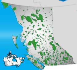
Provincial Parks in British Columbia — Karte der Provincial Parks in British Columbia Die kanadische Provinz British Columbia unterhält 620 Provincial Parks (Stand: November 2010). Damit besitzt die Provinz nach den kanadischen Nationalparks das größte Parksystem des Landes. Über 13,5 … Deutsch Wikipedia
List of British Columbia Provincial Parks — The following is a list of all British Columbia land currently managed by [http://www.env.gov.bc.ca/bcparks BC Parks] . Any parks that are closed are not currently listed.There were a number of provincial parks, protected areas and ecological… … Wikipedia
Copeland Islands Marine Provincial Park — Coordinates: 50°01′10″N 124°49′0″W / 50.01944°N 124.816667°W / 50.01944; 124.816667 For … Wikipedia
West Redonda Island — Vorlage:Infobox Insel/Wartung/Fläche fehltVorlage:Infobox Insel/Wartung/Höhe fehlt West Redonda Island Refuge Cove im Süden der Insel … Deutsch Wikipedia
West Redonda Island — is an island in British Columbia, Canada. It is part of the Discovery Islands, an archipelago between Vancouver Island and the mainland, and between the Strait of Georgia and Johnstone Strait.West Redonda Island is located west of East Redonda… … Wikipedia