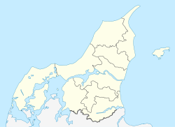
Egholm — bezeichnet mehrere dänische Orte: Egholm (Agersø), Halbinsel am Nordende der Insel Agersø Egholm (Bågø), kleine Insel nordwestlich der Insel Bågø im Kleinen Belt Egholm (Gørløse), Gebiet in Gørløse auf der Insel Seeland (Hillerød Kommune) Egholm… … Deutsch Wikipedia
Egholm — is a Danish island in the Limfjord close to Aalborg. The island covers an area of 6.05 km² and has 50 inhabitants. Egholm can be reached by ferry from Aalborg within 5 minutes.External links* http://www.sitecenter.dk/oesammenslutningen/egholm/ da … Wikipedia
Egholm — Saltar a navegación, búsqueda Egholm es una isla de Dinamarca ubicada en el fiordo de Limfjord, cerca de Aalborg. La isla ocupa una superficie de of 6,05 km² y alberga una población de 50 habitantes. A Egholm se puede llegar en ferry desde… … Wikipedia Español
Limfjord — Limfjord, der bedeutendste Meerbusen Dänemarks, 1460 qkm (26,5 QM.) groß, schneidet in einer Länge von 157 km vom Kattegat in die Halbinsel Jütland ein und teilt diese in zwei Teile. Der schmale Landstreifen (Tange) im W. bei Agger, der ihn von… … Meyers Großes Konversations-Lexikon
Liste dänischer Inseln — Diese Liste erfasst alle dänischen Inseln, die zur Zeit (2009) bewohnt sind, sowie deren Fläche, Einwohnerzahl (2009), Bevölkerungsdichte, kommunale und regionale Zugehörigkeit und bedeutende Ortschaften auf selbigen. Hinweis: Die Endungen ø bzw … Deutsch Wikipedia
List of islands of Denmark — Map showing some of the larger islands This is a list of islands of Denmark. Contents 1 Overview 1.1 … Wikipedia
North Jutlandic Island — Native name: Nørrejyske Ø The Grenen sand bar at the northern tip of the island … Wikipedia
Fiordo de Lim — (Limfjorden) El fiordo de Lim en invierno Ubicación geográfica … Wikipedia Español
Aalborg Municipality — is a municipality (Danish, kommune ) in Region Nordjylland on the Jutland peninsula in northern Denmark.Bridgwater, W. Beatrice Aldrich. (1966) The Columbia Viking Desk Encyclopedia . Columbia University. p. 11.] The municipality straddles the… … Wikipedia
Mors (island) — Mors Hanklit, Mors Geography Location Limfjor … Wikipedia

