- Galisteo (New Mexico)
-

Dieser Artikel wurde aufgrund von inhaltlichen Mängeln auf der Qualitätssicherungsseite des Projektes USA eingetragen. Hilf mit, die Qualität dieses Artikels auf ein akzeptables Niveau zu bringen, und beteilige dich an der Diskussion! 
Galisteo 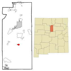 Lage in New Mexico
Basisdaten Staat: Vereinigte Staaten Bundesstaat: New Mexico County: Koordinaten: 35° 24′ N, 105° 57′ W35.395277777778-105.947777777781846Koordinaten: 35° 24′ N, 105° 57′ W Zeitzone: Mountain Standard Time (UTC−7) Einwohner: 265 (Stand: 2000) Bevölkerungsdichte: 39 Einwohner je km² Fläche: 6,8 km² (ca. 3 mi²)
davon 6,8 km² (ca. 3 mi²) LandHöhe: 1846 m Postleitzahl: 87540 Vorwahl: +1 505 FIPS: 35-27970 GNIS-ID: 928734 Galisteo ist ein Census-designated place (CDP) in Santa Fe County, New Mexico, USA. Es ist Teil der Santa Fe, New Mexico Metropolitan Statistical Area. Bei der Volkszählung im Jahr 2000 wurden 265 Einwohner erfasst. Das Dorf liegt südlich des Galisteo Basin am Galisteo Greek.
Kategorie:- Ort in New Mexico


Wikimedia Foundation.