- Gibbon River
-
Gibbon River 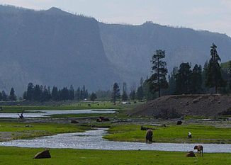
Der Gibbon River im Yellowstone-Nationalpark
Daten Gewässerkennzahl US: 1609254 Lage Wyoming, Vereinigte Staaten Flusssystem Mississippi River Abfluss über Madison → Missouri → Mississippi → Golf von Mexiko Quelle Grebe Lake
44° 45′ 10″ N, 110° 33′ 57″ W44.7527146-110.56576072450Quellhöhe 2.450 m[1] Zusammenfluss mit dem Firehole River zum Madison River 44.6421544-110.86549012071Koordinaten: 44° 38′ 32″ N, 110° 51′ 56″ W
44° 38′ 32″ N, 110° 51′ 56″ W44.6421544-110.86549012071Mündungshöhe 2.071 m Höhenunterschied 379 m Länge ca. 55 km[1] Durchflossene Seen Wolf Lake Der Gibbon River ist der rechte Quellfluss des Madisons, eines Quellflusses des Missouris, im Yellowstone-Nationalpark im Bundesstaat Wyoming der Vereinigten Staaten.
Er entspringt im Grebe Lake ⊙44.752066110.5585092450 auf 2.450 m[1] und entfließt dem See nach Westen in den Wolf Lake. Der Gibbon River verläuft dann in südwestliche Richtung, am Ice Lake vorbei in den Norris Canyon. Dort passiert er die Virginia-Kaskaden. Er umfließt den Gibbon Hill und stürzt über die Gibbon-Fälle etwa 25 Meter in die Tiefe. Nach etwa 55 Kilometern[1] Flusslauf vereinigt er sich mit dem Firehole River zum Madison.
Fauna
Im Gibbon River kommem Bachforellen, Regenbogenforellen und Äschen vor. Er ist ein beliebtes Ziel für Angler.
Weblinks
Gibbon River im Geographic Names Information System des United States Geological Survey
 Commons: Gibbon River – Sammlung von Bildern, Videos und Audiodateien
Einzelnachweise
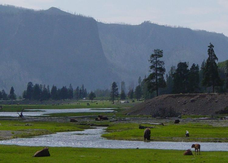
 Oberlauf des Gibbon Rivers
 Kategorien:
- Flusssystem Missouri River
- Fluss in Wyoming
- Fluss in Nordamerika
- Yellowstone-Nationalpark

Wikimedia Foundation.