Lake Yarrunga

Lake Yarrunga
Lake Yarrunga
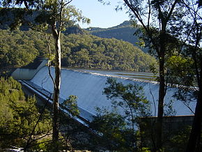
Ablauf von der Tallowa-Talsperre im Juli 2010
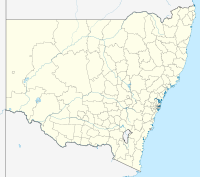
Lage: New South Wales, Australien
Zuflüsse: Shoalhaven River, Kangaroo River, Yarrunga Creek, Bundanoon Creek
Abflüsse: Shoalhaven River
Größere Orte am Ufer: Bendeela
Größere Orte in der Nähe: Bundanoon, Kangaroo Valley
Lake Yarrunga (New South Wales)
Lake Yarrunga
Koordinaten 34° 45′ 17,1″ S, 150° 21′ 47,8″ O-34.75473739150.3632768Koordinaten: 34° 45′ 17,1″ S, 150° 21′ 47,8″ O
Daten zum Bauwerk
Bauzeit: –1976
Höhe der Bauwerkskrone: 43 m
Kronenlänge: 528 m
Kraftwerksleistung: 240 MWdep1
Daten zum Stausee
Höhe des Stauziels: 176 m
Wasseroberfläche bei Vollstau: 5,7 km²
Stauseelänge: 19 km
Stauseebreite: 800 m
Speicherraum: 75 Mio. m³dep1

Der Lake Yarrunga ist ein Stausee südwestlich von Wollongong im Südosten des australischen Bundesstaates New South Wales im Küstengebirge. Der See wird von der Tallowa-Talsperre angestaut und befindet sich an den Unterläufen des Kangaroo River und des Shoalhaven River. Er wird zusätzlich vom Yarrunga Creek und vom Bundanoon Creek, Nebenflüssen des Kangaroo River, gespeist und dient der Energiegewinnung für den Großraum Wollongong.

Das Wasser kann vom Lake Yarrunga zum Fitzroy Falls Reservoir gepumpt und über das Kraftwerk wieder abgelassen werden. Es handelt sich daher um ein Pumpspeicherkraftwerk.

Am Nordufer des Sees liegt die Siedlung Bendeela. Die Kleinstadt Bundanoon befindet sich ca. 12 km (Luftlinie) nördlich oberhalb des Sees am Bundanoon Creek. Über Straßen ist sie allerdings erst nach einer Fahrt von 62 km erreichbar. Die Kleinstadt Kangaroo Valley liegt am oberen Ende des Sees am Kangaroo River.

Weblinks und Quellen


Wikimedia Foundation.

Игры ⚽ Нужно решить контрольную?

Schlagen Sie auch in anderen Wörterbüchern nach:

  • Shoalhaven-System — Das Shoalhaven System ist ein System von drei Stauseen und zwei Wasserkraftwerken im Osten des australischen Bundesstaates New South Wales. Es dient sowohl der Sammlung von Trinkwasser für den Großraum Sydney als auch der Gewinnung elektrischer… …   Deutsch Wikipedia

  • Shoalhaven Scheme — The Shoalhaven Scheme is a dual purpose water supply and hydro electric power generation scheme in New South Wales. It was built as a joint project between the Electricity Commission of NSW and the NSW Metropolitan Water Sewerage and Drainage… …   Wikipedia

  • Shoalhaven River — westlich von Batemans BayVorlage:Infobox Fl …   Deutsch Wikipedia

  • Shoalhaven River — The Shoalhaven River is a river on the South Coast of New South Wales, Australia.The Shoalhaven rises on the eastern side of the Great Dividing Range about 350 kilometres southwest of Sydney. The upper reaches flow northwards through an upland… …   Wikipedia

  • Kangaroo River (Shoalhaven River) — Kangaroo River Hampden Bridge über den Kangaroo River in Kangaroo ValleyVorlage:Infobox Fluss/KARTE fehlt …   Deutsch Wikipedia

  • Division of Throsby — Throsby Australian House of Representatives Division Division of Throsby (green) in New South Wales Created: 1984 M …   Wikipedia

  • List of localities in Victoria (Australia) — Map of Local Government Areas in Victoria This is a list of locality names and populated place names in the state of Victoria, Australia, outside the Melbourne metropolitan area. It is organised by region from the south west of the state to the… …   Wikipedia

  • Mittagong, New South Wales — Mittagong New South Wales …   Wikipedia

  • List of schools in Victoria, Australia — This is a list of schools in Victoria, Australia. (NOTE: This list is not complete) Contents 1 Government Primary Schools 1.1 A 1.2 B 1.3 C 1.4 …   Wikipedia

  • Liste Des Navires De La CMA-CGM — La liste non exhaustive ci dessous présente les différents porte conteneurs affrétés par la CMA CGM en 2008. Sommaire : Haut A B C D E F G H I J K L M N O P Q R S T U V W X Y Z …   Wikipédia en Français

Share the article and excerpts

Direct link
Do a right-click on the link above
and select “Copy Link”