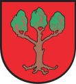
- Lubraniec
-
Lubraniec 
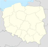
Basisdaten Staat: Polen Woiwodschaft: Kujawien-Pommern Landkreis: Włocławek Fläche: 1,97 km² Geographische Lage: 52° 33′ N, 18° 50′ O52.54194444444418.835555555556Koordinaten: 52° 32′ 31″ N, 18° 50′ 8″ O Einwohner: 3130
(31. Dez. 2010)[1]Postleitzahl: 87-890 Telefonvorwahl: (+48) 54 Kfz-Kennzeichen: CWL Gemeinde Gemeindeart: Stadt- und Landgemeinde Gemeindegliederung: 50 Ortschaften 32 Schulzenämter Fläche: 148,2 km² Einwohner: 9846
(31. Dez. 2010) [2]Bevölkerungsdichte: 66 Einw./km² Gemeindenummer (GUS): 0418123 Verwaltung (Stand: 2011) Bürgermeister: Krzysztof Wrzesiński Adresse: ul. Brzeska 49
87-890 LubraniecWebpräsenz: www.lubraniec.pl Lubraniec (deutsch 1939–1942 Lubranitz, 1943–1945 Lutbrandau) ist eine Stadt und Sitz der gleichnamigen Stadt- und Landgemeinde in Polen. Der Ort liegt im Powiat Włocławski der Wojewodschaft Kujawien-Pommern.
Inhaltsverzeichnis
Gemeinde
Zur Stadt- und Landgemeinde gehören neben der Stadt Lubraniec weitere 32 Ortsteile (deutsche Namen bis 1945)[3] mit einem Schulzenamt.
- Annowo
- Bielawy (1939–1942 Bielawy, 1943–1945 Bilsdorf)
- Biernatki (1939–1942 Bernatki , 1943–1945 Birndorf)
- Bodzanowo
- Czajno
- Dąbie Kujawskie
- Dęby Janiszewskie
- Gołębin-Parcele (1943–1945 Taubenau)
- Gołębin-Wieś
- Janiszewo
- Kazanie (1939–1942 Kasane, 1943–1945 Wildheim)
- Kłobia (1939–1942 Klobia, 1943–1945 Klobendorf)
- Kolonia Piaski
- Koniec (1939–1942 Konetz , 1943–1945 Enddorf)
- Krowice (1939–1942 Krowitz, 1943–1945 Kühnfelde)
- Lubraniec-Parcele
- Lubrańczyk
- Milżyn
- Milżynek
- Ossowo (1939–1942 Ossowo, 1943–1945 Ostau)
- Rabinowo
- Redecz Kalny
- Redecz Wielki-Wieś
- Sarnowo
- Siemnówek
- Skaszyn
- Smogorzewo (1939–1942 Smogorschew, 1943–1945 Morgen)
- Sułkowo (1943–1945 Solkau)
- Świątniki (1943–1945 Schwarzenheim)
- Wiktorowo
- Wola Sosnowa
- Żydowo
Weitere Ortschaften der Gemeinde sind:
- Agnieszkowo
- Borek
- Dąbie Poduchowne
- Dobierzyn (1939–1942 Doberschin, 1943–1945 Nahwalde)
- Zgłowiączka
- Florianowo
- Górniak
- Józefowo
- Kłobia Nowa
- Kolonia Łódź
- Korzeszynek
- Marysin
- Piaski
- Redecz Wielki-Parcele
- Siarczyce (1939–1942 Siartschitz, 1943–1945 Ulmenhang)
- Stok
- Turowo (1939–1942 Turowo, 1943–1945 Turnau)
- Zgłowiączka
Söhne und Töchter der Stadt
- Marek Wojtkowski (* 1968), polnischer Politiker (Platforma Obywatelska), Sejm-Abgeordneter und Hochschullehrer
Verweise
Weblinks
 Commons: Lubraniec – Sammlung von Bildern und/oder Videos und Audiodateien
Fußnoten
- ↑ Population. Size and Structure by Territorial Division. As of December 31, 2010. Główny Urząd Statystyczny (GUS), abgerufen am 9. Juli 2011.
- ↑ Population. Size and Structure by Territorial Division. As of December 31, 2010. Główny Urząd Statystyczny (GUS), abgerufen am 9. Juli 2011.
- ↑ Lutbrandau (Topograph. Karte, 1:25000), Deutsche Heereskarte, Ausgabe 1 vom XI.44
Kategorien:- Gmina in der Woiwodschaft Kujawien-Pommern
- Ort der Woiwodschaft Kujawien-Pommern
Wikimedia Foundation.

