Maghera

Maghera
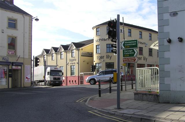
Maghera, Stadtzentrum (2007)
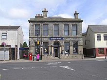
Ulster Bank, Maghera (2006)

Maghera (irisch: Machaire Rátha; engl.: „plain of the ringfort“) ist eine Stadt im Nordosten Irlands im County Derry in Nordirland.

Inhaltsverzeichnis

Der Ort

Der Ort Maghera entstand um die St. Lurach’s Church, die – ursprünglich als Kloster – um das Jahr 500 begründet wurde. Heute gehört Maghera zum District von Magherafelt, das 13 Kilometer südlich von Maghera liegt.

Parlamentarisch gehört Maghera zu Mid Ulster. Beim Census 2001 wurde für Maghera eine Einwohnerzahl von 3711 Personen ermittelt (nach 2876 beim Census 1991). Davon waren 72,4% römisch-katholisch, während 27,1% einen protestantischen Hintergrund hatten.[1] Während des Nordirlandkonflikts kamen in Maghera 14 Menschen ums Leben.

Bereits 1830 war es am 12. Juli bei Oranier-Paraden zu Auseinandersetzungen gekommen, in deren Folge mehrere Häuser katholischer Bewohner von Protestanten niedergebrannt wurden.[2]

Verkehr

Maghera liegt am Kreuzungspunkt der von Osten kommenden A42 mit der nord-südlich verlaufenden A29 und nur 1 km von der A6 entfernt, die Belfast mit Derry City verbindet.

An den Bahnverkehr war Maghera von 1880 bis 1959 angeschlossen.

Archäologie

Maghera gehört zu den Orten in Irland, wo Cross Slabs gefunden wurden. Nordöstlich von Maghera befindet sich die Wallanlage Dunglady und das Court tomb von Tamnyrankin.

Persönlichkeiten

  • Charles Thomson (1729–1824), US-amerikanischer Schriftsteller und Politiker

Weitere Orte gleichen Namens

Maghera ist auch der Name eines Townlands sowie eines Berges im Co. Clare, nördlich von Limerick, auf dessen Gipfel sich ein 122 Meter hoher Sendemast befindet (Koordinaten: 52°58'6"N 8°43'6"W).[3]

Weblinks

Einzelnachweise

  1. Area Profile of Maghera - Based on 2001 Census bei Northern Ireland Neighbourhood Information Service (NINIS, abgerufen am 19. August 2011).
  2. Parades and Marches - Chronology 2: Historical Dates and Events: 12 July 1830 auf cain.ulst.ac.uk (engl.)
  3. http://www.irish-tv.com/maghera.asp
54.844-6.673

Wikimedia Foundation.

Игры ⚽ Нужен реферат?

Schlagen Sie auch in anderen Wörterbüchern nach:

  • Maghera — For the Romanian village, see Vârfu Câmpului. Coordinates: 54°50′38″N 6°40′23″W / 54.844°N 6.673°W / 54.844; 6.673 …   Wikipedia

  • Maghera — Original name in latin Maghera Name in other language State code GB Continent/City Europe/London longitude 54.8439 latitude 6.67145 altitude 74 Population 4085 Date 2007 04 13 …   Cities with a population over 1000 database

  • Maghera (parish) — Maghera (from Irish: Machaire Rátha meaning plain of the fort ) is a parish in County Londonderry, Northern Ireland. It is bordered by the parishes of Ballynascreen, Ballyscullion, Desertmartin, Dungiven, Kilcronaghan, Killelagh, Magherafelt,… …   Wikipedia

  • Craigmore, Maghera civil parish — Craigmore is a townland lying within the civil parish of Maghera, County Londonderry, Northern Ireland. It lies on the west boundary of the parish, and is bounded by the townlands of; Craigadick, Falgortrevy, Grillagh, Tamnymullan, and Tirnony.… …   Wikipedia

  • The Troubles in Maghera — During the Troubles in Northern Ireland, a total of 14 people were killed in Troubles related violence in or near the village of Maghera, County Londonderry. Of the 13 from Northern Ireland, 11 were Protestant and two were Catholic. Seven of the… …   Wikipedia

  • Craigadick — is a townland lying within the civil parish of Maghera, County Londonderry, Northern Ireland. It lies in the west of the parish sharing a small boundary with Killelagh civil parish. It is bounded by the townlands of; Ballynahone Beg, Craigmore,… …   Wikipedia

  • Crew, County Londonderry — Crew is a townland lying within the civil parish of Maghera, County Londonderry, Northern Ireland. It lies in the east centre of the parish on the north boundary of the civil parish of Termoneeny, and is bounded by the townlands of Ballymacilcurr …   Wikipedia

  • Culnady (townland) — For the village of Culnady, see Culnady. Culnady (from Irish: Cuil Cnadaidhe meaning nook of the sluggard )[1] is a townland lying within the civil parish of Maghera, County Londonderry, Northern Ireland. It lies in the north east of the parish… …   Wikipedia

  • Drumconready — is a townland lying within the civil parish of Maghera, County Londonderry, Northern Ireland. It lies on the south west of the parish, with the Moyola River forming its southern boundary. It is bounded by the townlands of; Ballynure,… …   Wikipedia

  • Knockcloghrim — is a small village in County Londonderry, Northern Ireland, near Maghera. In the 2001 Census it had a population of 186 people. It is predominantly Protestant, although there is a small Roman Catholic population. It lies within the Magherafelt… …   Wikipedia

Share the article and excerpts

Direct link
Do a right-click on the link above
and select “Copy Link”