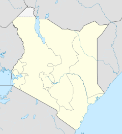
Murang’a

Murang’a
Murang’a
Basisdaten
Einwohner 11.021 Einw.
Höhe 1.255 m
Koordinaten 0° 43′ S, 37° 10′ O-0.72025137.1594311255Koordinaten: 0° 43′ S, 37° 10′ O
Murang’a (Kenia)
Murang’a
Murang’a
Politik
Provinz Central
Distrikt Murang’a

Murang’a, oft auch in der Schreibweise Muranga, ist eine Kleinstadt etwa 70 km nordöstlich von Nairobi in Kenia mit etwa 11.000 Einwohnern (Stand 1999).

Inhaltsverzeichnis

Geschichte

In der Kolonialzeit hieß die Stadt Fort Hall. Murang’a ist die Hauptstadt des gleichnamigen Distriktes in der Zentralprovinz in Kenia. Im Murang’a District wird vor allem Kaffee angebaut, in höheren Lagen auch Tee. Die Bewohner sind meist Kikuyu.

Infrastruktur

Murang’a besitzt Banken, Tankstellen, eine Post, Hotels und Restaurants, sowie mehrere Supermärkte und örtliche Märktplätze. 500 m nördlich der Stadt existiert ein District General Hospital. Die Thika Murang’a-Straße führt nach Nyeri und Nairobi. In der Stadtmitte gibt es einen Matatu-Bahnhof. Die Kathedrale zum hl. Herz Jesu stammt von 1902.[1]

Bildung

An die 800 Studenten besuchen die Schule und das Internat Murang’a High School. Diese Jungenschule, eine der ältesten in Kenia, wird seitens der katholischen Kirche betrieben. Das Medical Training College einen Kilometer außerhalb der Stadtmitte stammt von 1950, bildet Krankenschwestern aus und bietet als Abschluss Diplome in Klinischer Medizin.[2]

Weblinks

Einzelnachweise

  1. http://www.gcatholic.com/churches/data/cathKE.htm#hbp
  2. http://www.kmtc.ac.ke/KMTC-Campuses/Muranga

Wikimedia Foundation.

Игры ⚽ Поможем сделать НИР

Schlagen Sie auch in anderen Wörterbüchern nach:

  • Murang'a — Muranga lies between Nairobi and Mount Kenya Murang a (sometimes misspelled as Muranga) is a town in Central Province of Kenya. The town was previously called Fort Hall. It is the administrative centre of Murang a District and is mainly inhabited …   Wikipedia

  • Murang'a — Original name in latin Murang’a Name in other language Fort Hall, Murang a, Murang’a State code KE Continent/City Africa/Nairobi longitude 0.71667 latitude 37.15 altitude 1359 Population 11987 Date 2013 06 27 …   Cities with a population over 1000 database

  • Murang’a District — Basisdaten Einwohner  Bevölkerungsdichte 348.304 Einw. [1] 375 Einw./km² Fläche 930 km² Koordinaten …   Deutsch Wikipedia

  • Murang'a High School — is a Catholic church sponsored boys boarding high school located in Murang a town, Kenya. It has over 800 students Coordinates: 0°43′21″S 37°08′46″E /  …   Wikipedia

  • Murang people — The Murang people are a tribe living in the Chittagong Hill Tracts of Bangladesh. Categories: Bangladesh stubsEthnic groups in BangladeshChittagong …   Wikipedia

  • Murang'a District — Admin ASC 1 Code Orig. name Murang A Country and Admin Code KE.38 KE …   World countries Adminstrative division ASC I-II

  • Muranga District — Muranga lies between Nairobi and Mount Kenya Murang a (sometimes misspelled as Muranga) is one of the districts of Kenya s Central Province. Its capital town is also now named Murang a but was called Fort Hall in colonial times (before 1963). It… …   Wikipedia

  • Districts of Kenya — Kenya …   Wikipedia

  • Центральная (провинция Кении) — Координаты: 0°45′00″ ю. ш. 37°00′00″ в. д. /  …   Википедия

  • Центральная провинция (Кения) — У этого термина существуют и другие значения, см. Центральная провинция. Центральная Central Province Страна …   Википедия

Share the article and excerpts

Direct link
Do a right-click on the link above
and select “Copy Link”