Oporów (Powiat Kutnowski)

Oporów (Powiat Kutnowski)
Oporów
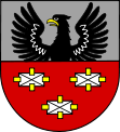
Wappen von Oporów
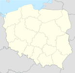
Oporów (Polen)
Oporów
Oporów
Basisdaten
Staat: Polen
Woiwodschaft: Łódź
Landkreis: Kutno
Geographische Lage: 52° 16′ N, 19° 34′ O52.26416666666719.565833333333Koordinaten: 52° 15′ 51″ N, 19° 33′ 57″ O
Einwohner:

-
(31. Dez. 2010)[1]

Postleitzahl: 99-322
Telefonvorwahl: (+48) 24
Kfz-Kennzeichen: EKU
Wirtschaft und Verkehr
Nächster int. Flughafen: Łódź
Gemeinde
Gemeindeart: Landgemeinde
Gemeindegliederung: 24 Schulzenämter
Fläche: 67,9 km²
Einwohner:

2679
(31. Dez. 2010) [2]

Bevölkerungsdichte: 39 Einw./km²
Gemeindenummer (GUS): 1002092
Verwaltung
Bürgermeister: Robert Pawlikowski
Adresse: Oporów 12a
99-322 Oporów
Webpräsenz: www.oporow.pl

Oporów ist ein Dorf und Sitz der gleichnamigen Gemeinde im Powiat Kutnowski der Woiwodschaft Łódź, Polen.

Gemeinde

Zur Landgemeinde Oporów gehören 24 Ortsteile mit einem Schulzenamt:

Golędzkie
Janów
Jastrzębia
Jaworzyna
Jurków Drugi
Jurków Pierwszy
Kamienna
Kurów-Parcel
Kurów-Wieś
Mnich-Ośrodek
Mnich-Południe
Oporów
Oporów-Kolonia
Pobórz
Podgajew
Samogoszcz
Skórzewa
Skarżyn
Stanisławów
Szczyt
Świechów
Wola Owsiana
Wola Prosperowa
Wólka-Lizigódź

Eine weitere Ortschaft der Gemeinde ist Mnich.

Verweise

Fußnoten

  1. Population. Size and Structure by Territorial Division. As of December 31, 2010. Główny Urząd Statystyczny (GUS), abgerufen am 16. Juli 2011.
  2. Population. Size and Structure by Territorial Division. As of December 31, 2010. Główny Urząd Statystyczny (GUS), abgerufen am 16. Juli 2011.

Wikimedia Foundation.

Игры ⚽ Нужно сделать НИР?

Schlagen Sie auch in anderen Wörterbüchern nach:

  • Powiat Kutnowski — Powiat Kutnowski …   Deutsch Wikipedia

  • Oporów — bezeichnet; eine Gemeinde in Polen in der Wojewodschaft Łódź, Powiat Kutnowski, siehe Oporów (Powiat Kutnowski) einen Ortsteil im Breslauer Stadtbezirk Fabryczna, siehe Oporów (Breslau) Diese Seite ist eine Begriffsklärung …   Deutsch Wikipedia

  • Gmina Oporów — Oporów Commune   Gmina   …   Wikipedia

  • Kutno County — Infobox Settlement name = Kutno County native name = Powiat kutnowski settlement type = image shield = POL powiat kutnowski COA.svg map caption = Location within the voivodeship subdivision type = Country subdivision name = POL subdivision type1 …   Wikipedia

  • Опорув (гмина) — Гмина Опорув Gmina Oporów Герб …   Википедия

  • Гмина Опорув — Gmina Oporów Герб Страна:  Польша Повят:  Кутновский повят Глава:  Станислав Оконь Площадь:  67,7 км² …   Википедия

  • Gmina Dąbrowice — Dąbrowice Commune   Gmina   Coordinates (Dąbrowice) …   Wikipedia

  • Gmina Nowe Ostrowy — Nowe Ostrowy Commune   Gmina   Coordinates (Nowe Ostrowy) …   Wikipedia

  • Nombres alemanes de ciudades polacas — Anexo:Nombres alemanes de ciudades polacas Saltar a navegación, búsqueda Viejo, los nombres de las localidades alemanas en la República de Polonia (antes de la Segunda Guerra Mundial) Nota, actualmente, sólo los nombres polacos son correctos.… …   Wikipedia Español

  • Noms allemands de villes polonaises — Voici une liste des anciens noms allemands des localités situées en République polonaise, avant la Seconde Guerre mondiale. Actuellement, seuls les noms polonais sont corrects. ville powiat województwo nom allemand remarques Adamowice rybnicki… …   Wikipédia en Français

Share the article and excerpts

Direct link
Do a right-click on the link above
and select “Copy Link”