- Orchard (Iowa)
-
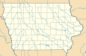
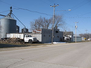
Orchard Lage in Iowa Basisdaten Staat: Vereinigte Staaten Bundesstaat: Iowa County: Koordinaten: 43° 14′ N, 92° 46′ W43.226944444444-92.774444444444336Koordinaten: 43° 14′ N, 92° 46′ W Zeitzone: Central Standard Time (UTC−6) Einwohner: 88 (Stand: 2000) Bevölkerungsdichte: 440 Einwohner je km² Fläche: 0,2 km² (ca. 0 mi²) Höhe: 336 m Postleitzahl: 50460 FIPS: 19-59520 GNIS-ID: 0459886 Orchard ist eine Stadt im Mitchell County im Nordosten des US-Bundesstaates Iowa. Orchard hat 88 Einwohner auf einer Fläche von 0.2 km². Sie ist an das Eisenbahnnetz angeschlossen und hat Anschluss an den IA 218. Orchard liegt ein paar Kilometer südlich des County-Seats Osage nahe dem Idlewild State Park.
Orte im Mitchell CountyCarpenter | Mc Intire | Mitchell | Orchard | Osage | Saint Ansgar | Stacyville
Wikimedia Foundation.
Schlagen Sie auch in anderen Wörterbüchern nach:
Orchard (Iowa) — Orchard Ciudad de los Estados Unidos … Wikipedia Español
Orchard, Iowa — City Orchard, Iowa, 2008 … Wikipedia
Orchard — bezeichnet: Orchard CMS, ein Web Content Management System Orte in den Vereinigten Staaten: Orchard (Alabama) Orchard (Colorado) Orchard (Idaho) Orchard (Iowa) Orchard (Louisiana) Orchard (Nebraska) Orchard (Texas) Orchard Point (Michigan)… … Deutsch Wikipedia
Orchard (disambiguation) — An orchard is an intentional planting of trees or shrubs maintained for food production. Orchard may also refer to: Seed orchard, refers usually to a place where seeds for forest culture are produced Orchard FM, an independent radio station in… … Wikipedia
Orchard — Orchard, NE U.S. village in Nebraska Population (2000): 391 Housing Units (2000): 208 Land area (2000): 0.417248 sq. miles (1.080668 sq. km) Water area (2000): 0.000000 sq. miles (0.000000 sq. km) Total area (2000): 0.417248 sq. miles (1.080668… … StarDict's U.S. Gazetteer Places
Orchard House — U.S. National Register of Historic Places U.S. National Historic Landmark … Wikipedia
Orchard Beach State Park — Orchard Beach State Park … Wikipedia
Orchard, IA — U.S. city in Iowa Population (2000): 88 Housing Units (2000): 35 Land area (2000): 0.088468 sq. miles (0.229132 sq. km) Water area (2000): 0.000000 sq. miles (0.000000 sq. km) Total area (2000): 0.088468 sq. miles (0.229132 sq. km) FIPS code:… … StarDict's U.S. Gazetteer Places
Orchard City — Burlington, Iowa also called Porkopolis of Iowa … Eponyms, nicknames, and geographical games
National Register of Historic Places listings in Lee County, Iowa — Location of Lee County in Iowa This is a list of the National Register of Historic Places listings in Lee County, Iowa. This is intended to be a complete list of the properties and districts on the National Register of Historic Places in Lee… … Wikipedia