- Stacyville
-
Stacyville 
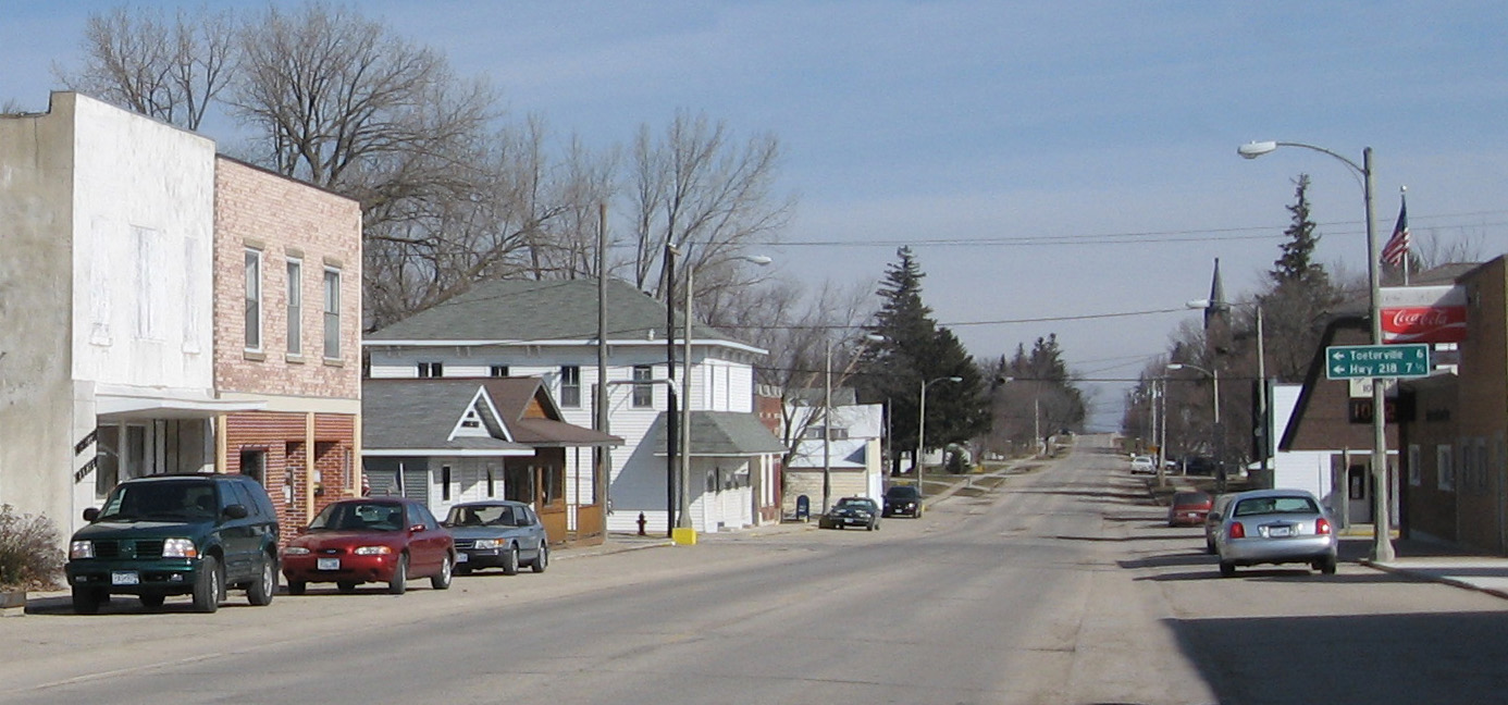
Downtown StacyvilleLage in Iowa 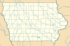

Stacyville Basisdaten Staat: Vereinigte Staaten Bundesstaat: Iowa County: Koordinaten: 43° 26′ N, 92° 47′ W43.436944444444-92.783055555556Koordinaten: 43° 26′ N, 92° 47′ W Zeitzone: Central Standard Time (UTC−6) Einwohner: 469 (Stand: 2000) Bevölkerungsdichte: 390,8 Einwohner je km² Fläche: 1,2 km² (ca. 0 mi²) Postleitzahl: 50476 FIPS: 19-74820 GNIS-ID: 0461945 Stacyville ist eine Stadt am Little Cedar River im Mitchell County im Nordosten des US-Bundesstaates Iowa nahe der Grenze zu Minnesota. Stacyville hat 469 Einwohner auf einer Fläche von 1.2 km². Bei Stacyville liegt der Riverside Park mit dem kleinen Riverside Park Pound. Ein weiterer Stadtpark ist der Stacyville City Park. Stacyville ist auch an ein Eisenbahnnetz angeschlossen, das hier endet. Weiterhin wird sie vom Iowa Highway 227 tangiert.
Geschichte
1855 erworben Homer Stacy und sein Bruder Fitch B. Stacy auf dem heutigen Stadtgebiet 600 Hektar Land. Im Februar 1856 zogen Homer und Amelia Stacy mit ihrer Familie in das Mitchell County. Homer erbaute ein Haus das im Juni 1856 vollendet war. Er benannte dieses Gebiet Stacyville. Im August des gleichen Jahres wurden ein Postamt und ein Sägewerk eröffnet. Während des Zweiten Weltkriegs traten viele junge Einwohner dem Militär bei. Außerdem betreute ein Mädchen aus Stacyville Leute, die aus einem Konzentrationslager befreit wurden. Viele Einwohner, die dem Militär dienten, wurden im Krieg verletzt oder getötet.
 Orte im Mitchell County
Carpenter | Mc Intire | Mitchell | Orchard | Osage | Saint Ansgar | Stacyville
Wikimedia Foundation.
Schlagen Sie auch in anderen Wörterbüchern nach:
Stacyville — is the name of several places in the United States:*Stacyville, Iowa *Stacyville, Maine … Wikipedia
Stacyville — Stacyville, IA U.S. city in Iowa Population (2000): 469 Housing Units (2000): 228 Land area (2000): 0.444162 sq. miles (1.150373 sq. km) Water area (2000): 0.024468 sq. miles (0.063371 sq. km) Total area (2000): 0.468630 sq. miles (1.213744 sq.… … StarDict's U.S. Gazetteer Places
Stacyville, IA — U.S. city in Iowa Population (2000): 469 Housing Units (2000): 228 Land area (2000): 0.444162 sq. miles (1.150373 sq. km) Water area (2000): 0.024468 sq. miles (0.063371 sq. km) Total area (2000): 0.468630 sq. miles (1.213744 sq. km) FIPS code:… … StarDict's U.S. Gazetteer Places
Stacyville (Iowa) — Stacyville Ciudad de los Estados Unidos … Wikipedia Español
Stacyville (Maine) — Stacyville Pueblo de los Estados Unidos … Wikipedia Español
Stacyville, Iowa — Infobox Settlement official name = Stacyville, Iowa settlement type = City nickname = motto = imagesize = image caption = Downtown Stacyville, Iowa. image image mapsize = 250px map caption = Location of Stacyville, Iowa mapsize1 = map caption1 =… … Wikipedia
Stacyville, Maine — Infobox Settlement official name = Stacyville, Maine settlement type = Town nickname = motto = imagesize = image caption = image |pushpin pushpin label position =left pushpin map caption =Location within the state of Maine pushpin mapsize =… … Wikipedia
Municipio de Stacyville (condado de Mitchell, Iowa) — Municipio de Stacyville Municipio de los Estados Unidos … Wikipedia Español
04782 — Stacyville, Me (Miscellaneous » ZIP Codes) … Abbreviations dictionary
50476 — Stacyville, Ia (Miscellaneous » ZIP Codes) … Abbreviations dictionary
Stacyville

18+
© Academic, 2000-2026
- Kontaktieren Sie uns: Unterstützung, Werbung
Wörterbücher Export, schritte mit PHP, Joomla, Drupal, WordPress, MODx.