Oromahoe

Oromahoe

p1

Oromahoe
Oromahoe (Neuseeland)
Oromahoe
Koordinaten 35° 19′ S, 173° 59′ O-35.316666666667173.98333333333Koordinaten: 35° 19′ S, 173° 59′ O
Region Northland
Distrikt Far North Distrikt

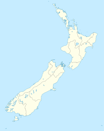
Oromahoe ist eine Siedlung im Far North Distrikt in der Region Northland auf der Nordinsel Neuseelands. Sie liegt am State Highway 10. Die nächstgelegenen Orte sind Puketona etwa 2 km nordwestlich und Pakaraka etwa 4 km südwestlich, wo Anschluss zum State Highway 1 besteht. [1]

Die Grundschule von Oromahoe ist eine koedukative Schule für die Klassen 1 bis 8 und hatte 2009 ein decile rating von 6 und 58 Schüler.[2] Sie entstand in den 1870er Jahren als Missionsschule und wurde später zur Eingeborenenschule. [3]. Nur etwa 20% der Schüler kann mit dem Bus anreisen, der Rest wird mit Privatautos aus einem Einzugsgebiet bis Paihia, Moerewa, Kerikeri und Ohaeawai zur Schule gefahren. [4]

Einzelnachweise

  1. New Zealand Travel Atlas, Wise Maps Auckland. ISBN 0-908794-47-9
  2. Te Kete Ipurangi - Oromahoe School. Ministry of Education. Abgerufen am 27. Januar 2011.
  3. Website bei communities.co.nz
  4. Schulwebsite

Wikimedia Foundation.

Игры ⚽ Поможем сделать НИР

Schlagen Sie auch in anderen Wörterbüchern nach:

  • Oromahoe — Oromahoe …   Wikipedia

  • List of towns in New Zealand — This is a list of towns in New Zealand. The term town has no current statutory meaning in New Zealand, the few Town Districts having been abolished in 1989 or earlier. No particular size minimum has been adopted. Many would be called villages in… …   Wikipedia

  • Bill Apiata — Infobox Military Person name= Bill Apiata lived= 28 June 1972 Present placeofbirth= Mangakino, New Zealand placeofdeath= caption= CPL Apiata on a school visit, 3 August 2007 nickname= Willie allegiance= flagicon|New Zealand New Zealand… …   Wikipedia

  • Willie Apiata — Bill Henry Willie Apiata Apiata on school visit, 3 August 2007 Born 28 June 1972 ( …   Wikipedia

  • New Zealand State Highway 10 — Der New Zealand State Highway 10 ist ein Teil des Highwaynetzes auf der Nordinsel Neuseelands. Die 104 km lange Straße verläuft in der Nähe der Nord und Ostküste im Nordosten der North Auckland Peninsula. Er versorgt die küstennahen Regionen,… …   Deutsch Wikipedia

Share the article and excerpts

Direct link
Do a right-click on the link above
and select “Copy Link”