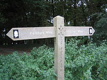
- Peddars Way
-
Der Peddars Way ist ein Fernwanderweg in Norfolk, England. Es ist 74 km (46 Meilen) lang und folgt dem Verlauf einer Römerstraße.
Es wird von verschiedenen Autoren angenommen, dass Peddars Way nicht von den Römern angelegt wurde, sondern ein noch älterer Weg sei, möglicherweise eine Abzweigung oder eine Verlängerung des keltischen Icknield Way, der von den Römern verwendet und umgebaut wurde.[1] Der Name kann aus dem Lateinischen pedester - zu Fuß abgeleitet werden. Er ist erstmalig auf einer Karte von 1587 erwähnt. Der Weg beginnt am Endes des Icknield Way bei Knettishall Heath in Suffolk, ca. 7 km (4 Meilen) östlich von Thetford in der Nähe der Norfolk-Suffolk-Grenze, und geht über in den Norfolk Coast Path bei Holme-next-the-Sea. Er ist einer von 15 National Trails in England und Wales.
Zusammen mit dem Norfolk Coast Path, bildet er den Peddars Way & Norfolk Coast Path National Trail mit einer Gesamtlänge von 156km (97 Meilen). Dies ist einer von vier Weitwanderwegen, die von Lyme Regis bis Hunstanton verlaufen und als Greater Ridgeway bezeichnet werden.
Bildergalerie
Einzelnachweise
- ↑ Maxwell, Donald (1925) Unknown Norfolk, London, The Bodley Head
National Trails in England und Wales
Cleveland Way | Cotswold Way | Glyndŵr’s Way | Hadrian’s Wall Path | North Downs Way | Offa’s Dyke Path | Peddar’s Way | Pembrokeshire Coast Path | Pennine Bridleway | Pennine Way | The Ridgeway | South Downs Way | South West Coast Path | Thames Path | Yorkshire Wolds WayLong Distance Routes in Schottland
Great Glen Way | Southern Upland Way | Speyside Way | West Highland Way
Wikimedia Foundation.
Schlagen Sie auch in anderen Wörterbüchern nach:
Peddars Way — Infobox Hiking trail Name=Norfolk Coast Path Photo=Peddars Way near Thompson.jpg Caption=Peddars Way near Thompson Location=Suffolk and Norfolk Designation=UK National Trail Length km=74 Start/End Points= Use=Walking ElevChange= HighPoint=… … Wikipedia
Icknield Way — bei Lewknor in Oxfordshire Der Icknield Way ist ein historischer Fußpfad in Süd England. Er liegt im ganzjährig trockenen Gebiet oberhalb der Wasserquellen auf der Kreide Schichtstufe der Berkshire Downs und Chiltern Hills Inhaltsverzeichn … Deutsch Wikipedia
Weavers Way — For the Philadelphia co op see Weavers Way (co op) Infobox Hiking trail Name=Weavers Way Photo=Weavers Way.jpg Caption=Weavers Way Location=Norfolk Designation=UK National Trail Length=Convert|90|km|mi|0 Start/End Points= Use=Walking ElevChange=… … Wikipedia
Cotswold Way — passing through the site of the Battle of Lansdowne Length 102 mi (164 km) Location Central England Desi … Wikipedia
Cleveland Way — Live Moor: the waymarked path crosses remote upland moors Length 110 miles (177 km) Location North Yorkshire, England Designation … Wikipedia
Marches Way — The trail follows the River Usk near Abergavenny Length 218 miles (351 km) Location Wales Midlands, England … Wikipedia
North Downs Way — The North Downs Way near Hollingbourne Length 246 kilometres (153 mi)[1] … Wikipedia
West Highland Way — Localisation Écosse Type … Wikipédia en Français
Great Glen Way — Carte du Great Glen Way. Localisation Écosse Type Scottish Long Distance Route Longueur 117 km Points de départ … Wikipédia en Français
Paston Way — Infobox Hiking trail Name=The Paston Way Photo= Paston Way Knapton Cutting 27 Jan 2008 (10).jpg Caption= Paston Way route marker Location=North east Norfolk Designation= Recreational walk Length=Convert| 32.1868|km|mi|0 Start/End Points=North… … Wikipedia


