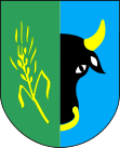
- Płoskinia
-
Płoskinia 
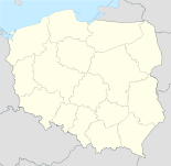
Basisdaten Staat: Polen Woiwodschaft: Ermland-Masuren Landkreis: Braniewo Geographische Lage: 54° 16′ N, 19° 56′ O54.26944444444419.938333333333Koordinaten: 54° 16′ 10″ N, 19° 56′ 18″ O Einwohner: 460 (2006)
Postleitzahl: 14-526 Telefonvorwahl: (+48) 55 Kfz-Kennzeichen: NBR Gemeinde Gemeindeart: Landgemeinde Gemeindegliederung: 26 Ortschaften 14 Schulzenämter Fläche: 172,1 km² Einwohner: 2678
(31. Dez. 2010) [1]Bevölkerungsdichte: 16 Einw./km² Gemeindenummer (GUS): 2802062 Verwaltung (Stand: 2006) Bürgermeister: Zbigniew Andrzej Kowalski Płoskinia (deutsch: Plaßwich) ist eine Gemeinde in Polen und liegt im Powiat Braniewski der Wojewodschaft Ermland-Masuren.
Gemeinde
Zur Landgemeinde Płoskinia gehören 14 Ortsteile (deutsche Namen bis 1945)[2] mit einem Schulzenamt:
- Chruściel (Tiedmannsdorf)
- Dąbrowa (Schöndamerau)
- Długobór (Langwalde)
- Jarzębiec (Schönau)
- Lubnowo (Liebenau)
- Łozy (Klingenberg)
- Pielgrzymowo (Pilgramsdorf)
- Pierzchały (Pettelkau)
- Płoskinia (Plaßwich)
- Podlechy (Podlechen)
- Robuzy (Rawusen)
- Strubno (Straubendorf)
- Tolkowiec (Bormanshof, 1938–1945: Bormannshof)
- Wysoka Braniewska (Hogendorf)
Weitere Ortschaften der Gemeinde sind:
- Bliżewo (Blieshöfen)
- Czosnowo (Knobloch)
- Demity (Demuth)
- Długobór-Osada
- Giedyle (Gedilgen)
- Łojewo (Lauenhof)
- Płoskinia-Kolonia
- Pierławki (Parlack)
- Piórkowo (Födersdorf)
- Stygajny (Stigehnen)
- Szalmia (Schalmey)
- Trąbki (Klein Tromp)
Einzelnachweise
- ↑ Population. Size and Structure by Territorial Division. As of December 31, 2010. Główny Urząd Statystyczny (GUS), abgerufen am 23. Juni 2011.
- ↑ Das Genealogische Orts-Verzeichnis
Kategorien:- Gmina in der Woiwodschaft Ermland-Masuren
- Ort der Woiwodschaft Ermland-Masuren
Wikimedia Foundation.

