Rangiahua

Rangiahua

p1

Rangiahua
Rangiahua (Neuseeland)
Rangiahua
Koordinaten 35° 18′ S, 173° 38′ O-35.305173.64111111111Koordinaten: 35° 18′ S, 173° 38′ O
Region Northland
Distrikt Far North Distrikt

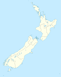
Rangiahua ist eine Siedlung im Far North Distrikt in der Region Northland auf der Nordinsel Neuseelands. Sie liegt nahe dem Nordende des Hokianga Harbour am State Highway 1. Umawera liegt etwa 6 km nordwestlich, Okaihau 12 km östlich. Der Waipapa River führt durch den Ort, der Highway überquert ihn hier auf einer Brücke. Kurz danach mündet der Fluss in den Hokianga Harbour.

Rangiahua wäre beinahe Neuseelands nördlichster Eisenbahnendpunkt geworden. 1923 wurde die Okaihau-Nebenbahn, einen Nebenbahn von Otiria zur North Auckland Line eröffnet und man begann an einer Erweiterung zum Hokianga Harbour und nach Kaitaia zu arbeiten. Die Wirtschaftlichkeit der Strecke wurde jedoch kontrovers diskuitiert. Man fand einen Kompromiss, nach dem Rangiahua der Endpunkt werden sollte. Die Arbeiten gingen in den 1920er Jahren langsam voran und wurden während der Great Depression eingestellt, obwohl die Strecke bereits nahezu vollendet war. Neuseelands nördlichster Bahntunnel war fertig und der Verschiebebahnhof und der Bahnsteig in Rangiahua gebaut. 1936 wurde eine neue Untersuchung zur Zukunft der Strecke angestellt und man kam zu dem Ergebnis, dass eine Verlängerung über Rangiahua nicht wirtschaftlich und der Absachnitt von Okaihau nach Rangiahua nicht lebensfähig sei. Die Schienen und die Bahnausrüstung wurden für den weiteren Gebrauch an anderen Orten demontiert. Heute verläuft der State Highway 1 durch den Bahnhof, der Bahnsteig befindet sich westlich, eine Laderampe westlich der Straße.

Einzelnachweise


Wikimedia Foundation.

Игры ⚽ Нужна курсовая?

Schlagen Sie auch in anderen Wörterbüchern nach:

  • Rangiahua — Location map New Zealand label=Rangiahua lat dir=S | lat deg=35 | lat min=18 lon dir=E | lon deg=173 | lon min=38 position=left width= 150 float=right caption=Rangiahua is a small locality near the Hokianga Harbour in the Northland Region of New… …   Wikipedia

  • Okaihau Branch — [v · d · …   Wikipedia

  • Okaihau-Nebenbahn — Streckenlänge: 40 km Legende …   Deutsch Wikipedia

  • Okaihau — Okaihau …   Wikipedia

  • Kaikohe — is the central service area for the Far North District of New Zealand, about 260 km from Auckland, situated on State Highway 12 at coord|35|24|S|173|48|E|. It is the largest inland town and highest community above sea level in the Northland… …   Wikipedia

  • Tunnels in New Zealand — This list of Tunnels in New Zealand is a link page for railway, road and waterway tunnels, including hydroelectric intakes and tailraces and gun battery tunnels. It includes artificial chambers but excludes caves and mines. For a list of caves,… …   Wikipedia

  • Hokianga — Image of the Hokianga generated by NASA s World Wind program Hokianga (or the Hokianga) is an area surrounding the Hokianga Harbour, also known as The Hokianga River, a long estuarine drowned valley on the west coast in the north of the North… …   Wikipedia

  • Kaitaia — Kaitaia …   Wikipedia

  • List of New Zealand railway lines — The New Zealand railway network consists of four main lines, seven secondary lines and numerous short branch lines in almost every region. It links all major urban centres, with the notable exceptions of Nelson and Taupo. The network is owned and …   Wikipedia

  • Maungataniwha Range — The Maungataniwha Range is a volcanic mountain range located halfway between Kaitaia and Okaihau in Northland of New Zealand.[1] The Mangamukas, as it is known by the local residents and many Northlanders because of the name of the settlement and …   Wikipedia

Share the article and excerpts

Direct link
Do a right-click on the link above
and select “Copy Link”