- Remetské Hámre
-
Remetské Hámre
Wappen Karte 

Remetské Hámre BasisdatenKraj: Košický kraj Okres: Sobrance Region: Dolný Zemplín Fläche: 24,586 km² Einwohner: 632 (31. Dez. 2010) Bevölkerungsdichte: 25,71 Einwohner je km² Höhe: 288 m n.m. Postleitzahl: 072 41 Telefonvorwahl: 0 56 Geographische Lage: 48° 51′ N, 22° 11′ O48.84722222222222.180555555556288Koordinaten: 48° 50′ 50″ N, 22° 10′ 50″ O Kfz-Kennzeichen: SO Gemeindekennziffer: 523003 StrukturGemeindeart: Gemeinde Verwaltung (Stand: August 2011)Bürgermeister: Michal Pado Adresse: Obecný úrad Remetské Hámre
82
072 41 Remetské HámreWebpräsenz: www.remetske-hamre.sk Gemeindeinformation
auf portal.gov.skStatistikinformation
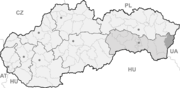
auf statistics.skRemetské Hámre (bis 1948 slowakisch „Remetské Hámry“; ungarisch Remetevasgyár) ist ein Ort und eine Gemeinde im äußersten Osten der Slowakei, mit 632 Einwohnern (Stand 31. Dezember 2010).
Geographie
Die Gemeinde liegt am Südhang des Vihorlatgebirges am rechten Ufer der Okna, 13 Kilometer von Sobrance und 27 Kilometer von Michalovce entfernt. Etwa 10 Kilometer nördlich des Ortes liegt im Vihorlatgebirge der See Morské oko („Seeauge“).
Geschichte
Der ursprüngliche Ort namens Hámre entstand im späten 18. Jahrhundert in der Gemarkung Potašňa (etwa 5 km weiter flussaufwärts) als eine typische Arbeitersiedlung bei Hammerwerken, am Gut des Adelsgeschlechts Sztaray. Nach der Gründung eines Eisenwerks im 19. Jahrhundert ist die Siedlung auf den heutigen Standort umgezogen. 1828 hatte sie 68 Häuser und 467 Einwohner. Das Eisenerz förderte man am Berg Mochnatý vrch und den Lehm beim See Morské oko. Das gewonnene Eisenerz wurde in drei Hammerwerken verarbeitet. Den größten Aufschwung erlebte der Ort nach 1864, als der Unternehmer Ignác Gross ein Walzwerk, eine Gießerei und später ein Werk zur Herstellung der landwirtschaftlichen Werkzeuge. Im frühen 20. Jahrhundert ging es aber mit dem ganzen Unternehmen bergab, bis es 1922 völlig niedergebrannte. Nach der Schließung des Unternehmens gründete man eine Säge, die teilweise noch heute in Betrieb ist.
Sehenswürdigkeiten
- römisch-katholische Kirche aus dem frühen 19. Jahrhundert
- Ausgangspunkt in verschiedene Ziele im Vihorlatgebirge, wie z. B. See Morské oko
Baškovce | Beňatina | Bežovce | Blatná Polianka | Blatné Remety | Blatné Revištia | Bunkovce | Fekišovce | Hlivištia | Horňa | Husák | Choňkovce | Inovce | Jasenov | Jenkovce | Kolibabovce | Koňuš | Koromľa | Krčava | Kristy | Lekárovce | Nižná Rybnica | Nižné Nemecké | Orechová | Ostrov | Petrovce | Pinkovce | Podhoroď | Porostov | Porúbka | Priekopa | Remetské Hámre | Ruská Bystrá | Ruskovce | Ruský Hrabovec | Sejkov | Sobrance (Sobranz) | Svätuš | Tašuľa | Tibava | Úbrež | Veľké Revištia | Vojnatina | Vyšná Rybnica | Vyšné Nemecké | Vyšné Remety | Záhor


Wikimedia Foundation.