- Rohuküla
-
58.90777823.428333Koordinaten: 58° 54′ N, 23° 26′ O
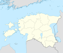
Rohuküla (deutsch Rohho, schwedisch Rus) ist ein Dorf (estnisch küla) in der estnischen Landgemeinde Ridala im Kreis Lääne. Es hat 53 Einwohner (Stand 2000).
Rohuküla liegt direkt an der Ostsee. Der Hafen von Rohuküla wurde während des Ersten Weltkriegs von der zaristischen Armee als Kriegshafen ausgebaut. Heute ist er nur noch als Handels- und Passagierhafen in Betrieb. Von dort aus verkehren über das Väinameri Fähren auf die westestnischen Inseln Hiiumaa (Hafen Heltermaa) und Vormsi (Hafen Sviby). Im Winter können Fahrzeuge über die zugefrorene Ostsee auf einer markierten Autotrasse die Inseln erreichen.[1]
Weblinks
- Beschreibung des Ortes (estnisch)
- Hafeninformation Rohuküla
Einzelnachweise
Schlagen Sie auch in anderen Wörterbüchern nach:
Route de glace — sur le Lac Saimaa en Finlande. Les routes de glace sont fabriqués par l homme c est une structure qui est congelé à la surface des baies, rivières, lacs, mers ou dans l extrême nord. Ils relient la terre ferme, sur des cours d eau gelés, portages … Wikipédia en Français
Ridala — Wappen … Deutsch Wikipedia
Rukkirahu — Vorlage:Infobox Insel/Wartung/Fläche fehltVorlage:Infobox Insel/Wartung/Höhe fehlt Rukkirahu Blick von Norden auf Rukkirahu mit seinem Richtfeuer … Deutsch Wikipedia
Hiiumaa — Tahkuna peninsula is the most northern part of Hiiumaa Geography … Wikipedia
Kärdla — Infobox Settlement subdivision type = Country subdivision name = EST subdivision type1 = image shield=Kardla coatofarms.png subdivision name1=Hiiu County leader name=Ene Kaups area total km2=4.5 population total=3736|population footnotes=… … Wikipedia
Osmussaar — Limestone cliff on the east coast of Osmussaar Geography Location … Wikipedia
Estonian Navy — Eesti Merevägi Naval Ensign of Estonia … Wikipedia
Hobulaid — (Swedish: Hästholm ) is an Baltic Sea island belong to the country of Estonia. Its coordinates are coord|58|56|37|N|23|23|07|E| [ [http://wikimapia.org/6173249/et/Hobulaid Wikipmapia] ] Hobulaid is located between the island of Vormsi and the… … Wikipedia
Ridala Parish — Ridala (Estonian: Ridala vald ) is a rural municipality of Estonia, in Lääne County. It has a population of 3,017 (2008) and an area of 253.4 km².Populated placesNõva Parish has 2 small boroughs and 56 villages: Small boroughs Paralepa, Uuemõisa … Wikipedia
Hobulaid — Vorlage:Infobox Insel/Wartung/Bild fehlt Hobulaid Gewässer Ostsee Geographische Lage … Deutsch Wikipedia

