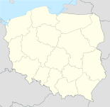
- Skrwilno
-
Skrwilno 
Basisdaten Staat: Polen Woiwodschaft: Kujawien-Pommern Landkreis: Rypin Geographische Lage: 53° 1′ N, 19° 36′ O53.01666666666719.6Koordinaten: 53° 1′ 0″ N, 19° 36′ 0″ O Höhe: 125 m n.p.m Einwohner: -
(31. Dez. 2010)[1]Postleitzahl: 87-510 Telefonvorwahl: (+48) 54 Kfz-Kennzeichen: CRY Gemeinde Gemeindeart: Landgemeinde Gemeindegliederung: 19 Schulzenämter Fläche: 124,4 km² Einwohner: 5996
(31. Dez. 2010) [2]Bevölkerungsdichte: 48 Einw./km² Gemeindenummer (GUS): 0412052 Verwaltung (Stand: 2006) Gemeindevorsteher: Dariusz Kolczyński Adresse: ul. Rypińska 7
87-510 SkrwilnoWebpräsenz: www.skrwilno.lo.pl Skrwilno (deutsch Skrwilno, 1942–1945 Reselerwalde) ist ein Dorf und Sitz der gleichnamigen Landgemeinde in Polen. Der Ort liegt im Powiat Rypiński der Wojewodschaft Kujawien-Pommern.
Gemeinde
Zur Landgemeinde Skrwilno gehören 19 Ortsteile (deutsche Namen bis 1945)[3][4] mit einem Schulzenamt.
- Budziska (1942–1945 Ollbuden)
- Czarnia Duża (Czarnia Duza, 1942–1945 Oberscharnen)[3]
- Czarnia Mała (Czarnia Mala, 1942–1945 Unterscharnen)[3]
- Kotowy (1942–1945 Kottau)
- Mościska (1942–1945 Brücken)
- Okalewo (1942–1945 Hegen)
- Otocznia (Otocznia, 1942–1945 Schrulhagen)[3]
- Przywitowo (1942–1945 Weitenfeld)
- Rak (1942–1945 Krebsen)
- Ruda (1942–1945 Rotenbruch)
- Skrwilno (Skrwilno, 1942–1945 Reselerwalde)[3]
- Skudzawy (1942–1945 Sandern)
- Szczawno (Szczawno, 1942–1945 Ampfergrund)[3]
- Szucie (1942–1945 Krähenhol)
- Szustek (1942–1945 Schusterfeld)
- Urszulewo (1942–1945 Urselhof)
- Wólka (1942–1945 Wolke)
- Zambrzyca (1942–1945 Sambritz)
- Zofiewo (1942–1945 Sophienfeld)
Weitere Ortschaften der Gemeinde sind:
- Baba (Baba, 1942–1945 Wernershof)[3]
- Baranie Góry
- Borki (1942–1945 Borke)
- Czerwonka (1942–1945 Rotbach)
- Gumowszczyzna
- Karczemka
- Klepczarnia (1942–1945 Klappenfeld)
- Modlin
- Niemcowizna Okalewska
- Niemcowizna Szustkowska (1942–1945 Deutschenrode)
- Nowe Skudzawy
- Nowy Młyn
- Stare Skudzawy
- Szucie Okalewskie
- Toki (Toki, 1942–1945 Tocken)[3]
- Warszawka
- Warszawka-Kolonia
Weblinks
Fußnoten
- ↑ Population. Size and Structure by Territorial Division. As of December 31, 2010. Główny Urząd Statystyczny (GUS), abgerufen am 9. Juli 2011.
- ↑ Population. Size and Structure by Territorial Division. As of December 31, 2010. Główny Urząd Statystyczny (GUS), abgerufen am 9. Juli 2011.
- ↑ a b c d e f g h Vgl. Weblink Amtsbezirk Reselerwalde in Danzig-Westpreußen - Gemeindeumbenennungen
- ↑ http://www.mapywig.org/m/German_maps/German_WIG/Grossblatt_Nr._339_Soldau.jpg
Städte und Gemeinden im Powiat RypińskiBrzuze | Rogowo | Rypin Miasto (Rippin-Stadt) | Rypin-Gmina (Rippin-Land) | Skrwilno | Wąpielsk
Wikimedia Foundation.
Schlagen Sie auch in anderen Wörterbüchern nach:
Skrwilno — Infobox Settlement name = Skrwilno settlement type = Village total type = image shield = subdivision type = Country subdivision name = POL subdivision type1 = Voivodeship subdivision name1 = Kuyavian Pomeranian subdivision type2 = County… … Wikipedia
Skrwilno — Original name in latin Skrwilno Name in other language Skrvil no, Skrwilno, Скрвильно State code PL Continent/City Europe/Warsaw longitude 53.01607 latitude 19.62364 altitude 120 Population 1624 Date 2010 09 15 … Cities with a population over 1000 database
Gmina Skrwilno — Infobox Settlement name = Gmina Skrwilno other name = Skrwilno Commune settlement type = Gmina total type = Total image shield = subdivision type = Country subdivision name = POL subdivision type1 = Voivodeship subdivision name1 = Kuyavian… … Wikipedia
Mościska, Gmina Skrwilno — For other places with the same name, see Mościska. Mościska Village Country Poland Voivodeship … Wikipedia
Ruda, Gmina Skrwilno — Infobox Settlement name = Ruda settlement type = Village total type = image shield = subdivision type = Country subdivision name = POL subdivision type1 = Voivodeship subdivision name1 = Kuyavian Pomeranian subdivision type2 = County subdivision… … Wikipedia
Czarnia Duża — Village … Wikipedia
Czarnia Mała — Village … Wikipedia
Okalewo — See also: Okalewo, Greater Poland Voivodeship Okalewo Village … Wikipedia
Otocznia — Village … Wikipedia
Nowe Skudzawy — Village Country Poland Voivodeship Kuyavian Pomerani … Wikipedia

