- Tioga Pass
-
Tioga Pass 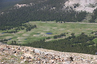
Blick auf die Tioga Pass-Straße
West Ost Passhöhe 3.031 m County Tuolumne County, Kalifornien (USA) Mono County, Kalifornien (USA) Wasserscheide Tuolumne River Talorte Yosemite-Nationalpark Lee Vining, Mono Lake Ausbau  California State Route 120
Gebirge Sierra Nevada Karte 

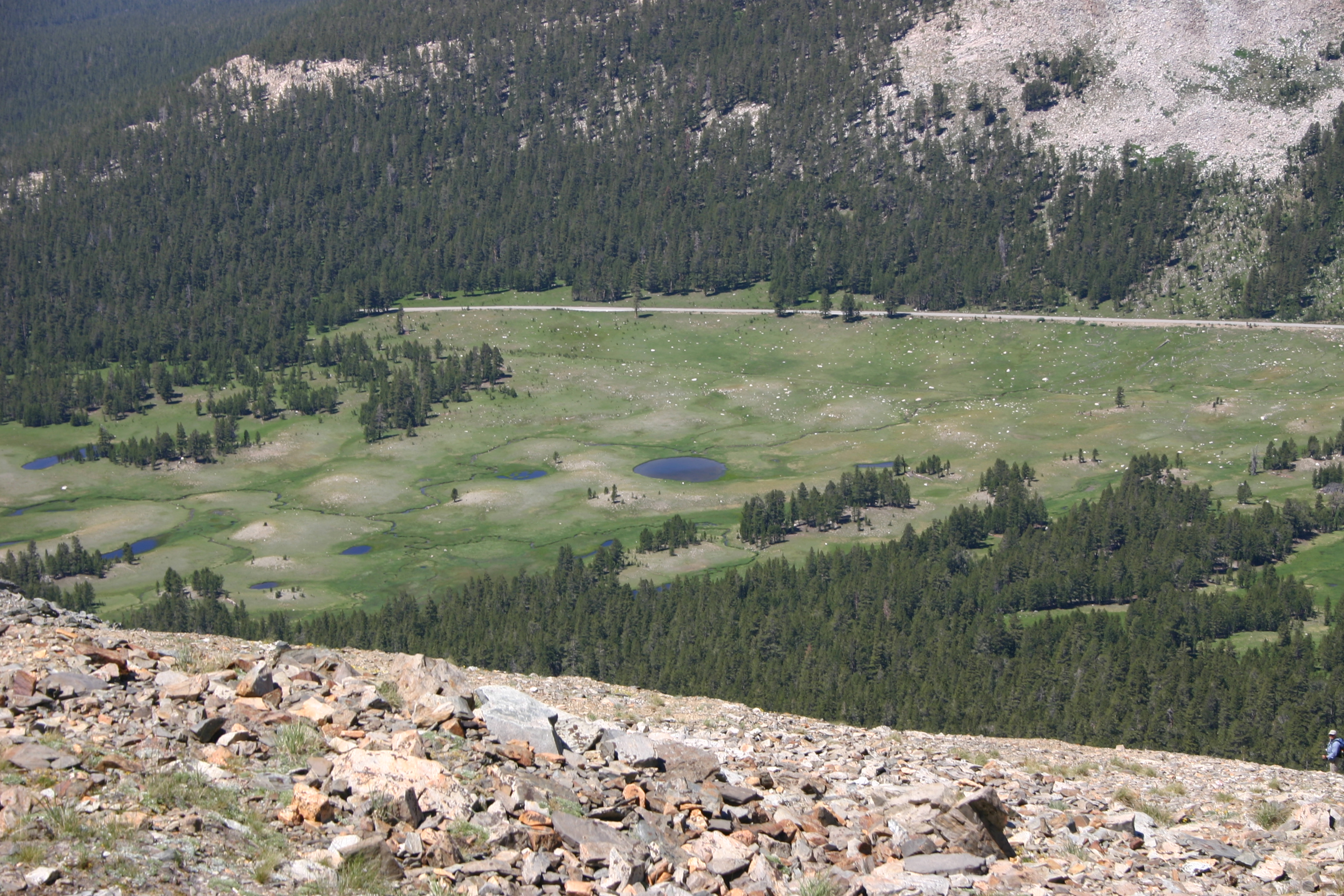
Koordinaten 37° 54′ 40″ N, 119° 15′ 29″ W37.911111111111-119.258055555563031Koordinaten: 37° 54′ 40″ N, 119° 15′ 29″ W Der Tioga Pass ist ein 3031 m hoher Gebirgspass in der Sierra Nevada in Kalifornien. Die California State Route 120 verläuft über ihn. Zugleich ist der Tioga Pass der östliche Zugangspunkt in den Yosemite-Nationalpark. Er ist der höchstgelegene Highway-Pass in Kalifornien und der Sierra Nevada[1]. Mount Dana liegt östlich des Tioga Pass. Es gibt eine Reihe von Wanderrouten in das Hinterland des Yosemite Nationalparks, die von hier beginnen. Ein Weg führt nach Westnordwest zu den Gaylor Lakes. Der Gipfel des Mount Dana ist ebenfalls von hier aus zu erreichen. Die Dana Meadows liegen unmittelbar südlich des Passes entlang des Highways.
Die Pass-Straße weist einen sanften Anstieg von Westen auf, während sie östlich des Passes steil bergab zum Mono Lake führt. Der Abstieg zum U.S. Highway 395 beträgt über 900 Höhenmeter.
Der Tioga Pass ist die kürzeste Route von Bishop oder Mammoth Lakes nach Fresno, Merced und Stockton. Es gibt noch vier weitere Gebirgspässe nördlich des Tioga zwischen Yosemite und Lake Tahoe. Der nächste Pass über die Sierra Nevada in südlicher Richtung ist der Sherman Pass in ca. 300 km Entfernung im südlichen Tulare County. Meistens ist der Pass ab Ende Mai bis Anfang Oktober geöffnet.Siehe auch
- Yosemite-Nationalpark
- Tioga Lake
- Dana Meadows
Einzelnachweise
Weblinks
- NPS: Tioga Road
- Westkueste USA: Tioga Pass Virtuelle Fahrt über den Tioga Pass mit 45 Fotos und ausführlichen Beschreibungen der Sehenswürdigkeiten (deutsch)
- Photo taken from Gaylor Saddle
- Tioga Pass etymology
- Tioga Pass Road Hiking Trails
- Tioga Pass Status from CalTrans

Wikimedia Foundation.