- Togwotee Pass
-
Togwotee Pass 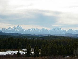
Teton Range vom Westen des Togwotee Pass
Passhöhe 2.944 m County Teton County, Wyoming,
 Vereinigte Staaten
Ausbau U.S. Highway 287 / U.S. Highway 26 Gebirge Absaroka Range (Rocky Mountains) Karte (Vereinigte Staaten) 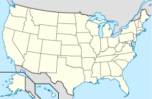

Koordinaten 43° 45′ 0″ N, 110° 4′ 48″ W43.75-110.082944Koordinaten: 43° 45′ 0″ N, 110° 4′ 48″ W Der Togwotee Pass ist ein 2.944 m hoher Gebirgspass in den Absaroka Mountains in den Vereinigten Staaten von Amerika. Er befindet sich zwischen den Städten Dubois, Moran und dem Tal Jackson Hole.
Der Pass wird von den U.S. Highways 287 und 26 überquert, die sich vierzig Kilometer westlich bei Moran verzweigen. Der Pass bietet direkten Zugang zum Grand-Teton-Nationalpark vom Osten Wyomings. Von den westlichen Hängen des Passes hat man eine weite Aussicht auf die Teton Range.
Der Pass befindet sich im Bridger-Teton National Forest nahe der Grenze zum Shoshone National Forest. Im Winter ist er von starken Schneefällen betroffen und daher ein beliebtes Ausflugsziel für Motorschlitten und Skilangläufer. Der Pass wird vom Continental Divide Snowmobile Trail gekreuzt und kann häufig Schneehöhen von über 760 cm pro Winter erreichen. Die Rekordhöhe lag bisher bei über 15 m. Bei auftretenden Blizzards kann es zu einer mehrtägigen Sperrung der Straße kommen.
Der Pass wurde nach Chief Togwotee benannt, der 1873 eine Forschungsexpedition der US-Regierung über diesen Pass führte. Chief Togwotee war ein Unterhäuptling des Sheepeater-Stammes, der zu dem Stamm der Shoshone gehörte.
Eine Skipiste im Jackson Hole Ski Resort wird ebenfalls als Togwotee Pass bezeichnet.[1]
Weblinks
Einzelnachweise
Kategorien:- Gebirgspass
- Pass in den Vereinigten Staaten
- Pass in den Rocky Mountains
- Geographie (Wyoming)


Wikimedia Foundation.