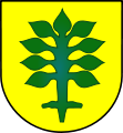
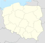
- Topólka
-
Topólka 
Basisdaten Staat: Polen Woiwodschaft: Kujawien-Pommern Landkreis: Radziejów Geographische Lage: 52° 31′ N, 18° 43′ O52.51666666666718.716666666667Koordinaten: 52° 31′ 0″ N, 18° 43′ 0″ O Einwohner: 480 (2006)
Postleitzahl: 87-875 Telefonvorwahl: (+48) 54 Kfz-Kennzeichen: CRA Gemeinde Gemeindeart: Landgemeinde Gemeindegliederung: 42 Ortschaften 24 Schulzenämter Fläche: 102,9 km² Einwohner: 4887
(31. Dez. 2010) [1]Bevölkerungsdichte: 47 Einw./km² Gemeindenummer (GUS): 0411072 Verwaltung (Stand: 2006) Gemeindevorsteher: Henryk Orłowski Adresse: ul. I Armii WP 14
87-875 TopólkaWebpräsenz: www.biuletyn.abip.pl/ugtopolka Topólka (deutsch Topolka, 1943–1945 Toppeln)[2] ist ein Dorf und Sitz der gleichnamigen Landgemeinde in Polen. Der Ort liegt im Powiat Radziejowski der Wojewodschaft Kujawien-Pommern.
Gemeinde
Zur Landgemeinde Topólka gehören 24 Ortsteile mit einem Schulzenamt.
- Bielki
- Borek
- Chalno
- Czamanin
- Czamanin-Kolonia
- Czamaninek
- Galonki
- Głuszynek
- Kamieniec
- Kamieńczyk
- Kozjaty
- Miłachówek
- Orle
- Paniewek
- Paniewo
- Sadłóg
- Sadłóżek
- Sierakowy
- Świerczyn
- Świerczynek
- Topólka
- Torzewo
- Wola Jurkowa
- Znaniewo
Weitere Ortschaften der Gemeinde sind:
- Biele
- Chalno-Parcele
- Dębianki
- Iłowo
- Jurkowo
- Karczówek
- Kolonia Chalińska
- Miałkie
- Opielanka
- Rogalki
- Rybiny
- Rybiny Leśne
- Świnki
- Wyrobki
- Zgniły Głuszynek
- Żabiniec
Weblinks
- Anordnung über Ortsnamenänderung im Reichsgau Wartheland im Verordnungsblatt des Reichstatthalters im Warthegau vom 18. Mai 1943 (pdf)
Fußnoten
- ↑ Population. Size and Structure by Territorial Division. As of December 31, 2010. Główny Urząd Statystyczny (GUS), abgerufen am 9. Juli 2011.
- ↑ Vgl. Weblink Anordnung über Ortsnamenänderung im Reichsgau Wartheland - Kreis Leslau
Wikimedia Foundation.

