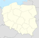
Łanięta

Łanięta
Łanięta
Wappen fehlt
Hilfe zu Wappen
Łanięta (Polen)
Łanięta
Łanięta
Basisdaten
Staat: Polen
Woiwodschaft: Łódź
Landkreis: Kutno
Geographische Lage: 52° 22′ N, 19° 17′ O52.36361111111119.282222222222Koordinaten: 52° 21′ 49″ N, 19° 16′ 56″ O
Einwohner:

-
(31. Dez. 2010)[1]

Postleitzahl: 99-306
Telefonvorwahl: (+48) 24
Kfz-Kennzeichen: EKU
Wirtschaft und Verkehr
Nächster int. Flughafen: Łódź
Gemeinde
Gemeindeart: Landgemeinde
Gemeindegliederung: 26 Ortschaften
13 Schulzenämter
Fläche: 54,9 km²
Einwohner:

2557
(31. Dez. 2010) [2]

Bevölkerungsdichte: 47 Einw./km²
Gemeindenummer (GUS): 1002072
Verwaltung
Bürgermeister: Stanisław Jędrzejczak

Łanięta (deutsch Lanieta, 1943–1945 Laningen)[3] ist ein Dorf und Sitz der gleichnamigen Gemeinde im Powiat Kutnowski der Woiwodschaft Łódź, Polen.

Gemeinde

Zur Landgemeinde Łanięta gehören 13 Ortsteile mit einem Schulzenamt:

Anielin
Chrosno
Juków
Kąty
Łanięta
Nowe Budy
Rajmundów
Suchodębie
Świeciny
Witoldów
Wilkowia
Wola Chruścińska
Zgoda

Weitere Ortschaften der Gemeinde sind:

Bronisławów
Chruścinek
Franciszków
Kliny
Klonowiec Wielki
Lipie
Marianów
Nutowo
Pomarzany
Ryszardów
Stare Budy
Suchodębie PGR
Świecinki

Verweise

Fußnoten

  1. Population. Size and Structure by Territorial Division. As of December 31, 2010. Główny Urząd Statystyczny (GUS), abgerufen am 16. Juli 2011.
  2. Population. Size and Structure by Territorial Division. As of December 31, 2010. Główny Urząd Statystyczny (GUS), abgerufen am 16. Juli 2011.
  3. Vgl. "Anordnung über Ortsnamenänderung im Reichsgau Wartheland, Nr.62" vom 18. Mai 1943

Wikimedia Foundation.

Игры ⚽ Поможем написать реферат

Schlagen Sie auch in anderen Wörterbüchern nach:

  • Łanięta, Łódź Voivodeship — Infobox Settlement name = Łanięta settlement type = Village total type = image shield = subdivision type = Country subdivision name = POL subdivision type1 = Voivodeship subdivision name1 = Łódź subdivision type2 = County subdivision name2 =… …   Wikipedia

  • Łanięta, Kuyavian-Pomeranian Voivodeship — Infobox Settlement name = Łanięta settlement type = Village total type = image shield = subdivision type = Country subdivision name = POL subdivision type1 = Voivodeship subdivision name1 = Kuyavian Pomeranian subdivision type2 = County… …   Wikipedia

  • Gmina Łanięta — Infobox Settlement name = Gmina Łanięta other name = Łanięta Commune settlement type = Gmina total type = Total image shield = subdivision type = Country subdivision name = POL subdivision type1 = Voivodeship subdivision name1 = Łódź subdivision… …   Wikipedia

  • Marianów, Gmina Łanięta — For other places with the same name, see Marianów (disambiguation). Marianów   Settlement   Country  Poland …   Wikipedia

  • Pomarzany, Gmina Łanięta — Infobox Settlement name = Pomarzany settlement type = Village total type = image shield = subdivision type = Country subdivision name = POL subdivision type1 = Voivodeship subdivision name1 = Łódź subdivision type2 = County subdivision name2 =… …   Wikipedia

  • Zgoda, Gmina Łanięta — Infobox Settlement name = Zgoda settlement type = Village total type = image shield = subdivision type = Country subdivision name = POL subdivision type1 = Voivodeship subdivision name1 = Łódź subdivision type2 = County subdivision name2 = Kutno… …   Wikipedia

  • Chrosno, Łódź Voivodeship — For the village in Zgierz County, see Chrośno. Chrosno   Village   …   Wikipedia

  • Nowe Budy, Łódź Voivodeship — For other places with the same name, see Nowe Budy (disambiguation). Nowe Budy   Village   …   Wikipedia

  • Nutowo —   Settlement   …   Wikipedia

  • Chruścinek —   Village   Country  Poland Voivodeship Łódź …   Wikipedia

Share the article and excerpts

Direct link
Do a right-click on the link above
and select “Copy Link”