- Coffeeville (Alabama)
-
Coffeeville 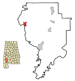 Lage in Alabama
Basisdaten Staat: Vereinigte Staaten Bundesstaat: Alabama County: Koordinaten: 31° 46′ N, 88° 5′ W31.761111111111-88.08888888888953Koordinaten: 31° 46′ N, 88° 5′ W Zeitzone: Central Standard Time (UTC−6) Einwohner: 354 (Stand: 2005) Bevölkerungsdichte: 30,3 Einwohner je km² Fläche: 11,7 km² (ca. 5 mi²)
davon 11,7 km² (ca. 5 mi²) LandHöhe: 53 m Postleitzahl: 36524 Vorwahl: +1 251 FIPS: 01-16264 GNIS-ID: 0116356 Coffeeville ist ein Ort im Clarke County, Alabama, Vereinigte Staaten. Der Ort hat eine Gesamtfläche von 11,7km². Bei der Volkszählung aus dem Jahr 2000 hatte Coffeeville 360 Einwohner. 2005 betrug die Schätzung 354 Einwohner.
Demographie
Nach der Volkszählung aus dem Jahr 2000 hatte Coffeeville 360 Einwohner, die sich auf 165 Haushalte und 97 Familien verteilten. Die Bevölkerungsdichte betrug 30,8 Einwohner/km². 61,11% der Einwohner waren weiß, 38,89% afroamerikanisch. In 22,4% der Haushalte lebten Kinder unter 18 Jahren. Das Durchschnittseinkommen betrug 19545 Dollar pro Haushalt, wobei 25,6% der Bevölkerung unterhalb der Armutsgrenze lebten.
Quelle
Kategorien:- Ort in Alabama
- Clarke County (Alabama)

Wikimedia Foundation.