- Agutaya
-
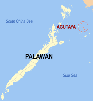
Municipality of Agutaya Lage von Agutaya in der Provinz Palawan 
Basisdaten Bezirk: Western Visayas Provinz: Palawan Barangays: 10 Distrikt: 1. Distrikt von Palawan PSGC: 175302000 Einkommensklasse: 5. Einkommensklasse Haushalte: 2040 Zensus 1. Mai 2000Einwohnerzahl: 10.426 Zensus 1. August 2007Koordinaten: 11° 9′ N, 120° 57′ O11.15120.95Koordinaten: 11° 9′ N, 120° 57′ O Postleitzahl: 5320 Geographische Lage auf den Philippinen 

Agutaya Agutaya ist eine philippinische Stadtgemeinde in der Provinz Palawan. Die Stadtgemeinde Agutaya wurde 1916 durch Erlass des Act of Congress vom 29. August 1916 gegründet, das Gebiet gehörte vorher zu Cuyo.
Geografie
Die Stadtgemeinde liegt in der Sulusee im Nordosten der Provinz Palawan. Sie besteht aus den Inseln Agutaya, Carnasa, Oco, Pamalican und Macaranao sowie mehreren weiteren kleineren Inseln und hat keine Landgrenzen zu anderen Stadtgemeinden.
Baranggays
Agutaya ist politisch in zehn Baranggays unterteilt.
- Algeciras
- Concepcion
- Diit
- Maracanao
- Matarawis
- Abagat (Pob.)
- Bangcal (Pob.)
- Cambian (Pob.)
- Villafria
- Villasol
Städte und Stadtgemeinden in der Provinz PalawanStädte: Puerto Princesa City
Stadtgemeinden: Aborlan | Agutaya | Araceli | Balabac | Bataraza | Brooke's Point | Busuanga | Cagayancillo | Coron | Culion | Cuyo | Dumaran | El Nido | Kalayaan | Linapacan | Magsaysay | Narra | Quezon | Rizal | Roxas | San Vicente | Sofronio Española | Taytay
Wikimedia Foundation.
Schlagen Sie auch in anderen Wörterbüchern nach:
Agutaya — Mapa que muestra la localización de Agutaya. Agutaya es un municipio de la provincia filipina de Palawan en la región de Bisayas Occidentales. Actualmente posee una población de 10.422 habitantes distribuidos en sus diferentes aldeas o barangayes … Wikipedia Español
Agutaya — Original name in latin Agutaya Name in other language Agatuya, Agutaya State code PH Continent/City Asia/Manila longitude 11.148 latitude 120.9417 altitude 23 Population 4989 Date 2012 01 17 … Cities with a population over 1000 database
Agutaya (Palawan) — Saltar a navegación, búsqueda Mapa que muestra la localización de Agutaya. Agutaya es un municipio de la provincia filipina de Palawan en la región de Bisayas Occidentales. Actualmente posee una población de 10.422 habitantes distribuidos en sus… … Wikipedia Español
Agutaya, Palawan — Agutaya is a 5th class municipality in the province of Palawan, Philippines. According to the 2000 census, it has a population of 10,422 people in 2,040 households.BarangaysAgutaya is politically subdivided into 10 barangays.* Algeciras *… … Wikipedia
New Agutaya — Original name in latin New Agutaya Name in other language New Agutaya State code PH Continent/City Asia/Manila longitude 10.56139 latitude 119.30778 altitude 4 Population 2464 Date 2012 02 01 … Cities with a population over 1000 database
Cuyo Archipelago — Cuyo Archipelago. Geography Location Sulu Sea Coordinates … Wikipedia
Palawan — Infobox Philippine province name = Palawan sealfile = Ph seal palawan.png region = MIMAROPA (Region IV B) (in transitioncite web url=http://www.ops.gov.ph/records/eo no429.htm title=Executive Order No. 429 date=May 23, 2005 author=President of… … Wikipedia
Cuyo, Palawan — Cuyo 4th class municipality The Quiniluban island group, in the extreme north of the Cuyo archipelago … Wikipedia
Culion, Palawan — Culion Municipality … Wikipedia
Brooke's Point — Municipality of Brooke s Point Lage von Brooke s Point in der Provinz Palawan Basisdaten Bezirk: Western Visayas … Deutsch Wikipedia
Agutaya

18+
© Academic, 2000-2026
- Kontaktieren Sie uns: Unterstützung, Werbung
Wörterbücher Export, schritte mit PHP, Joomla, Drupal, WordPress, MODx.