Esutoru

Esutoru
Stadt
Uglegorsk
Углегорск
Wappen
Wappen
Föderationskreis Ferner Osten
Oblast Sachalin
Rajon Uglegorsk
Gegründet Anfang 20. Jh.
Stadt seit 1946
Fläche 26 km²
Höhe des Zentrums 20 m
Bevölkerung 12.534 Einw. (Stand: 2006)
Bevölkerungsdichte 482 Ew./km²
Zeitzone UTC+10 (Sommerzeit: UTC+11)
Telefonvorwahl (+7)42432
Postleitzahl 694920, 694923
Kfz-Kennzeichen 65
OKATO 64 435
Geographische Lage
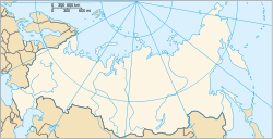
Koordinaten: 49° 4′ N, 142° 2′ O49.066666666667142.0333333333320Koordinaten: 49° 4′ 0″ N, 142° 2′ 0″ O
Uglegorsk (Sachalin) (Russland)
DEC
Liste der Städte in Russland

Uglegorsk (russisch Углегорск) ist eine Stadt in der Oblast Sachalin (Russland) mit 12.534 Einwohnern (Berechnung 2006).

Inhaltsverzeichnis

Geographie

Die Stadt liegt an der Westküste der Insel Sachalin, etwa 350 km nordwestlich der Oblasthauptstadt Juschno-Sachalinsk, am Tatarensund zwischen dem Japanischen und dem Ochotskischen Meer, am Rande der sumpfigen Niederung des Flusses Uglegorka nahe seiner Mündung.

Die Stadt Uglegorsk ist der Oblast administrativ direkt unterstellt und zugleich Verwaltungszentrum des gleichnamigen Rajons.

Uglegorsk hat einen kleinen Seehafen.

Geschichte

Uglegorsk entstand nach 1905, während der Zugehörigkeit des Südteils der Insel Sachalin (bis zum 50. Breitengrad) zu Japan, unter dem Namen Esutoru (jap. 恵須取町, -chō). Im Ergebnis des Zweiten Weltkriegs kam der Ort 1945 zur Sowjetunion und erhielt 1946 unter dem heutigen Namen – von russisch ugol für Kohle – Stadtrecht.

Einwohnerentwicklung

Jahr Einwohnerzahlen
1937 31.959 *
1959 17.900 **
1979 18.400 **
1989 18.402 *
2002 13.396 *
2006 12.534

Anmerkung: * Volkszählung ** Volkszählung (gerundet)

Wirtschaft

In Uglegorsk gibt es Betriebe der Holz-, Papier- und Bauwirtschaft sowie Lebensmittelindustrie. Der Ort ist Zentrum eines Landwirtschaftsgebietes (Kartoffel- und Gemüseanbau). In der Umgebung wird Steinkohle gefördert, welche der Stadt den Namen gab.

Weblinks


Wikimedia Foundation.

Игры ⚽ Поможем решить контрольную работу

Schlagen Sie auch in anderen Wörterbüchern nach:

  • Organization of Karafuto Fortress — The Karafuto Fortress was the defensive unit formed by the Karafuto fortification installations, and the Karafuto detachment of Japanese forces, the 88th Division. The headquarters was in Toyohara, capital of the province, based on the Suzuya… …   Wikipedia

  • Karafuto Prefecture — 樺太庁 (Shinjitai) 樺太廳 (Kyūjitai) Karafuto Prefecture Prefecture of the Great Japanese Empire …   Wikipedia

  • Political divisions of Karafuto Prefecture — Between 1905 and 1945, the Japanese Empire administered the southern half of Sakhalin, using the name nihongo|Karafuto|樺太. The area was designated a chō , the same term given to Hokkaidō at the time. It is commonly referred to as Karafuto… …   Wikipedia

  • Evacuation of Karafuto and Kuriles — The evacuation of Karafuto and the Kuriles refers to the events that took place as the Japanese population left these areas, to the north west of the main islands of Japan, inAugust 1945. (Simultaneously Chosen, Kwantung and Manchukuo were being… …   Wikipedia

  • Geography of Karafuto — The geography of Karafuto deals with the geography of the former prefecture or Karafuto, the sourthern part of Sakhalin which was administrated by Japan from 1905 till 1945.Names in italics are the current Russian names. Islands The Karafuto… …   Wikipedia

  • Ouglegorsk — Pour la ville d Ukraine appelée Ouglegorsk en russe, voir Vouhlehirsk. Ouglegorsk Углегорск …   Wikipédia en Français

  • Uglegorsk — 1 Original name in latin Uglegorsk Name in other language Esutoru, Esutoru Hamashigai, Hama shigai, UGLEGORSK, Uglegorsk, УГЛЕГОРСК State code RU Continent/City Asia/Sakhalin longitude 49.08047 latitude 142.06449 altitude 8 Population 12669 Date… …   Cities with a population over 1000 database

  • Subprefectures of Japan — Certain prefectures of Japan are now, or once were, divided into subprefectures. The subprefecture is the jurisdiction surrounding a nihongo|branch office|支庁|shichō of the prefectural government. Normally, the area of a subprefecture consists of… …   Wikipedia

  • List of renamed cities and towns in Russia — Reasons for geographical renaming in Russia were *an especially large number of cities and towns were renamed in Russia after the October Revolution of 1917 *more renamings happened during the whole history of the Soviet Union due to political… …   Wikipedia

  • Uglegorsk, Sakhalin Oblast — Uglegorsk ( ru. Углегорск) is a coastal port town in Sakhalin Oblast, Russia, located on the western coast of Sakhalin 359 km west of Yuzhno Sakhalinsk at coord|49.0833|N|142.0333|E. Population: 13,396 (2002 Census); 18,402 (1989 Census).Founded… …   Wikipedia

Share the article and excerpts

Direct link
Do a right-click on the link above
and select “Copy Link”