Florida Panhandle

Florida Panhandle
Florida Panhandle

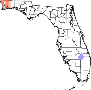
Der Nordwestteil Floridas wird aufgrund der Form als Florida Panhandle (Pfannengriff) bezeichnet. Geographisch ist der Florida Panhandle ein ca. 370 km langer und zwischen 60 und 140 km breiter Streifen zwischen Alabama und Georgia im Norden und dem Golf von Mexiko im Süden und gehört nicht zur eigentlichen Halbinsel Florida. Auch kulturell entspricht die Region eher den klassischen Südstaaten.

Politisch besteht der Florida Panhandle aus den Countys:

Bedeutende Städte sind Pensacola, Panama City und Tallahassee. Die Strandorte ziehen während der Frühjahrsferien zahlreiche Collegestudenten an. Außerdem befinden sich dort die Luftwaffenstützpunkte Eglin Air Force Base und Tyndall Air Force Base. In Ost-West-Richtung verläuft Interstate 10 durch das Gebiet.

Der 1936 ausgewiesene Nationalforst Apalachicola National Forest befindet sich ebenfalls in diesem Gebiet.


Wikimedia Foundation.

Игры ⚽ Поможем написать курсовую

Schlagen Sie auch in anderen Wörterbüchern nach:

  • Florida Panhandle — For a list of other U.S. states with similar geographic extensions, see Panhandle Map showing Florida counties that may be included in references to the Panhandle; the eastern extent of the Panhandle is arbitrarily defined and may vary …   Wikipedia

  • Panhandle de Floride — Le Panhandle de Floride (Florida Panhandle) est la région de l État américain de Floride qui comprend les 16 comtés les plus à l ouest de l État. Cette panhandle forme une bande étroite s étirant entre les États d Alabama et de Georgie au nord et …   Wikipédia en Français

  • Panhandle — (engl. für „Pfannenstiel“) im Sinne von Landzipfel bezeichnet Alaska Panhandle Connecticut Panhandle Nebraska Panhandle Florida Panhandle Idaho Panhandle Oklahoma Panhandle Texas Panhandle Eastern Panhandle of West Virginia Northern Panhandle of… …   Deutsch Wikipedia

  • Florida Constitution — Florida This article is part of the series: Politics and government of Florida …   Wikipedia

  • Florida — Saltar a navegación, búsqueda Para otros usos de este término, véase Florida (desambiguación). State of Florida Estado de los Estados Unidos …   Wikipedia Español

  • Florida — This article is about the U.S. state of Florida. For other uses, see Florida (disambiguation). State of Florida …   Wikipedia

  • Florida Museum of Natural History — Coordinates: 29°38′09″N 82°22′13″W / 29.63583°N 82.37028°W / 29.63583; 82.37028 …   Wikipedia

  • Florida's 1st congressional district — Infobox U.S. congressional district state = Florida district number = 1 representative = Jeff Miller party = Republican english area = 5,241 metric area = percent urban = 77.5 percent rural = 22.5 population = 639,295 population year = 2000… …   Wikipedia

  • Florida-Georgia District (LCMS) — The Florida Georgia District is one of the 35 districts of the Lutheran Church Missouri Synod (LCMS), and encompasses the states of Georgia and Florida, with the exception of the Florida Panhandle which is part of the Southern District; in… …   Wikipedia

  • Florida Keys — Palm trees in Islamorada Satellite image …   Wikipedia

Share the article and excerpts

Direct link
Do a right-click on the link above
and select “Copy Link”