Fort McPherson

Fort McPherson
Fort McPherson
Lage in Kanada
Fort McPherson (Kanada)
Fort McPherson
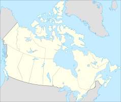
Fort McPherson
Staat: Kanada
Territorium: Nordwest-Territorien
Region: Inuvik Region
Koordinaten: 67° 26′ N, 134° 53′ W67.433333333333-134.88333333333Koordinaten: 67° 26′ N, 134° 53′ W
Einwohner: 776 (Stand: 2006)
Gründung: 1849
Webpräsenz: www.fortmcpherson.ca

Fort McPherson (Gwich'in: Teetl'it Zheh, dt.: „Am Kopf des Wassers“) ist eine Gemeinde in den kanadischen Nordwest-Territorien. Die Gemeinde hatte bei der Erhebung von 2006 776 Einwohner.

Sie wurde 1849 gegründet, als John Bell, ein Forscher der Hudson’s Bay Company eine Handelsniederlassung entlang des Peel River errichtete. Nach zahlreichen Überflutungen wurde diese später an eine höhere Stelle verschoben. Diese Niederlassung wurde zuerst Peel River House benannt, später jedoch umbenannt nach Murdoch McPherson.

Fort McPherson liegt am Ostufer des Peel Rivers, 121 Kilometer südlich von Inuvik und ist durch den Dempster Highway mit ihr verbunden. Gesprochen wird Gwich'in und Englisch.

Der Ort ging durch ein Begräbnis in die Geschichte ein. Auf dem Friedhof neben der anglikanischen Kirche sind Inspector Francis J. Fitzgerald, Constable G. F. Kinney, R. O. H. Taylor und Sam Carter von der Royal Northwest Mounted Police (R.N.W.M.P.) begraben, deren Geschichte der Lost Patrol noch heute erzählt wird, als sie 1910/1911 zu einer Patrouille mit Hundeschlittengespannen von Fort McPherson nach Dawson City unterwegs waren, wegen der Unbilden des arktischen Wetters und offenbar ungenauer Ortskenntnisse aber umkehren mussten und auf dem Rückweg ca. 30 Meilen vor Fort McPherson erfroren und verhungert sind.

Fort McPherson sollte nicht mit der gleichnamigen United States Army Militärbasis in East Point (Georgia) verwechselt werden.

Literatur

  • Melanie Fafard / Ingrid Kritsch: The History and Archaeology of Fort McPherson, Gwich'in Social and Cultural Institute Tsiigehtchic 2005

Wikimedia Foundation.

Игры ⚽ Поможем написать реферат

Schlagen Sie auch in anderen Wörterbüchern nach:

  • Fort McPherson — Infobox Military Structure name=Fort McPherson partof= location=East Point, Georgia caption=Shoulder sleeve insignia and emblem of units stationed at Fort McPherson type=Army post built=1885 builder= materials= height= used=1885 present… …   Wikipedia

  • Fort McPherson — Original name in latin Fort McPherson Name in other language State code CA Continent/City America/Yellowknife longitude 67.43863 latitude 134.88543 altitude 21 Population 1069 Date 2008 04 11 …   Cities with a population over 1000 database

  • Fort McPherson, Nebraska — Fort McPherson was established in October 1863. It was located on the banks of the North Platte River, at the mouth of Cottonwood Canyon, a strategic location near the site of present day Maxwell, Nebraska.The decision to build the fort was… …   Wikipedia

  • Fort McPherson (Territorios del Noroeste) — Saltar a navegación, búsqueda Fort McPherson (Gwich’in: Teet lit Zhen {En la cabecera de las aguas}) es una aldea localizada en la región Inuvik de los Territorios del Noroeste, Canadá. Se halla al este de la ribera del Río Peel y a 121 km al sur …   Wikipedia Español

  • Fort McPherson National Cemetery — is a United States National Cemetery which is 4 miles (6 km) south of the village of Maxwell in Lincoln County, Nebraska. It encompasses 20 acres, and as of the end of 2005, it had 8,355 interments. History Fort McPherson was established in 1863… …   Wikipedia

  • Fort McPherson, Northwest Territories — Infobox Settlement name = Fort McPherson native name = Teet lit Zhen other name = Location map polarx CanadaGeo caption = lon shift = 4.1 label= Fort McPherson label size=70 | lat skew=1.2 background = #DDDD22 position=top lat = 67.435278 long =… …   Wikipedia

  • Fort McPherson Airport — Infobox Airport name = Fort McPherson Airport IATA = ZFM ICAO = CZFM type = Public owner = operator = Government of the Northwest Territories city served = location = Fort McPherson, Northwest Territories elevation f = 142 elevation m = 43… …   Wikipedia

  • Fort McPherson Water Aerodrome — was located adjacent to Fort McPherson, Northwest Territories, Canada on the Peel River. The airport was listed as abandoned in the 15 March 2007 Canada Flight Supplement.ee also*Fort McPherson AirportReferences*WAS …   Wikipedia

  • Aeropuerto de Fort McPherson — Fort McPherson Airport IATA: ZFM   OACI: CZFM Sumario Tipo Público …   Wikipedia Español

  • Lakewood/Fort McPherson (MARTA station) — Infobox Station name=Lakewood/Fort McPherson type=MARTA rapid transit station logo=marta.gif logo size= image size=250 image caption=Lakewood/Fort McPherson (MARTA station) address=2020 Lee Street SW Atlanta, GA 30310 line=rail color… …   Wikipedia

Share the article and excerpts

Direct link
Do a right-click on the link above
and select “Copy Link”