- Frysztak
-
Frysztak 


Frysztak Basisdaten Staat: Polen Woiwodschaft: Karpatenvorland Landkreis: Strzyżów Fläche: 2,2 km² Geographische Lage: 49° 50′ N, 21° 37′ O49.83333333333321.616666666667Koordinaten: 49° 50′ 0″ N, 21° 37′ 0″ O Höhe: 267 m n.p.m Einwohner: 950 (31. Dez. 2004)
Postleitzahl: 38-130 Telefonvorwahl: (+48) 17 Kfz-Kennzeichen: RSR Wirtschaft und Verkehr Nächster int. Flughafen: Flughafen Rzeszów Gemeinde Gemeindeart: Landgemeinde Gemeindegliederung: 8 Ortschaften Fläche: 90,5 km² Einwohner: 10.616
(31. Dez. 2010) [1]Bevölkerungsdichte: 117 Einw./km² Gemeindenummer (GUS): 1819022 Verwaltung (Stand: 2007) Bürgermeister: Jan Ziarnik Adresse: Blajer 20
38-130 FrysztakFrysztak (deutsch Freistadt) ist ein Dorf in Polen, 17 km nordwestlich von Krosno. Es gehört dem Powiat Strzyżowski, Woiwodschaft Karpatenvorland an. Frysztak besaß von 1267 bis 1932 die Stadtrechte. Von 1772-1914 gehörte es zum Kreis Jasło, Steuerbezirk Frysztak in der Provinz Galizien.
Inhaltsverzeichnis
Sehenswürdigkeiten
- Die Pfarrkirche wurde seit ihrer Entstehung 1927 mehrmals umgebaut.
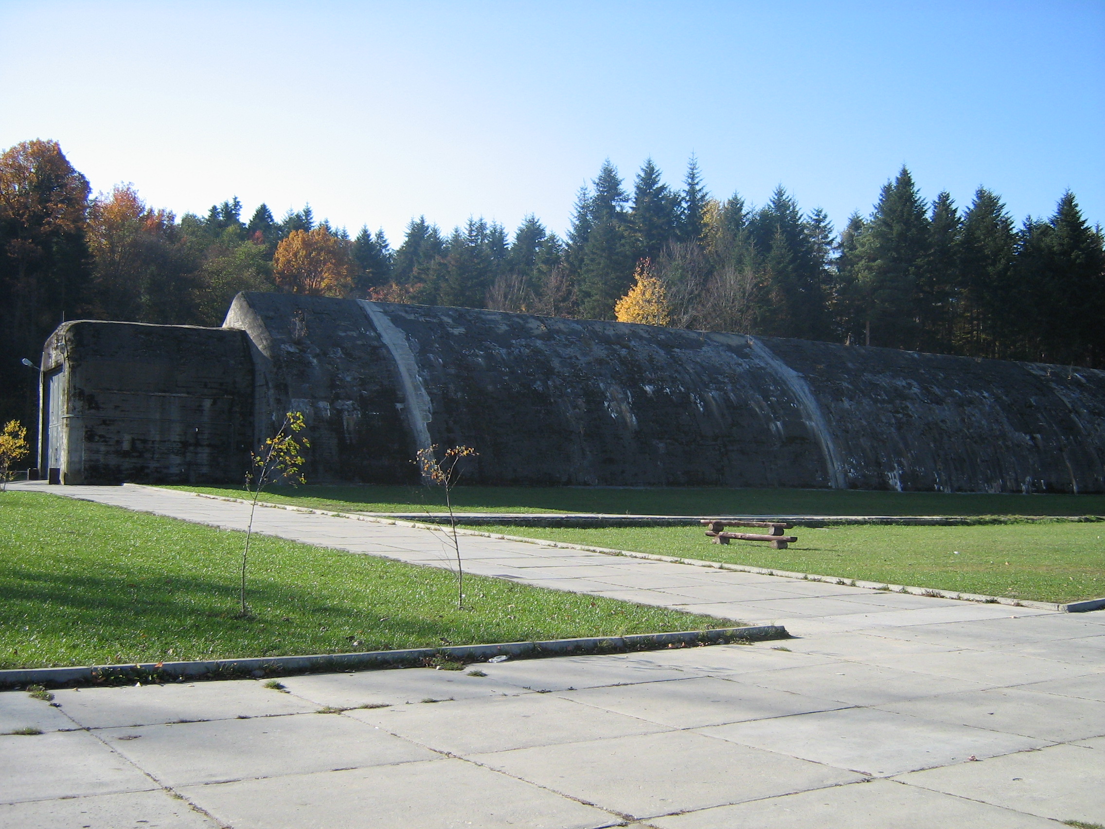
- Führerbunker in Stępina
- Die Holzkirche (1672) in Gogołów
- Die Holzkirche (18. Jh.) in Lubla 1782
 Führerbunker in Stępina
Gemeinde
Die Landgemeinde (Einwohner: 10 645) besteht aus Frysztak sowie 14 Schulzenämtern:
- Chytrówka,
- Cieszyna,
- Frysztak, (deutsch: Freistadt[2])
- Glinik Dolny, (deutsch: Nieder Gleinig[2]
- Glinik Górny, (deutsch: Ober Gleinig[2]
- Glinik Średni, (deutsch Mittel Gleinig[2]
- Gogołów,
- Huta Gogołowska,
- Kobyle,
- Lubla,
- Pułanki,
- Stępina,
- Twierdza,
Söhne und Töchter des Ortes
- Ludwik de Laveaux (1891-1969), polnischer General
siehe auch
Weblinks
Fußnoten
- ↑ Population. Size and Structure by Territorial Division. As of December 31, 2010. Główny Urząd Statystyczny (GUS), abgerufen am 1. Juli 2011.
- ↑ a b c d Wojciech Blajer: Bemerkungen zum Stand der Forschungen uber die Enklawen der mittelalterlichen deutschen Besiedlung zwischen Wisłoka und San. [in:] Późne średniowiecze w Karpatach polskich. red. Prof. Jan Gancarski. Krosno, 2007, ISBN 978-83-60545-57-7
Kategorien:- Gmina in der Woiwodschaft Karpatenvorland
- Ort der Woiwodschaft Karpatenvorland


Wikimedia Foundation.