Gorgany

Gorgany
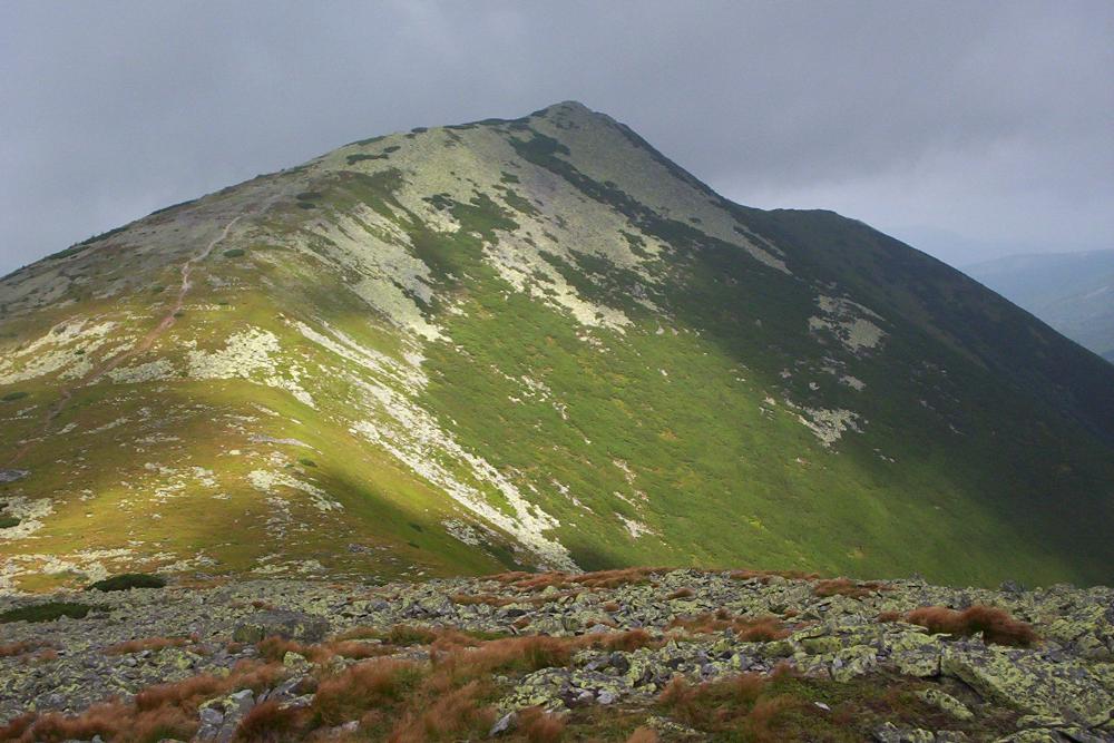
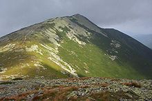
Blick auf den Sywulja

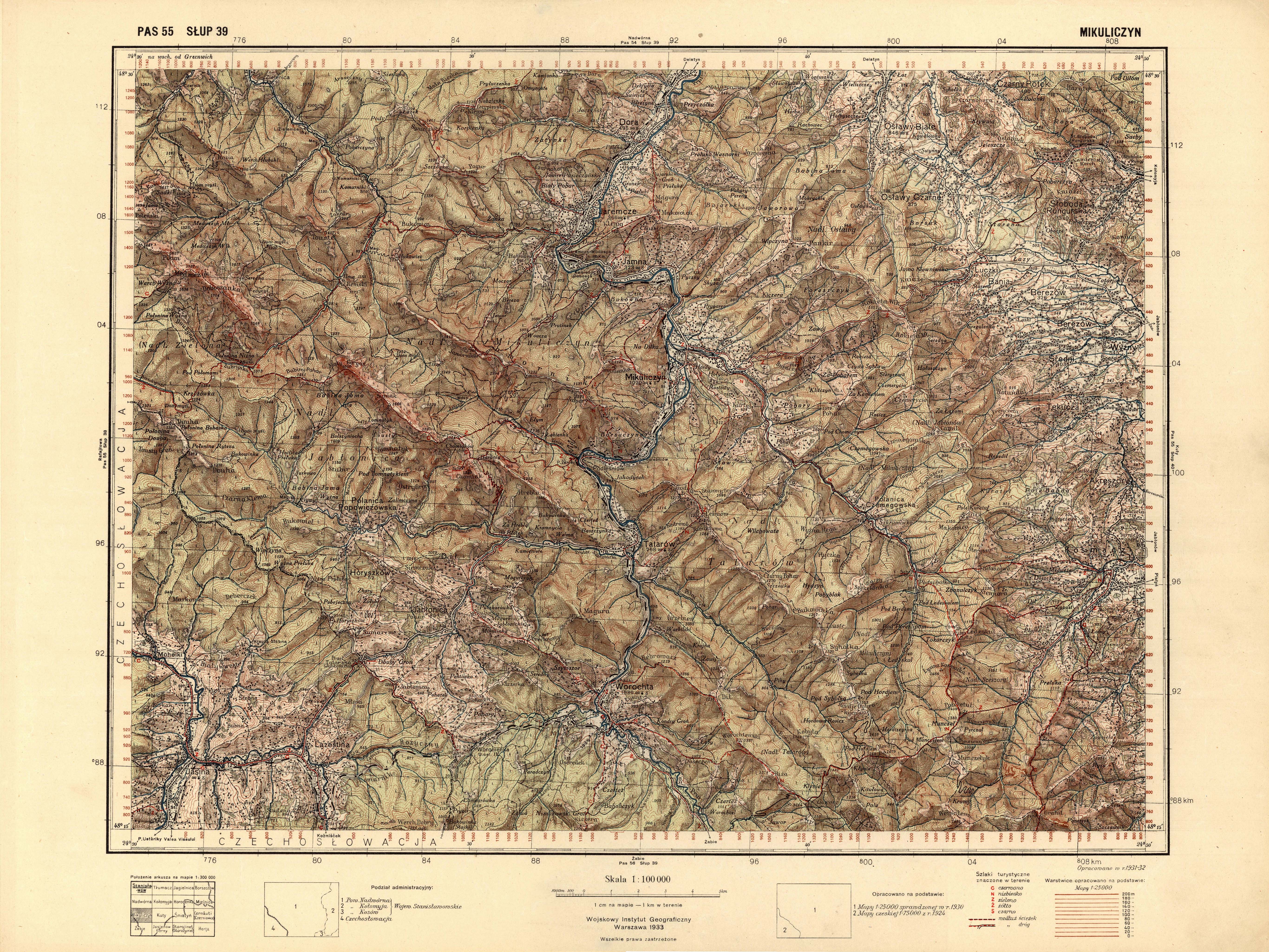
Die Gorgany (ukrainisch Ґорґани) ist ein Gebirgszug in der Westukraine.

Sie liegt in den Äußeren Ostkarpaten, schließt nördlich an die Tschornohora an und zu den höchsten Erhebungen gehören der Sywulja (1836 Meter), der Ihrowyschtsche, der Wyssoka und der Grofa.

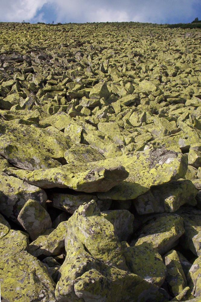
Typisch für das aus Flyschsandstein bestehende Gebirge sind die ausgedehnten Geröllfelder (Gorgan oder Grechot genannt). Sie werden im Osten durch den Fluss Misunka und den Wyschkowskyj-Pass sowie im Westen durch den Pruth und den Jablunyzkyj-Pass begrenzt. Die Gorgany ist eines der dünnstbesiedelten Gebiete der Ukraine, im Westen leben Teil des Volkes der Bojken, die sich mit Weidewirtschaft und Holzfällerei beschäftigen.

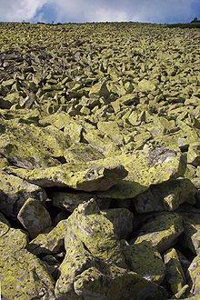
Blick auf ein typisches Geröllfeld (Gorgan)

Größere Orte des Gebietes sind Worochta und Jaremtsche.

Weblinks

 Commons: Gorgany – Sammlung von Bildern, Videos und Audiodateien

Wikimedia Foundation.

Игры ⚽ Нужен реферат?

Schlagen Sie auch in anderen Wörterbüchern nach:

  • Gorgany — (Yablunytsya,Украина) Категория отеля: 3 звездочный отель Адрес: Yablunytsya Village, Urochy …   Каталог отелей

  • Gorgany — Syvulia Debris field gorgan Gorgany (Ukrainian …   Wikipedia

  • Tisza — Tisa redirects here. For other uses, see Tisa (disambiguation) and Tisza (disambiguation). Geobox River name =Tisza River native name = other name = ro. Tisa ry. Тиса uk. Тиса sk. Tisa sr. Тиса/Tisa other name1 = image size = 300 image caption =… …   Wikipedia

  • Stanisławów Voivodeship — ( pl. Województwo stanisławowskie; uk. Станіславське воєводство) was an administrative unit of interwar Poland (1918 1939). It ceased to exist in September of 1939, following German and Soviet aggression on Poland (see: Invasion of… …   Wikipedia

  • Józef Haller de Hallenburg — (August 13, 1873, in Jurczyce June 4, 1960, in London) was a Lieutenant General of the Polish Army, legionary in Polish Legions, harcmistrz (the highest Scouting instructor rank in Poland), the President of The Polish Scouting and Guiding… …   Wikipedia

  • Divisions of the Carpathians — Map of the main divisions of the Carpathians. 1. Outer Western Carpathians 2. Inner Western Carpathians 3. Outer Eastern Carpathians 4. Inner Eastern Carpathians 5. Southern Carpathians 6. Western Romanian Carpathians 7. Transylvanian Plateau 8.… …   Wikipedia

  • Chornohora — North part of Chornohora with Hoverla Chornohora (literally: Black Mountain, Ukrainian: Чорногора, Polish: Czarnohora, Hungarian: Feketebérc) is the highest mountain range in Western Ukraine in the Eastern Beskids and the Ukra …   Wikipedia

  • Bystrytsia River — Infobox River river name = Bystrytsia, Бистриця 1st branch: Bystrytsia Solotvynska 2nd branch: Bystrytsia Nadvirnyanska caption = origin = Ivano Frankivsk Oblast, Ukraine mouth = Dniester River basin countries = Ukraine length = 183 km (w/ both… …   Wikipedia

  • National Environmental Park "Podilski Tovtry" — Podilian Tovtry (Подільські Товтри) Medobory National nature park National Park (IUCN II) …   Wikipedia

  • Gwiazda Polski — ( The Star of Poland ) was a balloon, which, according to the Polish planners, was going to reach the stratosphere, thus beating the 1930s high altitude world record, established on November 11, 1935 by Albert William Stevens and Orvil A.… …   Wikipedia

Share the article and excerpts

Direct link
Do a right-click on the link above
and select “Copy Link”