- Amakusa (Kumamoto)
-
Amakusa-shi
天草市

Geographische Lage in Japan Region: Kyūshū Präfektur: Kumamoto Koordinaten: 32° 28′ N, 130° 12′ O32.458619444444130.19301666667Koordinaten: 32° 27′ 31″ N, 130° 11′ 35″ O Basisdaten Fläche: 683,07 km² Einwohner: 87.793
(1. Juli 2011)Bevölkerungsdichte: 129 Einwohner je km² Gemeindeschlüssel: 43215-6 Symbole Flagge/Wappen: 
Rathaus Adresse: Amakusa City Hall
8-1, Higashihama-machi
Amakusa-shi
Kumamoto 863-0014Webadresse: http://www.city.amakusa.kumamoto.jp Lage Amakusas in der Präfektur Kumamoto 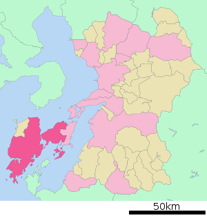
Amakusa (jap. 天草市, -shi; wörtlich: Himmelsgras) ist eine Stadt in der Präfektur Kumamoto auf den Amakusa-Inseln in Japan.
Inhaltsverzeichnis
Geschichte
Die Stadt wurde am 27. März 2006 durch die Zusammenlegung der Städte Hondo (本渡市, -shi) und Ushibuka (牛深市, -shi), sowie den Gemeinden Amakusa (天草町, -machi), Ariake (有明町, -machi), Goshoura (御所浦町, -machi), Itsuwa (五和町, -machi), Kawaura (河浦町, -machi), Kuratake (倉岳町, -machi), Shinwa (新和町, -machi) und Sumoto (栖本町, -machi) des Landkreises Amakusa gegründet.
Verkehr
- Flughafen Amakusa
- Straße:
- Nationalstraßen 266, 324, 389
Angrenzende Städte und Gemeinden
Weblinks
 Commons: Amakusa – Sammlung von Bildern, Videos und Audiodateien
 Gemeinden und Landkreise in der Präfektur Kumamoto
Kreisfreie Städte (shi): Amakusa | Arao | Aso | Hitoyoshi | Kami-Amakusa | Kikuchi | Kōshi | Kumamoto (Verwaltungssitz) | Minamata | Tamana | Uki | Uto | Yamaga | Yatsushiro
Amakusa-gun: Reihoku | Ashikita-gun: Ashikita | Tsunagi | Aso-gun: Minamiaso | Minamioguni | Nishihara | Oguni | Takamori | Ubuyama | Kamimashiki-gun: Kashima | Kosa | Mashiki | Mifune | Yamato | Kikuchi-gun: Kikuyō | Ōzu | Kuma-gun: Asagiri | Itsuki | Kuma | Mizukami | Nishiki | Sagara | Taragi | Yamae | Yunomae | Shimomashiki-gun: Misato | Tamana-gun: Gyokutō | Nagasu | Nagomi | Nankan | Yatsushiro-gun: Hikawa
Wikimedia Foundation.
Schlagen Sie auch in anderen Wörterbüchern nach:
Amakusa, Kumamoto — Infobox City Japan Name= Amakusa JapaneseName= 天草市 Map Region= Kyūshū Prefecture= Kumamoto District= Area km2= 683.17 PopDate= January 2008 Population= 93,047 Density km2= 136 Coords= LatitudeDegrees= 32 LatitudeMinutes= 28 LatitudeSeconds=… … Wikipedia
Amakusa, Kumamoto (town) — was a town located in Amakusa District, Kumamoto, Japan.As of 2003, the town had an estimated population of 4,405 and a density of 51.54 persons per km². The total area was 85.46 km².The town was dissolved and became part of the new city of… … Wikipedia
Amakusa Airlines — Saltar a navegación, búsqueda Amakusa Airlines Co., Ltd. 天草エアライン株式会社 Archivo:AmakusaAirlines.png Callsign AMAKUSA AIR Fundación … Wikipedia Español
Amakusa — (天草) is an island belonging to Japan, 26½ miles long and 13½ in extreme width, situated about 32°20 N, 130°E, on the west of Kumamoto Prefecture (formerly the province of Higo on the island of Kyūshū), from which it is separated by the Yatsushiro … Wikipedia
Amakusa — bezeichnet: eine japanische Inselgruppe: Amakusa Inseln eine japanische Stadt: Amakusa (Kumamoto) einen japanischen Landkreises: Amakusa gun (Kumamoto) einen anderen Name eines Lehens mit Sitz in diesem: Tomioka (Han) einen japanischen Flughafens … Deutsch Wikipedia
Kami-Amakusa, Kumamoto — nihongo|Kami Amakusa|上天草市|Kami amakusa shi is a city located in Kumamoto Prefecture, Japan. It was founded on March 31, 2004, by merging the three cities Himedo, Matsushima and Ryugatake.As of 2005, the city has an estimated population of 35,314… … Wikipedia
Amakusa Shirō — In this Japanese name, the family name is Amakusa . Statue of Amakusa Shirō at Hara Castle Amakusa Shirō (天草 四郎 … Wikipedia
Kumamoto — shi 熊本市 Geographische Lage in Japan … Deutsch Wikipedia
Amakusa-Inseln — Die Amakusa Inseln (jap. 天草諸島, shōtō) sind eine zu Japan gehörende Inselgruppe. Sie liegen westlich vor der Präfektur Kumamoto und zwischen der Ariake See und der Yatsushiro See. Die größten Inseln sind: Kami shima ( … Deutsch Wikipedia
Amakusa District, Kumamoto — Amakusa (天草郡; gun) is a district located in Kumamoto Prefecture, Japan.Following the March 27, 2006 Amakusa merger the district consists of the single town of Reihoku. After the merger, the district has an estimated population of 9,105 and a… … Wikipedia
Amakusa (Kumamoto)


18+
© Academic, 2000-2025
- Kontaktieren Sie uns: Unterstützung, Werbung
Wörterbücher Export, schritte mit PHP, Joomla, Drupal, WordPress, MODx.