- Interstate 76 (West)
-

Basisdaten Länge: 188 mi/303 km Bundesstaaten: Colorado
NebraskaKarte 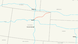
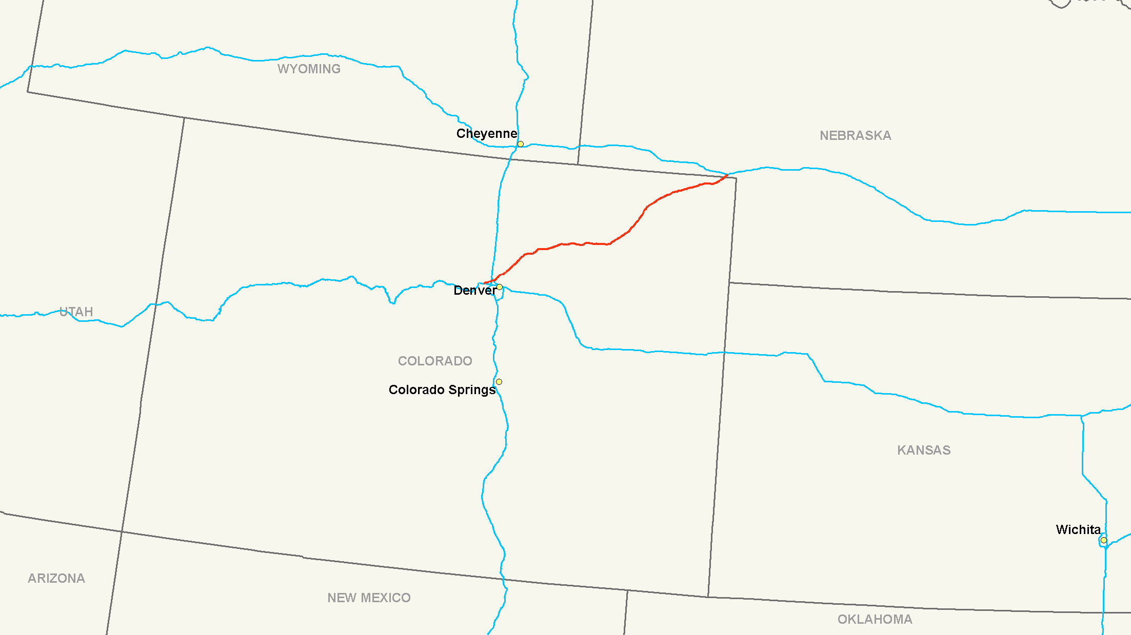
Die Interstate 76 (kurz I-76) ist ein Interstate Highway in den Vereinigten Staaten. Er beginnt an der Interstate 70 in Arvada im Bundesstaat Colorado und endet nach 303 Kilometern bei Big Springs in Nebraska an der Interstate 80. Da es an der Ostküste eine weitere Interstate mit der Nummer 76 gibt, trägt diese Straße den Zusatz West.
Inhaltsverzeichnis
Längen
Meilen km Staat 185 298 Colorado 3 5 Nebraska 188 303 Total Wichtige Städte
Verlauf
Colorado
Von Arvada führt die Interstate in nordöstlicher Richtung durch den Großraum von Denver bis zur Staatsgrenze zu Nebraska. In Welby trifft die I-76 auf die Interstates 25 und 270. Ab Fort Morgan verläuft sie parallel zum South Platte River und erreicht bei Julesburg Nebraska.
Nebraska
In Nebraska verläuft die Interstate 76 für 5 Kilometer parallel zum South Platte River und zum U.S. Highway 138, bevor er südlich von Big Springs an der Interstate 80 endet.
Weblinks
 Commons: Interstate 76 – Sammlung von Bildern, Videos und Audiodateien
- Interstate-Guide (englisch)
1 bis 99 4 • 5 • 8 • 10 • 12 • 15 • 16 • 17 • 19 • 20 • 22 • 24 • 25 • 26 • 27 • 29 • 30 • 35 • 37 • 39 • 40 • 43 • 44 • 45 • 49 • 55 • 57 • 59 • 64 • 65 • 66 • 68 • 69 • 70 • 71 • 72 • 73 • 74 • 75 • 76 (West) • 76 (Ost) • 77 • 78 • 79 • 80 • 81 • 82 • 83 • 84 (West) • 84 (Ost) • 85 • 86 (West) • 86 (Ost) • 87 • 88 (West) • 88 (Ost) • 89 • 90 • 91 • 93 • 94 • 95 • 96 • 97 • 99

ab 100 105 (Kalifornien) • 180 (Illinois) • 180 (Nebraska) • 180 (Pennsylvania) • 180 (Wyoming) • 205 (Kalifornien) • 205 (Oregon-Washington) • 235 (Iowa) • 238 • 280 (Illinois-Iowa) • 280 (Kalifornien) • 280 (New Jersey) • 280 (Ohio) • 380 (Iowa) • 380 (Kalifornien) • 380 (Pennsylvania) • 405 (Kalifornien) • 405 (Oregon) • 480 (Iowa-Nebraska) • 480 (Ohio) • 505 (Kalifornien) • 515 • 580 (Kalifornien) • 580 (Nevada) • 710 • 805
Hawaii Alaska A-1 • A-2 • A-3 • A-4
Puerto Rico PR-1 • PR-2 • PR-3
Wikimedia Foundation.
Schlagen Sie auch in anderen Wörterbüchern nach:
Interstate 66 (west) — Infobox road route=66 type=I alternate name= length mi= length round= length ref= year established= direction a= terminus a= junction= direction b= terminus b=The U.S. Department of Transportation has had plans to extend Interstate 66 westward… … Wikipedia
Interstate 84 (west) — Infobox road route=84 route type=reg type=I length mi=770 year established=1966 direction a=West direction b=East length km=1239 terminus a= terminus b= junction= commons=categoryInterstate 84 (I 84) is an interstate highway in the Western United … Wikipedia
Interstate 88 (West) — Basisdaten Länge: 140 mi/226 km Bundesstaat: Illinois Verlaufsrichtung: Os … Deutsch Wikipedia
Interstate 84 (West) — Basisdaten Länge: 770 mi/1239 km Bundesstaaten: Oregon Idaho Utah … Deutsch Wikipedia
Interstate 86 (West) — Basisdaten Länge: 63 mi/101 km Bundesstaat: Idaho Karte … Deutsch Wikipedia
Interstate 76 (west) — For the Interstate 76 that runs through Ohio, Pennsylvania, and New Jersey, see Interstate 76 (east). Interstate 76 … Wikipedia
Interstate 88 (west) — Infobox road state=IL type=I route=88 maint=Illinois DOT alternate name=Ronald Reagan Memorial Freeway, Ronald Reagan Memorial Tollway year established=July 1988cite news |publisher=Chicago Tribune |author=Mehler, Neil H.|date=1987 07 06… … Wikipedia
Interstate 86 (west) — Infobox road state=ID type=I route=86 maint=ITD length mi=62.850 length round=3 length ref= established= direction a=West terminus a=jct|state=ID|I|84|US|30 near Declo junction= direction b=East terminus b=jct|state=ID|I|15 in Pocatello previous… … Wikipedia
The South Carolina Interstate and West Indian Exposition — In 1901 Charleston hosted a World s Fair formally called The South Carolina Interstate and West Indian Exposition. That name was shortened to The West Indian Exposition or The Charleston Exposition. External links*… … Wikipedia
Interstate 84 in Oregon — Interstate 84 Route information … Wikipedia
Interstate 76 (West)


18+
© Academic, 2000-2026
- Kontaktieren Sie uns: Unterstützung, Werbung
Wörterbücher Export, schritte mit PHP, Joomla, Drupal, WordPress, MODx.