- Interstate 27
-

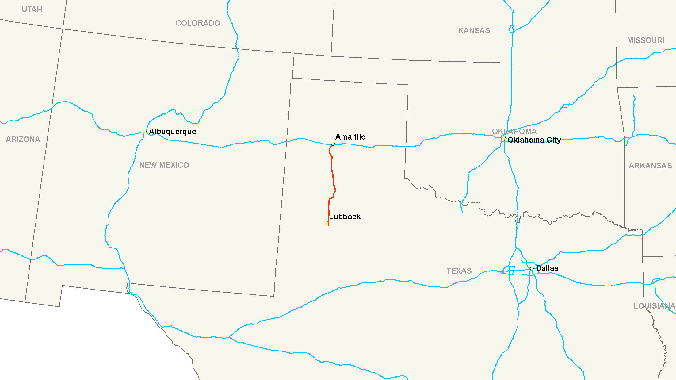
Basisdaten Länge: 124 mi/199 km Bundesstaat: Texas Verlaufsrichtung: Nord-Süd Karte 
 I-27 in Lubbock
Die Interstate 27 (kurz I-27) ist ein Interstate Highway in den Vereinigten Staaten. Sie beginnt an der Interstate 40 bei Amarillo und endet am U.S. Highway 87 in Lubbock. Die I-27 wird bei Amarillo auch Canyon Expressway genannt.
Wichtige Städte
Weblinks
 Commons: Interstate 27 – Sammlung von Bildern, Videos und Audiodateien
- Interstate-Guide: Interstate 27 (englisch)
1 bis 99 4 • 5 • 8 • 10 • 12 • 15 • 16 • 17 • 19 • 20 • 22 • 24 • 25 • 26 • 27 • 29 • 30 • 35 • 37 • 39 • 40 • 43 • 44 • 45 • 49 • 55 • 57 • 59 • 64 • 65 • 66 • 68 • 69 • 70 • 71 • 72 • 73 • 74 • 75 • 76 (West) • 76 (Ost) • 77 • 78 • 79 • 80 • 81 • 82 • 83 • 84 (West) • 84 (Ost) • 85 • 86 (West) • 86 (Ost) • 87 • 88 (West) • 88 (Ost) • 89 • 90 • 91 • 93 • 94 • 95 • 96 • 97 • 99

ab 100 105 (Kalifornien) • 180 (Illinois) • 180 (Nebraska) • 180 (Pennsylvania) • 180 (Wyoming) • 205 (Kalifornien) • 205 (Oregon-Washington) • 235 (Iowa) • 238 • 280 (Illinois-Iowa) • 280 (Kalifornien) • 280 (New Jersey) • 280 (Ohio) • 380 (Iowa) • 380 (Kalifornien) • 380 (Pennsylvania) • 405 (Kalifornien) • 405 (Oregon) • 480 (Iowa-Nebraska) • 480 (Ohio) • 505 (Kalifornien) • 515 • 580 (Kalifornien) • 580 (Nevada) • 710 • 805
Hawaii Alaska A-1 • A-2 • A-3 • A-4
Puerto Rico PR-1 • PR-2 • PR-3
Wikimedia Foundation.
Schlagen Sie auch in anderen Wörterbüchern nach:
Interstate 77 — Route information Length … Wikipedia
Interstate 69 — Route information Length … Wikipedia
Interstate 10 — Basisdaten Länge: 2460 mi/3960 km Bundesstaaten: Kalifornien Arizona New Mexico Texas … Deutsch Wikipedia
Interstate 80 — Route information Length … Wikipedia
Interstate 91 — Route information Length … Wikipedia
Interstate 5 — Basisdaten Länge: 1381 mi / 2222 km Bundesstaaten: Kalifornien Oregon Washington … Deutsch Wikipedia
Interstate 93 — Route information Length … Wikipedia
Interstate 71 — Route information Maintained by … Wikipedia
Interstate 87 — Map of the northeastern United States with I 87 highlighted in red Route information … Wikipedia
Interstate 20 — Basisdaten Länge: 1535 mi/2470 km Bundesstaaten: Texas Louisiana Mississippi Alabama … Deutsch Wikipedia
Interstate 77 — Basisdaten Länge: 611 mi/984 km Bundesstaaten: South Carolina North Carolina Virginia … Deutsch Wikipedia
Interstate 27


18+
© Academic, 2000-2026
- Kontaktieren Sie uns: Unterstützung, Werbung
Wörterbücher Export, schritte mit PHP, Joomla, Drupal, WordPress, MODx.