- Interstate 29
-

Basisdaten Länge: 755 mi/1215 km Bundesstaaten: Missouri
Iowa
South Dakota
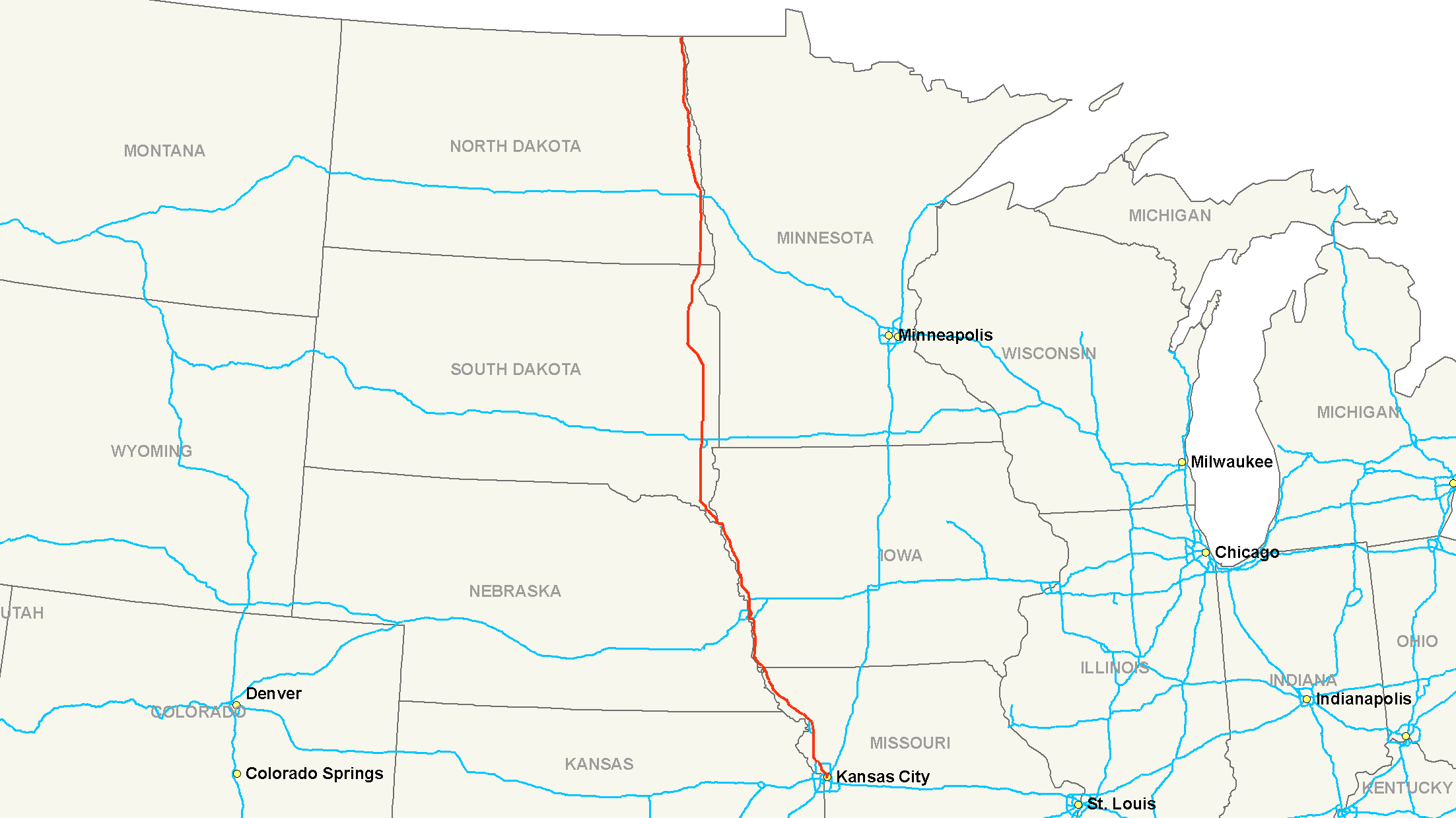
North DakotaKarte 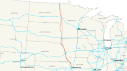 Verlauf
Kansas City  I-35
I-35Kansas City  I-635
I-635Kansas City  I-435
I-435St. Joseph  I-229
I-229Council Bluffs  I-80
I-80Council Bluffs  I-480
I-480Council Bluffs  I-680
I-680Sioux City  I-129
I-129Sioux Falls I-229Sioux Falls  I-90
I-90Fargo  I-94
I-94Die Interstate 29 (kurz I-29) ist ein Interstate Highway im Mittleren Westen der Vereinigten Staaten. Sie beginnt an der Interstate 35 in Kansas City und endet an der kanadischen Grenze, wonach sie zur Manitoba Provincial Highway 75 wird.
Inhaltsverzeichnis
Längen
Meilen km Staat 123 198 Missouri 161 259 Iowa 252 406 South Dakota 217 349 North Dakota 753 1212 Total Wichtige Städte
- Kansas City (Missouri)
- St. Joseph (Missouri)
- Mound City (Missouri)
- Council Bluffs (Iowa)
- Sioux City (Iowa)
- Sioux Falls (South Dakota)
- Fargo (North Dakota)
- Grand Forks (North Dakota)
Zubringer und Umgehungen
- Interstate 229 bei St. Joseph
- Interstate 129 bei Sioux City
- Interstate 229 bei Sioux Falls
Weblinks
 Commons: Interstate 29 – Sammlung von Bildern, Videos und Audiodateien
1 bis 99 4 • 5 • 8 • 10 • 12 • 15 • 16 • 17 • 19 • 20 • 22 • 24 • 25 • 26 • 27 • 29 • 30 • 35 • 37 • 39 • 40 • 43 • 44 • 45 • 49 • 55 • 57 • 59 • 64 • 65 • 66 • 68 • 69 • 70 • 71 • 72 • 73 • 74 • 75 • 76 (West) • 76 (Ost) • 77 • 78 • 79 • 80 • 81 • 82 • 83 • 84 (West) • 84 (Ost) • 85 • 86 (West) • 86 (Ost) • 87 • 88 (West) • 88 (Ost) • 89 • 90 • 91 • 93 • 94 • 95 • 96 • 97 • 99

ab 100 105 (Kalifornien) • 180 (Illinois) • 180 (Nebraska) • 180 (Pennsylvania) • 180 (Wyoming) • 205 (Kalifornien) • 205 (Oregon-Washington) • 235 (Iowa) • 238 • 280 (Illinois-Iowa) • 280 (Kalifornien) • 280 (New Jersey) • 280 (Ohio) • 380 (Iowa) • 380 (Kalifornien) • 380 (Pennsylvania) • 405 (Kalifornien) • 405 (Oregon) • 480 (Iowa-Nebraska) • 480 (Ohio) • 505 (Kalifornien) • 515 • 580 (Kalifornien) • 580 (Nevada) • 710 • 805
Hawaii Alaska A-1 • A-2 • A-3 • A-4
Puerto Rico PR-1 • PR-2 • PR-3
Wikimedia Foundation.
Schlagen Sie auch in anderen Wörterbüchern nach:
Interstate 77 — Route information Length … Wikipedia
Interstate 69 — Route information Length … Wikipedia
Interstate 10 — Basisdaten Länge: 2460 mi/3960 km Bundesstaaten: Kalifornien Arizona New Mexico Texas … Deutsch Wikipedia
Interstate 80 — Route information Length … Wikipedia
Interstate 91 — Route information Length … Wikipedia
Interstate 5 — Basisdaten Länge: 1381 mi / 2222 km Bundesstaaten: Kalifornien Oregon Washington … Deutsch Wikipedia
Interstate 93 — Route information Length … Wikipedia
Interstate 71 — Route information Maintained by … Wikipedia
Interstate 87 — Map of the northeastern United States with I 87 highlighted in red Route information … Wikipedia
Interstate 20 — Basisdaten Länge: 1535 mi/2470 km Bundesstaaten: Texas Louisiana Mississippi Alabama … Deutsch Wikipedia
Interstate 77 — Basisdaten Länge: 611 mi/984 km Bundesstaaten: South Carolina North Carolina Virginia … Deutsch Wikipedia
Interstate 29


18+
© Academic, 2000-2026
- Kontaktieren Sie uns: Unterstützung, Werbung
Wörterbücher Export, schritte mit PHP, Joomla, Drupal, WordPress, MODx.