Jamena

Jamena
Јамена
Jamena
Wappen fehlt
Hilfe zu Wappen
Jamena (Serbien)
Paris plan pointer b jms.svg
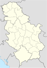
Basisdaten
Staat: Serbien
Provinz: Vojvodina
Okrug: Srem (Syrmien)
Koordinaten: 44° 53′ N, 19° 4′ O44.88333333333319.063888888889Koordinaten: 44° 53′ 0″ N, 19° 3′ 50″ O
Einwohner: 1.121 (2002)
Telefonvorwahl: (+381) 022
Postleitzahl: 22 248
Kfz-Kennzeichen: SM

Jamena (kyrillisch Јaмена) ist ein Dorf im serbischen Teil Syrmiens. Es liegt in der Schwemmebene der unteren Save und ist die westlichste Siedlung in der Gemeinde Šid.

Das Dorf hatte im Jahr 2002 1121 Einwohner. Die meisten von ihnen waren Serben. Jamena ist an drei Seiten von internationalen Grenzen zu Kroatien sowie Bosnien und Herzegowina umgeben, nur nach Osten hin besteht eine Verbindung zum serbischen Territorium.

Geschichte

Jamena wurde ursprünglich als Außenposten des Römischen Reichs an der Save gegründet und fiel in seiner Geschichte mehrmals der Zerstörung anheim.

In den Jugoslawienkriegen war der Ort völlig vom Rest Serbiens abgeschnitten, da die einzige Straßenverbindung über kroatisches Territorium verläuft. 1999 bombardierten NATO-Flugzeuge den Ort.

Verkehr

Unweit von Jamena befindet sich ein internationaler Grenzübergang über die Save nach Bosnien und Herzegowina. Mehrmals täglich fährt ein Bus von Jamena ins 33 km entfernte Šid, von wo aus Ziele in ganz Serbien angesteuert werden.


Wikimedia Foundation.

Игры ⚽ Нужно решить контрольную?

Schlagen Sie auch in anderen Wörterbüchern nach:

  • Jamena — Јамена L église orthodoxe serbe de Jamena Administration …   Wikipédia en Français

  • Jamena — (Јамена) is a village in the region of Srem, southwestern Vojvodina, Serbia. It is situated in the municipality of Šid. Jamena has a population of 1,130 (2002 census), but it is declining. Most of the inhabitants of the village are ethnic Serbs.… …   Wikipedia

  • FK Graničar Jamena — is a football team from the town of Jamena, which is located in the municipality of Srem.It currently competes in the Šid League were it has been playing for the last few years after being relegated from the Sremska league. The ground has seating …   Wikipedia

  • Morović — The old Catholic church. Morović (Моровић) is a village in northwestern Serbia in the Šid municipality, Srem District, autonomous province of Vojvodina. The village has a population of 2,164 people (2002 census), mainly of Serbian origin.… …   Wikipedia

  • Šid (Gemeinde) — Oпштина Шид Opština Šid …   Deutsch Wikipedia

  • Šid — Pour les articles homonymes, voir Sid (homonymie). Šid Шид …   Wikipédia en Français

  • List of football clubs in Serbia — This is a list of football clubs located in Serbia and the leagues and divisions they play in, as well as some other notable football clubs that play in the Serbian football league system.erbian Superliga (First Level)* OFK Beograd * FK Borac… …   Wikipedia

  • Syrmia — Srem redirects here. For other meanings of Srem and Srem , see Srem (disambiguation). Map of the Syrmia region …   Wikipedia

  • Sava River — Refimprove|date=March 2008Infobox River | river name = Sava caption = River Sava sunset skyline in the city of Zagreb origin = Planica mountain, Slovenia (as Sava Dolinka) mouth = Danube, Belgrade, Serbia basin countries = Slovenia, Croatia,… …   Wikipedia

  • Šid — Infobox Serbia municipality native name = Шид|official name=Šid image shield= Sidcoa.gif mayor = Mita Avramov district = Srem area km2 = 687 population total = 16311 mpop = 38973 latd = 45| latm = 07|longd = 19| longm = 14 code = 22 settlements …   Wikipedia

Share the article and excerpts

Direct link
Do a right-click on the link above
and select “Copy Link”