Johnston (Rhode Island)

Johnston (Rhode Island)
Johnston
Johnston (Rhode Island)
Johnston
Johnston
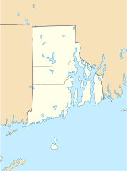
Lage in Rhode Island
Basisdaten
Staat: Vereinigte Staaten
Bundesstaat: Rhode Island
County:

Providence County

Koordinaten: 41° 49′ N, 71° 29′ W41.816666666667-71.48333333333397Koordinaten: 41° 49′ N, 71° 29′ W
Zeitzone: Eastern Standard Time (UTC−5)
Einwohner: 28.200 (Stand: 2000)
Bevölkerungsdichte: 460 Einwohner je km²
Fläche: 63,1 km² (ca. 24 mi²)
davon 61,3 km² (ca. 24 mi²) Land
Höhe: 97 m
Postleitzahl: 02919
Vorwahl: +1 401
FIPS: 44-37720
GNIS-ID: 1220073
Webpräsenz: www.johnston-ri.us

Johnston ist eine US-amerikanische Stadt in Rhode Island im Providence County. Sie ist (teilweise Haupt-)Sitz mehrerer Versicherungen.

Inhaltsverzeichnis

Geschichte

Johnston wurde offiziell am 6. März 1759 gegründet und nach dem General August Johnston benannt. [1]

Sehenswürdigkeiten

In Johnston befindet sich das Clemence Irons House aus dem Jahre 1691, ein Haus im sogenannte Stone-Ender-Stil, bei dem der Schornstein eine Hauswand darstellt. Das Clemence Irons House ist heute ein Museum für diese für Rhode Island typische Bauform, da es als eines von wenigen noch im Originalzustand erhalten ist.

Bildung

Johnston besitzt insgesamt sechs Schulen, darunter vier Grundschulen, eine Mittelschule und eine High School (Johnston Senior High School). Das Bildungsamt hat jedoch beschlossen zwei der Grundschulen, die Grundschule Graniteville und die Calef-Grundschule demnächst schließen zu wollen.[2]

Medien

Die offizielle Tageszeitung in Johnston ist The Johnston Sunrise.[3]

Einzelnachweise

  1. Johnston Historical Society: Johnston History
  2. Johnston school problems cited
  3. Johnston Sun Rise - Breaking News, classifieds, businesses, and events in the Johnston, RI area.. www.johnstonsunrise.net. Abgerufen am 11. März 2009.

Wikimedia Foundation.

Игры ⚽ Нужно сделать НИР?

Schlagen Sie auch in anderen Wörterbüchern nach:

  • Johnston (Rhode Island) — Johnston Pueblo de los Estados Unidos …   Wikipedia Español

  • Johnston, Rhode Island — Infobox Settlement official name = Johnston, Rhode Island settlement type = Town nickname = motto = map caption1 = imagesize = image caption = image mapsize = 250px map caption = Location of Johnston in Rhode Island mapsize1 = map caption1 =… …   Wikipedia

  • Johnston (Rhode Island) — 41°49′N 71°29′W / 41.817, 71.483 …   Wikipédia en Français

  • Johnston Senior High School (Rhode Island) — Infobox Public School background = #f0f6fa border = #ccd2d9 name = Johnston Senior High School motto = Panther Pride established = 1973 type = Public head name = Head of School head = Dr. Elizabeth Mantelli city = Johnston state = Rhode Island… …   Wikipedia

  • Rhode Island — Rhode Islander. /rohd/ a state of the NE United States, on the Atlantic coast: a part of New England. 947,154; 1214 sq. mi. (3145 sq. km). Cap.: Providence. Abbr.: RI (for use with zip code), R.I. * * * officially Rhode Island and Providence… …   Universalium

  • Rhode Island — This article is about the U.S. state of Rhode Island. For other uses, see Rhode Island (disambiguation). RI and R.I. redirect here. For other uses, see RI (disambiguation). State of Rhode Island and Providence Plantations …   Wikipedia

  • Rhode Island — 41° 42′ N 71° 30′ W / 41.7, 71.5 …   Wikipédia en Français

  • Rhode Island in the American Civil War — The state of Rhode Island during the American Civil War, as with all of New England, remained loyal to the Union. Rhode Island furnished 25,236 fighting men to the Union Army, of which 1,685 died. [ Dyer s Compendium ] On the home front, Rhode… …   Wikipedia

  • Rhode Island High School Championships — An eight team Rhode Island High School League existed from 1918 1929. Below is what is known about its champions:*Hope won 4 Baseball Championships *Hope won 3 Football Championships *Burrillville won the 1927 Baseball championship *St. Raphael… …   Wikipedia

  • Rhode Island Route 5 — Infobox RI Route type= route=5 length mi=26.0 length km=41.8 formed=by 1934 dir1=South dir2=North from= junction= to=Central Street in Millville, MA previous type= previous route=4 next type=U.S. next route=6Route 5 is a state highway in the U.S …   Wikipedia

Share the article and excerpts

Direct link
Do a right-click on the link above
and select “Copy Link”