- Kangarli
-
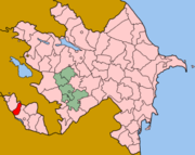 Lage des Rayons Kəngərli in Aserbaidschan
Kəngərli, auch Kangarli, ist ein Rayon in Aserbaidschan in der Autonomen Republik Nachitschewan. Die Hauptstadt des Bezirks ist die Stadt Qıvraq.
Inhaltsverzeichnis
Geografie
Der Bezirk hat eine Fläche von 628 km² und grenzt im Norden an Armenien, im Süden mit dem Fluss Aras (Fluss) an den Iran.
Geschichte
Der Bezirk wurde am 2. April 2004 gegründet, das Gebiet gehörte zuvor zum Ravon Şərur.[1]
Bevölkerung
Im Rayon lebten 2004 über 25.300 Menschen. Diese verteilen sich auf 10 Dörfer und eine Stadt.[2]
Kultur
Im Bezirk befindet sich die Ruinen des Kultischen Zentrums in Qarabağlar.
Quellen
- ↑ Gesetz über die Gründung des Bezirks Kəngərli bei Azerbaijan Developement Gateway
- ↑ Azerbaijan über den Bezirk
 Verwaltungsgliederung Aserbaidschan
Rayons: Abşeron | Ağcabədi | Ağdam | Ağdaş | Ağstafa | Ağsu | Astara | Balakən | Bərdə | Beyləqan | Biləsuvar | Cəbrayıl | Cəlilabad | Daşkəsən | Dəvəçi | Füzuli | Gədəbəy | Goranboy | Göyçay | Hacıqabul | İmişli | İsmayıllı | Kəlbəcər | Kürdəmir | Laçın | Lənkəran | Lerik | Masallı | Neftçala | Oğuz | Qəbələ | Qax | Qazax | Qobustan | Quba | Qubadlı | Qusar | Saatlı | Sabirabad | Şəki | Salyan | Şamaxı | Şəmkir | Samux | Siyəzən | Şuşa | Tərtər | Tovuz | Ucar | Xaçmaz | Göygöl | Xızı | Xocalı | Xocavənd | Yardımlı | Yevlax | Zəngilan | Zaqatala | Zərdab
Städte: Bakı | Gəncə | Lənkəran | Mingəçevir | Naftalan | Şəki | Şirvan | Sumqayıt | Şuşa | Xankəndi | Yevlax
Autonome Republik: Nachitschewan (Naxçıvan)
Rayons der autonomen Republik: Babək | Culfa | Kəngərli | Ordubad | Sədərək | Şahbuz | Şərur
Stadt: Naxçıvan

Wikimedia Foundation.